Enable Location

We need your location to show you interesting places around you

Discover nearby places

Find interesting locations and hidden gems around you

Precise directions

Get accurate directions and distances to places

Your location is never shared with other users. It's only used when you tap the location button.

Anderson County

Log in to your account

Start exploring — it's free

Trusted by 62,487 travelers worldwide

Continue with Google
Continue with Apple
or

We will send you a code to connect

By continuing, you accept our Terms and Conditions and our Privacy Policy

Check your inbox

We've sent a pincode in your inbox. Please enter the code below.

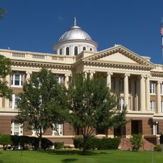
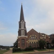
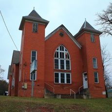
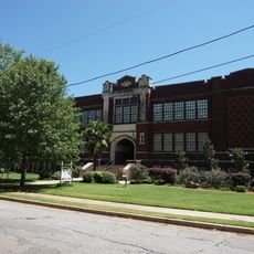
Anderson County, County government center in Palestine, Texas, United States.

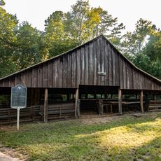
Anderson County is an administrative division in East Texas encompassing forests, lakes, and farmland across its terrain. The landscape supports wildlife populations and local agricultural practices throughout the region.

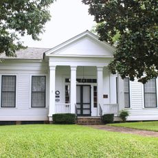
The county was established in 1846 and named after Kenneth Lewis Anderson, who served as the final vice president of the Republic of Texas. This founding marked an important moment in early statehood.

The Texas State Railroad operates through the area, offering train journeys that keep alive the transportation heritage of East Texas.

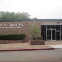
The county seat in Palestine provides access to court records, tax services, and vehicle registration for residents. Multiple administrative offices are located in one area for convenience.

The region is known for flowering dogwood trees that thrive in the area's climate conditions. Spring brings a display of these blossoms throughout the landscape.

The community of curious travelers

AroundUs brings together thousands of curated places, local tips, and hidden gems, enriched daily by 60,000 contributors worldwide.

Start exploring
Location
Inception
March 24, 1846
Capital city
Palestine
Shares border with
Houston County, Leon County, Freestone County, Henderson County, Cherokee County
GPS coordinates
31.81000,-95.65000
Latest update
December 20, 2025 12:39
Around this place
Millimeter Anisotropy eXperiment IMaging Array
United States of America

Millimeter Anisotropy eXperiment IMaging Array

7.7 km
United States of America

Prairies and Pineywoods Wildlife Trail

39.3 km
Texas State Railroad
United States of America

Texas State Railroad

10.4 km
Museum for East Texas Culture
United States of America

Museum for East Texas Culture

6.2 km
Sacred Heart Catholic Church and School
United States of America

Sacred Heart Catholic Church and School

5.5 km
Anderson County Courthouse
United States of America

Anderson County Courthouse

5.5 km
Anderson Camp Ground
United States of America

Anderson Camp Ground

16.2 km
United States of America

Catfish Creek

27 km
Howard House
United States of America

Howard House

5 km
First Presbyterian Church
United States of America

First Presbyterian Church

5.7 km
United States of America

Gus Engeling Wildlife Management Area

27.5 km
Mount Vernon African Methodist Episcopal Church
United States of America

Mount Vernon African Methodist Episcopal Church

5.3 km
United States of America

Soil Conservation Service Site 1 Reservoir

19.1 km
United States of America

Redlands Hotel

5.5 km
United States of America

Bomer Lake

21.3 km
United States of America

Fairfield Lake

39 km
United States of America

Anderson Bluff

33.8 km
United States of America

Lindsey Bluff

38.5 km
United States of America

Anderson County Jail

5.5 km
John H. Reagan Statue
United States of America

John H. Reagan Statue

6.3 km
United States of America

Allen Bluff

39.5 km
Palestine High School
United States of America

Palestine High School

6.2 km
United States of America

The Landmark

39.8 km
United States of America

Lincoln High School

6.1 km
United States of America

Lost Prairie Lake

11.8 km
United States of America

Catfish Creek Ranch Lake

30.5 km
United States of America

Calhoun Lake Number 1

10.8 km
United States of America

Caddo Creek Lake

30.4 km
Show the full map
Administrative divisions
« Anderson County - County government center in Palestine, Texas, United States » is provided by Around Us (aroundus.com). Images and texts are derived from Wikimedia project under a Creative Commons license. You are allowed to copy, distribute, and modify copies of this page, under the conditions set by the license, as long as this note is clearly visible.

Discover hidden gems everywhere you go!

From secret cafés to breathtaking viewpoints, skip the crowded tourist spots and find places that match your style. Our app makes it easy with voice search, smart filtering, route optimization, and insider tips from travelers worldwide. Download now for the complete mobile experience.

Around Us App Screenshot

A unique approach to discovering new places

Le Figaro

All the places worth exploring

France Info

A tailor-made excursion in just a few clicks

20 Minutes

Around Us
Travel Guide & Maps
Download

Send to your phone

QR Code
1

Open the camera app on your mobile.

2

Point at the QR code with your camera. A notification will appear.

3

Tap the notification to open the link.