Log in to your account

AroundUs is a community-driven map of interesting places, built by curious explorers like you. It grows with every review, story, and photo you share.
Connect to save your favorite spots, contribute locations, and create personalized routes.
Continue with Google
Continue with Apple
Continue with X
Continue with Facebook
Continue with email
By continuing, you accept our Terms and Conditions and our Privacy Policy
Create an account

Prairies and Pineywoods Wildlife Trail

Add to collection
Map
Suggest a change
Share

Prairies and Pineywoods Wildlife Trail, Protected wildlife trail system in Texas, United States

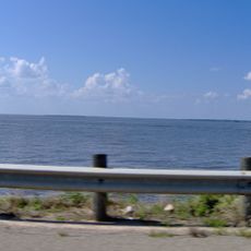
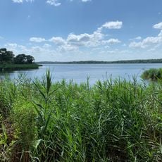
Prairies and Pineywoods Wildlife Trail is a network of connected paths stretching across Texas from Wichita Falls through the Dallas-Fort Worth region to College Station. The trail system passes through grasslands, pine forests, and wetlands, creating a route that shows how different plant and animal communities live across the state.

The trail system was established as one of four major wildlife corridors designated by Texas Parks & Wildlife Department to protect native landscapes and animal migration routes. This designation recognized that wildlife populations need connected natural spaces to move safely across the state.

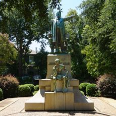
The loops here carry names inspired by regional pioneers like Davy Crockett and Stephen F. Austin, reflecting how locals honor the figures who shaped Texas history. Walking these paths connects you directly to stories woven into the landscape itself.

Multiple access points throughout the trail system let visitors explore different sections depending on which habitats they want to see. The best time to visit is early morning, especially if you plan to watch birds or take photographs of wildlife.

The trail network protects remaining sections of the Blackland Prairies, where visitors can see grazing bison and Scissor-tailed Flycatchers in their native habitat. These birds, recognizable by their long forked tails, perform striking aerial maneuvers that make them stand out against the open sky.

Location: Texas

GPS coordinates: 32.00000,-96.00000

Latest update: December 14, 2025 12:23

Photos
Around this place
Cedar Creek Reservoir
United States of America

Cedar Creek Reservoir

43.7 km
Lake Palestine
United States of America

Lake Palestine

53.1 km
Fairfield Lake State Park
United States of America

Fairfield Lake State Park

25.3 km
United States of America

Purtis Creek State Park

40.3 km
Millimeter Anisotropy eXperiment IMaging Array
United States of America

Millimeter Anisotropy eXperiment IMaging Array

35.9 km
Temple Beth-El
United States of America

Temple Beth-El

45.3 km
Waterpark at the Villages
United States of America

Waterpark at the Villages

56.5 km
Texas State Railroad
United States of America

Texas State Railroad

49.5 km
Museum for East Texas Culture
United States of America

Museum for East Texas Culture

44.4 km
Sacred Heart Catholic Church and School
United States of America

Sacred Heart Catholic Church and School

43.5 km
Anderson County Courthouse
United States of America

Anderson County Courthouse

44 km
Anderson Camp Ground
United States of America

Anderson Camp Ground

36 km
Whatz-Up Family Fun Park
United States of America

Whatz-Up Family Fun Park

40.9 km
Howard House
United States of America

Howard House

43.6 km
First Presbyterian Church
United States of America

First Presbyterian Church

43.9 km
Henderson County Courthouse
United States of America

Henderson County Courthouse

26.6 km
Texas Hall
United States of America

Texas Hall

58.9 km
Mount Vernon African Methodist Episcopal Church
United States of America

Mount Vernon African Methodist Episcopal Church

44 km
Navarro County Courthouse
United States of America

Navarro County Courthouse

45.4 km
Trinity and Brazos Valley Railroad Depot and Office Building
United States of America

Trinity and Brazos Valley Railroad Depot and Office Building

49.6 km
Faulk and Gauntt Building
United States of America

Faulk and Gauntt Building

26.7 km
Texas Theater
United States of America

Texas Theater

43.6 km
Cannon Creek Vineyard
United States of America

Cannon Creek Vineyard

53.9 km
Palestine High School
United States of America

Palestine High School

44.3 km
John H. Reagan Statue
United States of America

John H. Reagan Statue

44.6 km
Palace Theater
United States of America

Palace Theater

45 km
Freestone County Courthouse
United States of America

Freestone County Courthouse

34.1 km
Mills Place Historic District
United States of America

Mills Place Historic District

46.3 km
Show the full map
Reviews

Visited this place? Tap the stars to rate it and share your experience / photos with the community! Try now! You can cancel it anytime.

« Prairies and Pineywoods Wildlife Trail - Protected wildlife trail system in Texas, United States » is provided by Around Us (aroundus.com). Images and texts are derived from Wikimedia project under a Creative Commons license. You are allowed to copy, distribute, and modify copies of this page, under the conditions set by the license, as long as this note is clearly visible.

Discover hidden gems everywhere you go!

From secret cafés to breathtaking viewpoints, skip the crowded tourist spots and find places that match your style. Our app makes it easy with voice search, smart filtering, route optimization, and insider tips from travelers worldwide. Download now for the complete mobile experience.

Around Us App Screenshot

A unique approach to discovering new places

Le Figaro

All the places worth exploring

France Info

A tailor-made excursion in just a few clicks

20 Minutes