Enable Location

We need your location to show you interesting places around you

Discover nearby places

Find interesting locations and hidden gems around you

Precise directions

Get accurate directions and distances to places

Your location is never shared with other users. It's only used when you tap the location button.

Somervell County

Log in to your account

Start exploring — it's free

Trusted by 62,487 travelers worldwide

Continue with Google
Continue with Apple
or

We will send you a code to connect

By continuing, you accept our Terms and Conditions and our Privacy Policy

Check your inbox

We've sent a pincode in your inbox. Please enter the code below.

Somervell County, County administrative division in Texas, United States

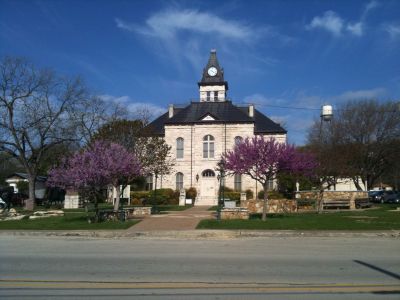
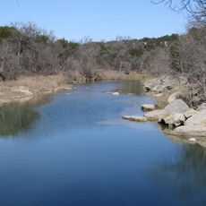
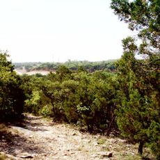
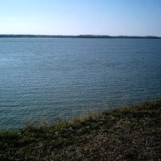
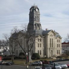
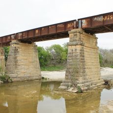
Somervell County is an administrative region in Texas characterized by rolling hills and waterways, with Glen Rose serving as its administrative center. The area features a mix of natural terrain and rural communities spread throughout the landscape.

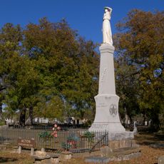
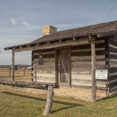
Somervell County was established in 1875 and named after James Somervell, a soldier who fought in the Texas Revolution. This connection to the independence movement remains part of the region's historical identity.

The Glen Rose Honey Festival brings together local beekeepers and artisans who maintain the region's agricultural traditions. The event connects visitors and residents through appreciation for handcrafted products and rural ways of living.

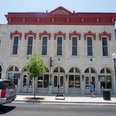
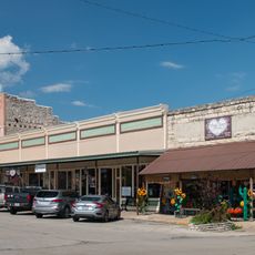
Visitors can find shops, restaurants, and services in Glen Rose that serve as a base for exploring the region. The rolling terrain offers good accessibility for day trips and general travel throughout the area.

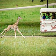
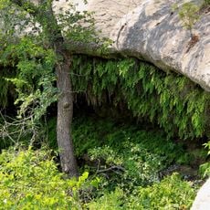
Dinosaur Valley State Park contains preserved footprints from prehistoric animals that once walked through the region millions of years ago. These fossil impressions offer a direct window into the distant geological past of the area.

The community of curious travelers

AroundUs brings together thousands of curated places, local tips, and hidden gems, enriched daily by 60,000 contributors worldwide.

Start exploring
GPS coordinates
32.22758,-97.77241
Latest update
December 7, 2025 19:28
Around this place
Dinosaur Valley State Park
United States of America

Dinosaur Valley State Park

5.2 km
Creation Evidence Museum
United States of America

Creation Evidence Museum

3.1 km
Fossil Rim Wildlife Center
United States of America

Fossil Rim Wildlife Center

5.7 km
Cleburne State Park
United States of America

Cleburne State Park

20.7 km
Lake Pat Cleburne
United States of America

Lake Pat Cleburne

34.2 km
Acton State Historic Site
United States of America

Acton State Historic Site

25.1 km
Bluff Dale Suspension Bridge
United States of America

Bluff Dale Suspension Bridge

27.7 km
Meridian State Park
United States of America

Meridian State Park

37.9 km
Hood County Courthouse Historic District
United States of America

Hood County Courthouse Historic District

23.9 km
Barnard's Mill
United States of America

Barnard's Mill

1.6 km
Nolan River Bridge 303-A of the Gulf, Colorado and Santa Fe Railway
United States of America

Nolan River Bridge 303-A of the Gulf, Colorado and Santa Fe Railway

36.5 km
Smith Ranch
United States of America

Smith Ranch

34.2 km
Erath County Courthouse
United States of America

Erath County Courthouse

40.5 km
Erath Memorial Arch
United States of America

Erath Memorial Arch

40.8 km
Bosque County Courthouse
United States of America

Bosque County Courthouse

35.6 km
Dawson Saloon
United States of America

Dawson Saloon

40.5 km
First National Bank Building
United States of America

First National Bank Building

40.5 km
Carlton meteorite
United States of America

Carlton meteorite

42.5 km
Somervell County Courthouse
United States of America

Somervell County Courthouse

1.8 km
Brazos Drive In
United States of America

Brazos Drive In

23.9 km
Granbury Opera House
United States of America

Granbury Opera House

23.9 km
Granbury Live Theatre
United States of America

Granbury Live Theatre

24 km
Henry Briden Cabin
United States of America

Henry Briden Cabin

37 km
Glen Rose Downtown Historic District
United States of America

Glen Rose Downtown Historic District

1.8 km
Granbury Railroad Depot
United States of America

Granbury Railroad Depot

24.6 km
Clairette Schoolhouse
United States of America

Clairette Schoolhouse

38.7 km
Bosque River Bridge
United States of America

Bosque River Bridge

35.9 km
Dotey-Kirkham House
United States of America

Dotey-Kirkham House

38.4 km
Show the full map
« Somervell County - County administrative division in Texas, United States » is provided by Around Us (aroundus.com). Images and texts are derived from Wikimedia project under a Creative Commons license. You are allowed to copy, distribute, and modify copies of this page, under the conditions set by the license, as long as this note is clearly visible.

Discover hidden gems everywhere you go!

From secret cafés to breathtaking viewpoints, skip the crowded tourist spots and find places that match your style. Our app makes it easy with voice search, smart filtering, route optimization, and insider tips from travelers worldwide. Download now for the complete mobile experience.

Around Us App Screenshot

A unique approach to discovering new places

Le Figaro

All the places worth exploring

France Info

A tailor-made excursion in just a few clicks

20 Minutes

Around Us
Travel Guide & Maps
Download

Send to your phone

QR Code
1

Open the camera app on your mobile.

2

Point at the QR code with your camera. A notification will appear.

3

Tap the notification to open the link.