Enable Location

We need your location to show you interesting places around you

Discover nearby places

Find interesting locations and hidden gems around you

Precise directions

Get accurate directions and distances to places

Your location is never shared with other users. It's only used when you tap the location button.

Oak Grove Missionary Baptist Church

Log in to your account

Start exploring — it's free

Trusted by 62,806 travelers worldwide

Continue with Google
Continue with Apple
or

We will send you a code to connect

By continuing, you accept our Terms and Conditions and our Privacy Policy

Check your inbox

We've sent a pincode in your inbox. Please enter the code below.

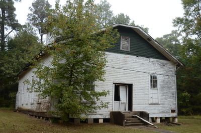
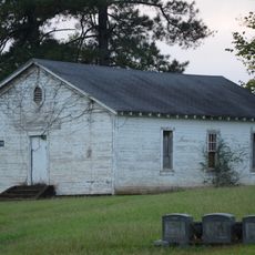
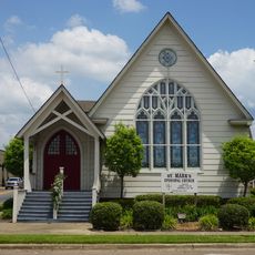
Oak Grove Missionary Baptist Church, Protestant church on Hempstead County Route 16 near Blevins, Arkansas.

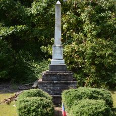
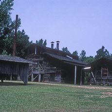
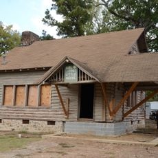
Oak Grove Missionary Baptist Church is a single-story wooden building near Blevins featuring a Jerkinhead roof and a steeple topped with a hip roof. The property sits on approximately 2 acres and includes a Sunday school building and a cemetery.

The building was constructed in 1942, but its origins trace to materials from a 1870s structure that was removed from the site. The relocation became necessary to make room for the Southwestern Proving Ground, which expanded in the region.

This house of worship serves an African-American community that gathers regularly for services and has built deep roots in the local area. The congregation shapes the social life of the region through its regular meetings and importance as a gathering place for neighbors.

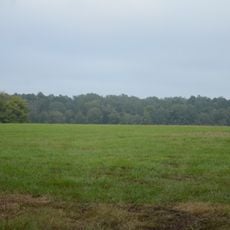
The site is accessible via Hempstead County Route 16 and offers straightforward access for visitors. The flat terrain and open surroundings make navigation easy and allow you to explore the building and property features without difficulty.

The building earned recognition on the National Register of Historic Places in 2003 for its Plain and Traditional architectural style. This honor acknowledged its local historical importance and how the structure reflects the building practices of its era.

The community of curious travelers

AroundUs brings together thousands of curated places, local tips, and hidden gems, enriched daily by 60,000 contributors worldwide.

Start exploring
Location
GPS coordinates
33.83250,-93.61083
Latest update
December 14, 2025 14:26
Around this place
Crater of Diamonds State Park
United States of America

Crater of Diamonds State Park

23 km
President William Jefferson Clinton Birthplace Home National Historic Site
United States of America

President William Jefferson Clinton Birthplace Home National Historic Site

18.4 km
Historic Washington State Park
United States of America

Historic Washington State Park

9.4 km
Confederate State Capitol building
United States of America

Confederate State Capitol building

8.6 km
Moscow Methodist Church and Cemetery
United States of America

Moscow Methodist Church and Cemetery

23.4 km
Prairie D'Ane Battlefield
United States of America

Prairie D'Ane Battlefield

16.5 km
Hempstead County Courthouse
United States of America

Hempstead County Courthouse

18.7 km
Washington Confederate Monument
United States of America

Washington Confederate Monument

9.8 km
Ward-Jackson House
United States of America

Ward-Jackson House

18.2 km
Foster House
United States of America

Foster House

18.2 km
Allen Tire Company and Gas Station
United States of America

Allen Tire Company and Gas Station

21.4 km
Foster House
United States of America

Foster House

18.6 km
Howard County Courthouse
United States of America

Howard County Courthouse

25.4 km
Ethridge House
United States of America

Ethridge House

17.8 km
Emmet Methodist Church
United States of America

Emmet Methodist Church

17.3 km
Womack–Parker House
United States of America

Womack–Parker House

25.6 km
Grandison D. Royston House
United States of America

Grandison D. Royston House

9.4 km
Flavius Holt House
United States of America

Flavius Holt House

25.3 km
McRae House
United States of America

McRae House

18.6 km
St. Mark's Episcopal Church
United States of America

St. Mark's Episcopal Church

18.6 km
Goodlett Gin
United States of America

Goodlett Gin

8.6 km
D.L. McRae House
United States of America

D.L. McRae House

21.9 km
Nashville American Legion Building
United States of America

Nashville American Legion Building

24.8 km
Henry McKenzie House
United States of America

Henry McKenzie House

21.8 km
Brundidge Building
United States of America

Brundidge Building

18.4 km
Hope Girl Scout Little House
United States of America

Hope Girl Scout Little House

19.4 km
Nesburt T. Ruggles House
United States of America

Nesburt T. Ruggles House

25.3 km
Prescott/Nevada County Library and Educational Facility
United States of America

Prescott/Nevada County Library and Educational Facility

21.5 km
Show the full map
« Oak Grove Missionary Baptist Church - Protestant church on Hempstead County Route 16 near Blevins, Arkansas » is provided by Around Us (aroundus.com). Images and texts are derived from Wikimedia project under a Creative Commons license. You are allowed to copy, distribute, and modify copies of this page, under the conditions set by the license, as long as this note is clearly visible.

Discover hidden gems everywhere you go!

From secret cafés to breathtaking viewpoints, skip the crowded tourist spots and find places that match your style. Our app makes it easy with voice search, smart filtering, route optimization, and insider tips from travelers worldwide. Download now for the complete mobile experience.

Around Us App Screenshot

A unique approach to discovering new places

Le Figaro

All the places worth exploring

France Info

A tailor-made excursion in just a few clicks

20 Minutes

Around Us
Travel Guide & Maps
Download

Send to your phone

QR Code
1

Open the camera app on your mobile.

2

Point at the QR code with your camera. A notification will appear.

3

Tap the notification to open the link.