Enable Location

We need your location to show you interesting places around you

Discover nearby places

Find interesting locations and hidden gems around you

Precise directions

Get accurate directions and distances to places

Your location is never shared with other users. It's only used when you tap the location button.

Jones County

Log in to your account

Start exploring — it's free

Trusted by 62,421 travelers worldwide

Continue with Google
Continue with Apple
or

We will send you a code to connect

By continuing, you accept our Terms and Conditions and our Privacy Policy

Check your inbox

We've sent a pincode in your inbox. Please enter the code below.

Jones County, Administrative county in southeastern Mississippi, United States

Jones County is an administrative unit in southeastern Mississippi that connects urban centers like Laurel and Ellisville with wide agricultural areas. The territory stretches between neighboring regions Jasper to the north and Perry to the south and unites different landscape forms.

The administrative unit was founded in 1826 and experienced a secession during the Civil War under Newton Knight, who formed an independent community with deserters. This episode shaped local memory culture lasting and is addressed in museums.

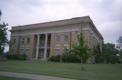
The name honors John Paul Jones, a naval officer from the independence era, whose legacy appears in public buildings. The population maintains a mix of rural traditions and small-town life, visible in local festivals and craft markets.

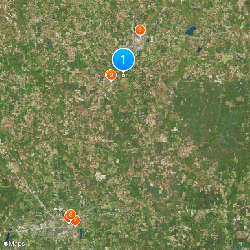
Visitors can reach the two administrative centers Laurel and Ellisville to obtain information or use public facilities. Most services are available on weekdays, and parking spaces are located near the main buildings.

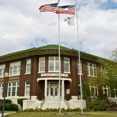
During the conflict between North and South, residents hoisted the Union flag at government buildings and declared their independence from Confederate territory. This action led to a distinct local identity that is still mentioned in narratives and exhibitions today.

The community of curious travelers

AroundUs brings together thousands of curated places, local tips, and hidden gems, enriched daily by 60,000 contributors worldwide.

Start exploring
Location
Inception
1826
Capital city
Laurel
Shares border with
Smith County, Jasper County, Wayne County, Perry County, Forrest County, Covington County
GPS coordinates
31.62000,-89.17000
Latest update
December 15, 2025 08:13
Around this place
Lauren Rogers Museum of Art
United States of America

Lauren Rogers Museum of Art

9.3 km
Laurel Central Historic District
United States of America

Laurel Central Historic District

9.4 km
Amos Deason Home
United States of America

Amos Deason Home

3.1 km
African American Military History Museum
United States of America

African American Military History Museum

33.9 km
Old Hattiesburg High School
United States of America

Old Hattiesburg High School

34.5 km
Eaton Elementary School
United States of America

Eaton Elementary School

34.6 km
United States of America

Eureka School

33.8 km
Amos Deason House
United States of America

Amos Deason House

2.8 km
Trinity Episcopal Church
United States of America

Trinity Episcopal Church

35.1 km
Newell Rogers House
United States of America

Newell Rogers House

9.2 km
United States of America

Ritz Theatre

9 km
United States of America

Beach Theatre

34.6 km
Hub City Historic District
United States of America

Hub City Historic District

34.6 km
United States of America

Buck Theatre

34.6 km
United States of America

Cloverleaf Mall Cinema 3

34.1 km
United States of America

Northside Cinemas

12.6 km
United States of America

Royal Theatre

34.5 km
United States of America

Gem Theatre

34.7 km
United States of America

Central 3 Discount Theatres

8.9 km
United States of America

Lincoln Theatre

9.1 km
United States of America

Hattiesburg North Main Street Historic District

34.2 km
United States of America

Masonite Lake

17.6 km
Hattiesburg Historic Neighborhood District
United States of America

Hattiesburg Historic Neighborhood District

35.2 km
The University of Southern Mississippi Historic District
United States of America

The University of Southern Mississippi Historic District

34.4 km
United States of America

Jones County Lake

11.4 km
North Main Street Historic District
United States of America

North Main Street Historic District

34 km
United States of America

Laurel Country Club

8.6 km
United States of America

Landrum's Homestead & Village

7.5 km
Show the full map
Administrative divisions
« Jones County - Administrative county in southeastern Mississippi, United States » is provided by Around Us (aroundus.com). Images and texts are derived from Wikimedia project under a Creative Commons license. You are allowed to copy, distribute, and modify copies of this page, under the conditions set by the license, as long as this note is clearly visible.

Discover hidden gems everywhere you go!

From secret cafés to breathtaking viewpoints, skip the crowded tourist spots and find places that match your style. Our app makes it easy with voice search, smart filtering, route optimization, and insider tips from travelers worldwide. Download now for the complete mobile experience.

Around Us App Screenshot

A unique approach to discovering new places

Le Figaro

All the places worth exploring

France Info

A tailor-made excursion in just a few clicks

20 Minutes

Around Us
Travel Guide & Maps
Download

Send to your phone

QR Code
1

Open the camera app on your mobile.

2

Point at the QR code with your camera. A notification will appear.

3

Tap the notification to open the link.