Chest opened
+${chestReward.xp} XP
Explorer
NOUVEAU ×${chestReward.collectible.quantity}
tapez pour fermer
Chest locked

Open chests in the app

Around Us is built for your phone — chests unlock when you walk, explore and capture nearby places.

Enable Location

We need your location to show you interesting places around you

Discover nearby places

Find interesting locations and hidden gems around you

Precise directions

Get accurate directions and distances to places

Your location is never shared with other users. It's only used when you tap the location button.

Log in to your account

Start exploring — it's free

Trusted by 72,893 travelers worldwide

Continue with Google
Continue with Apple
or

We will send you a code to connect

By continuing, you accept our Terms and Conditions and our Privacy Policy

Check your inbox

We've sent a pincode in your inbox. Please enter the code below.

Bartram Canoe Trail
Discussion Reviews Photo
1.3k Popularity

Bartram Canoe Trail, Recreational water trail system in Mobile-Tensaw River Delta, Alabama.

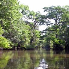
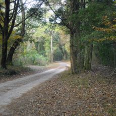
The Bartram Canoe Trail is a water trail network extending across 200 miles through bottomland hardwood swamps, creeks, lakes, and backwaters in the Mobile-Tensaw Delta. It consists of upper and lower sections that connect different waterways and offer varied paddling routes.

The Upper Bartram Canoe Trail was established in 2003 by Alabama State Lands, with the Lower section added in 2018. These developments made the waterways more accessible for recreational paddling.

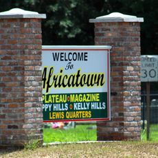
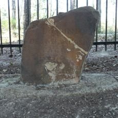
The trail passes near Bottle Creek Indian Mounds, where visitors can see traces of Indigenous peoples who lived in this region long ago. These sites remain present in the landscape today.

Floating platforms, pile-supported shelters, and primitive camping sites are available throughout the trail. Groups of eight or fewer require advance reservations to use these facilities.

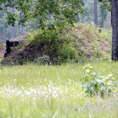
The protected wetlands along the trail contain habitats supporting over 50 rare plant and animal species. This makes it one of the most diverse regions within the second-largest river delta in North America.

The community of curious travelers

AroundUs brings together thousands of curated places, local tips, and hidden gems, enriched daily by 60,000 contributors worldwide.

Start exploring
Location
GPS coordinates
31.09380,-87.88990
Latest update
December 14, 2025 18:13
Around this place
Africatown
United States of America

Africatown

43 km
General W.K. Wilson Jr. Bridge
United States of America

General W.K. Wilson Jr. Bridge

21.2 km
United States of America

Old Mobile Site

17.1 km
Mobile-Tensaw River Delta
United States of America

Mobile-Tensaw River Delta

38.1 km
Cochrane–Africatown USA Bridge
United States of America

Cochrane–Africatown USA Bridge

42.7 km
Bottle Creek Indian Mounds
United States of America

Bottle Creek Indian Mounds

10.6 km
Blakeley
United States of America

Blakeley

39.3 km
Historic Blakeley State Park
United States of America

Historic Blakeley State Park

39.1 km
Mount Vernon Arsenal
United States of America

Mount Vernon Arsenal

13.2 km
Ellicott's Stone
United States of America

Ellicott's Stone

16.6 km
Magee Farm
United States of America

Magee Farm

40 km
Chickasaw Shipyard Village Historic District
United States of America

Chickasaw Shipyard Village Historic District

41.1 km
Andrews Chapel
United States of America

Andrews Chapel

23.2 km
N.Q. and Virginia M. Thompson House
United States of America

N.Q. and Virginia M. Thompson House

32.3 km
Latham United Methodist Church
United States of America

Latham United Methodist Church

5.7 km
First Baptist Church
United States of America

First Baptist Church

25.7 km
Montgomery Hill Baptist Church
United States of America

Montgomery Hill Baptist Church

12.5 km
Isaac Nettles Gravestones
United States of America

Isaac Nettles Gravestones

28.2 km
Citronelle Railroad Historic District
United States of America

Citronelle Railroad Historic District

32.3 km
Gainestown Methodist Church and Cemetery
United States of America

Gainestown Methodist Church and Cemetery

43 km
Gainestown Schoolhouse
United States of America

Gainestown Schoolhouse

44.2 km
Nelson House
United States of America

Nelson House

5.7 km
Willis G. Clark House
United States of America

Willis G. Clark House

32.1 km
Davis-Oak Grove District
United States of America

Davis-Oak Grove District

38.4 km
Central Core Historic District
United States of America

Central Core Historic District

31.7 km
Stockton Methodist Church
United States of America

Stockton Methodist Church

9.4 km
Barr's Subdivision Historic District
United States of America

Barr's Subdivision Historic District

33.3 km
Africatown
United States of America

Africatown

43.1 km
Show the full map
Reviews
Share your experience

No review yet

Discussions
Start a discussion...

No discussion yet

« Bartram Canoe Trail - Recreational water trail system in Mobile-Tensaw River Delta, Alabama » is provided by Around Us (aroundus.com). Images and texts are derived from Wikimedia project under a Creative Commons license. You are allowed to copy, distribute, and modify copies of this page, under the conditions set by the license, as long as this note is clearly visible.

Discover hidden gems everywhere you go!

From secret cafés to breathtaking viewpoints, skip the crowded tourist spots and find places that match your style. Our app makes it easy with voice search, smart filtering, route optimization, and insider tips from travelers worldwide. Download now for the complete mobile experience.

Around Us App Screenshot

A unique approach to discovering new places

Le Figaro

All the places worth exploring

France Info

A tailor-made excursion in just a few clicks

20 Minutes

Around Us
Travel Guide & Maps
Download

Send to your phone

QR Code
1

Open the camera app on your mobile.

2

Point at the QR code with your camera. A notification will appear.

3

Tap the notification to open the link.