Chest opened
+${chestReward.xp} XP
Explorer
NOUVEAU ×${chestReward.collectible.quantity}
tapez pour fermer
Chest locked

Open chests in the app

Around Us is built for your phone — chests unlock when you walk, explore and capture nearby places.

Enable Location

We need your location to show you interesting places around you

Discover nearby places

Find interesting locations and hidden gems around you

Precise directions

Get accurate directions and distances to places

Your location is never shared with other users. It's only used when you tap the location button.

Atmore

Log in to your account

Start exploring — it's free

Trusted by 72,879 travelers worldwide

Continue with Google
Continue with Apple
or

We will send you a code to connect

By continuing, you accept our Terms and Conditions and our Privacy Policy

Check your inbox

We've sent a pincode in your inbox. Please enter the code below.

Discussion Reviews 2 Photos
32.6k Popularity

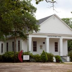
Atmore, Administrative division in Escambia County, Alabama, United States.

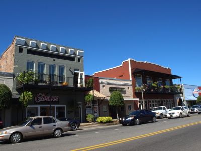
Atmore is a city in Escambia County, Alabama, situated where U.S. Route 31 crosses Alabama State Route 21, roughly six miles from Interstate 65. The city functions as a local hub for government services and community activity.

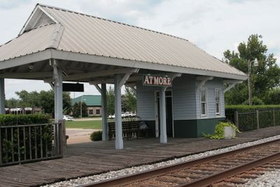
The settlement originally developed as Carney, named after a sawmill operator, until 1897 when C.P. Atmore, an agent for the Louisville and Nashville Railroad, gave it his name. This renaming reflected the growing importance of rail transportation in the region.

The Poarch Band of Creek Indians shapes community life through events and projects that visitors can observe throughout the area. Their influence appears in local businesses and gathering spaces that reflect Indigenous heritage.

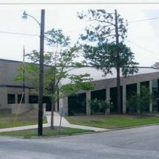
The city provides access to government services through local offices where residents and businesses can handle permits, licenses, and official records. These services are available during standard business hours.

Escambia County High School in the city was the first public county high school established in Alabama when it opened in 1911. This milestone shaped educational opportunities for generations of students in the area.

The community of curious travelers

AroundUs brings together thousands of curated places, local tips, and hidden gems, enriched daily by 60,000 contributors worldwide.

Start exploring
Location
Inception
1907
Elevation above the sea
86 m
GPS coordinates
31.02318,-87.49207
Latest update
December 20, 2025 00:21
Around this place
United States of America

Little River State Forest

26.1 km
United States of America

Commercial Hotel-Hart Hotel

22.3 km
United States of America

Bartram Canoe Trail

38.7 km
Latham United Methodist Church
United States of America

Latham United Methodist Church

33.4 km
First Baptist Church
United States of America

First Baptist Church

31.2 km
United States of America

Brewton Historic Commercial District

41.1 km
Montgomery Hill Baptist Church
United States of America

Montgomery Hill Baptist Church

32.1 km
Nelson House
United States of America

Nelson House

33.1 km
Alger-Sullivan Lumber Company Residential Historic District
United States of America

Alger-Sullivan Lumber Company Residential Historic District

23.2 km
Stockton Methodist Church
United States of America

Stockton Methodist Church

34.4 km
United States of America

Holiday Park

32.1 km
United States of America

Claude D Kelley State Park

26.6 km
United States of America

Strand Theatre

676 m
United States of America

Fort Mims

37.3 km
United States of America

Thomas E. McMillan Museum and Alabama Room

39.6 km
Atmore Public Library
United States of America

Atmore Public Library

587 m
United States of America

LaFlorestra Perdido Wildlife Management Area

18.3 km
United States of America

Dogwood Hills Golf Course

42.5 km
United States of America

Live Oak Landing park

37.2 km
United States of America

Live Oak Landing Park with camping.

37.2 km
United States of America

Bay Minette Skatepark

32.2 km
United States of America

Earth satellite dish

47.3 km

Wind Creek Amphitheater

8.9 km
United States of America

Statue, Work of art

47.3 km
United States of America

Statue, Work of art

47.2 km
United States of America

Statue, Work of art

47.3 km
United States of America

Statue, Work of art

47.3 km
United States of America

Monument featuring aircraft

48.1 km
Show the full map
Reviews
Share your experience

No review yet

Discussions
Start a discussion...

No discussion yet

« Atmore - Administrative division in Escambia County, Alabama, United States » is provided by Around Us (aroundus.com). Images and texts are derived from Wikimedia project under a Creative Commons license. You are allowed to copy, distribute, and modify copies of this page, under the conditions set by the license, as long as this note is clearly visible.

Discover hidden gems everywhere you go!

From secret cafés to breathtaking viewpoints, skip the crowded tourist spots and find places that match your style. Our app makes it easy with voice search, smart filtering, route optimization, and insider tips from travelers worldwide. Download now for the complete mobile experience.

Around Us App Screenshot

A unique approach to discovering new places

Le Figaro

All the places worth exploring

France Info

A tailor-made excursion in just a few clicks

20 Minutes

Around Us
Travel Guide & Maps
Download

Send to your phone

QR Code
1

Open the camera app on your mobile.

2

Point at the QR code with your camera. A notification will appear.

3

Tap the notification to open the link.