Governador Valadares, Regional trade center in eastern Minas Gerais, Brazil.
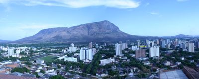
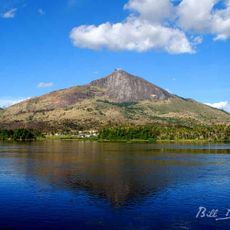
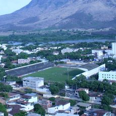
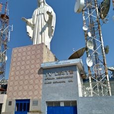
Governador Valadares sits along the banks of the Doce River in eastern Minas Gerais, Brazil, surrounded by hills and mineral-rich countryside. The city spreads across gently rolling terrain and serves as a commercial hub for the surrounding region, with residential and business districts lining broad avenues.
The settlement began after the Vitória-Minas Railway reached the area in 1907, bringing ore transport and people to the riverside location. The former village gained municipal status in 1938 and was renamed after a governor who contributed to regional development.
The city takes its name from a governor who served during the early republic and has shaped its identity through migration to North America. Many families still maintain ties to relatives in the United States, visible in local businesses and everyday customs.
Visitors reach the city using long-distance highways from other parts of Minas Gerais or from the coastal state of Espírito Santo. Main roads are easy to navigate and the downtown area can be explored on foot, though summer months can be quite warm.
Gemstone dealers offer semi-precious stones from local mines in shops along the main streets, including amethyst and topaz in different colors. Many traders cut and polish the stones on site, allowing visitors to sometimes watch the working process.
The community of curious travelers
AroundUs brings together thousands of curated places, local tips, and hidden gems, enriched daily by 60,000 contributors worldwide.