Agoura Hills, Residential city in Los Angeles County, United States.
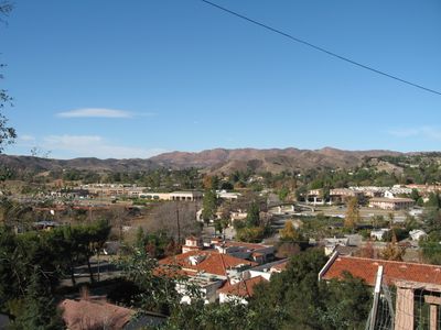
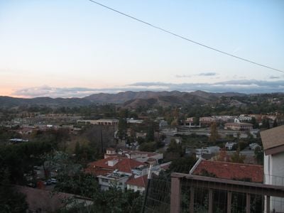
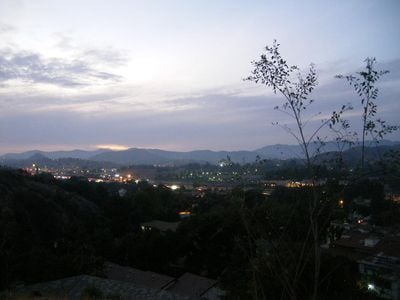
Agoura Hills is a residential city in Los Angeles County, California, USA, that stretches between two mountain ranges. Homes spread across rolling hills and valleys while roads wind through the natural terrain of the Santa Monica Mountains.
The area belonged to Rancho Las Virgenes in the 19th century and served as a backdrop for Western films by Paramount Pictures from the 1920s onward. The settlement developed into a suburb after World War II and was officially incorporated as a city in 1982.
The music style of bands from this city reached millions of listeners worldwide. Today musicians and groups from different genres play at the Canyon Club, a concert hall that has drawn visitors from the region for years.
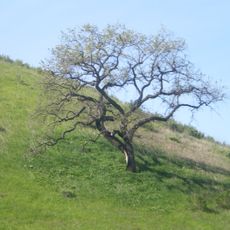
Several hiking trails start directly from residential areas and lead into the hills. Most parks remain open from sunrise to sunset and provide picnic tables and rest spots.
The name comes from Pierre Agoure, a French Basque who settled here in 1871. When residents set up the post office in 1927, they misspelled the name, and the incorrect version has stayed ever since.
Location: Los Angeles County
Inception: 1982
Elevation above the sea: 281 m
Shares border with: Oak Park, Calabasas
Website: https://agourahillscity.org
GPS coordinates: 34.15333,-118.76167
Latest update: December 4, 2025 19:04
Ronald Reagan Presidential Library
13 km
Malibu Creek State Park
7.5 km
Sherwood Country Club
11.6 km
Santa Monica Mountains National Recreation Area
15.6 km
Leonis Adobe
11.2 km
Malibu Hindu Temple
8 km
Jungleland USA
8.3 km
Upper Las Virgenes Canyon Open Space Preserve
6.5 km
Orcutt Ranch Horticulture Center
13.3 km
Thousand Oaks Civic Arts Plaza
8.3 km
Firestone Fieldhouse
13.6 km
Stagecoach Inn
14.1 km
Case Study House No. 28
11.1 km
The Rock Store
5.4 km
Joel McCrea Ranch
13.1 km
Gardens of the World
8.4 km
Shadow Ranch
13.8 km
Grant R. Brimhall Library
9.3 km
Mount McCoy
12.8 km
Sherwood Dam
8.9 km
Conejo Valley Botanical Garden
12.2 km
Banning Dam
8.6 km
Simi Adobe-Strathearn House
14 km
Castro Peak
7.8 km
Pederson House and Water Tower
13.1 km
Colony House
14 km
South Malibu Canyon Road
11.6 km
Leonis Adobe
11.2 kmReviews
Visited this place? Tap the stars to rate it and share your experience / photos with the community! Try now! You can cancel it anytime.
Discover hidden gems everywhere you go!
From secret cafés to breathtaking viewpoints, skip the crowded tourist spots and find places that match your style. Our app makes it easy with voice search, smart filtering, route optimization, and insider tips from travelers worldwide. Download now for the complete mobile experience.
A unique approach to discovering new places❞
— Le Figaro
All the places worth exploring❞
— France Info
A tailor-made excursion in just a few clicks❞
— 20 Minutes