La Vega Province, Administrative province in central Dominican Republic
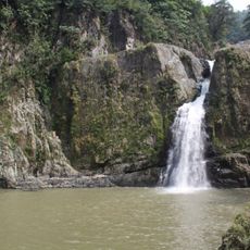
La Vega Province is an administrative province in north-central Dominican Republic encompassing mountains, valleys, and agricultural regions. The territory includes diverse landscapes with varying elevations and climate conditions that shape how communities and farming develop across the area.
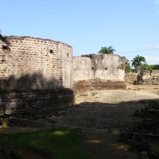
The area was founded as a settlement by Bartholomew Columbus in 1495 and relocated to its current location following an earthquake in 1562. This resettlement marked a pivotal change in the development of the location and its regional importance.
The region maintains deep agricultural traditions through the cultivation of cacao, coffee, tobacco, and rice across its fertile valleys and mountainous terrain.
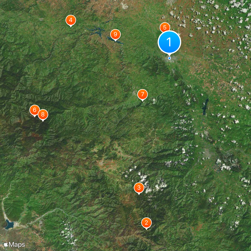
The province is organized into four municipalities, with the city of La Vega serving as the main administrative and economic hub of the region. From here, visitors can explore the various areas and their different characteristics.
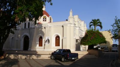
Santo Cerro, located within the province, marks the site where Christopher Columbus reportedly encountered indigenous peoples during early colonization. This historic landmark remains a place of cultural and historical significance to visitors and locals alike.
Location: Dominican Republic
Inception: 1844
Capital city: La Vega
Elevation above the sea: 1,250 m
Shares border with: Azua Province, San Juan Province, Santiago Province, Espaillat Province, Hermanas Mirabal Province, Duarte Province, Sánchez Ramírez Province, Monseñor Nouel Province, San José de Ocoa Province
GPS coordinates: 19.22000,-70.53000
Latest update: December 20, 2025 02:16
Valle Nuevo National Park
57.6 kmLoma Alto de la Bandera
46.5 kmFort Santo Tomás
34.7 kmPueblo Viejo National Park
8.3 kmLoma La Rucilla
49.1 km
Salto de Baiguate
16.8 kmPico del Yaque
47.2 kmEmbalse Tavera
19 kmPico de Rancho Nuevo
33.7 km
La Vega Vieja national park
8.3 kmPico de Piedra
41.4 kmMogote de Tinaja
31.5 kmEmbalse de Rincón
20.1 km
Salto de Jimenoa Uno
15.6 kmLoma Monteada Nueva
41.2 kmEmbalse de Bao
25.1 kmLoma La Golondrina
18.2 kmPico Bonito
47 kmAlto de Piedra
52.6 kmMemoria del Trensito
2.5 kmCruce se ve las dos entradas de Sajoma
44.2 kmCasona antigua (pueblito fantasma)
52 kmJardin rosa maria
18.3 kmAntena
17.7 kmHelados ivone
16 kmVegetalero
18.6 kmFrancisca Morel
17.7 kmRuinas Monasterio de los Franciscanos
7.5 kmVisited this place? Tap the stars to rate it and share your experience / photos with the community! Try now! You can cancel it anytime.
Discover hidden gems everywhere you go!
From secret cafés to breathtaking viewpoints, skip the crowded tourist spots and find places that match your style. Our app makes it easy with voice search, smart filtering, route optimization, and insider tips from travelers worldwide. Download now for the complete mobile experience.
A unique approach to discovering new places❞
— Le Figaro
All the places worth exploring❞
— France Info
A tailor-made excursion in just a few clicks❞
— 20 Minutes