Anna Maria Island

Log in to your account

AroundUs is a community-driven map of interesting places, built by curious explorers like you. It grows with every review, story, and photo you share.
Connect to save your favorite spots, contribute locations, and create personalized routes.
By continuing, you accept our Terms and Conditions and our Privacy Policy
Add to collection
Map
Suggest a change
Share

Anna Maria Island, Barrier island in Florida, United States.

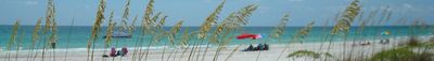
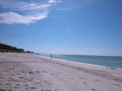
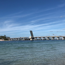
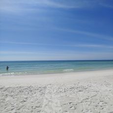
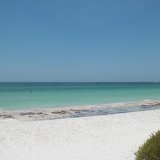
Anna Maria Island is a barrier formation off the Gulf Coast of Florida, extending roughly seven miles (11 km) between the Gulf of Mexico and Tampa Bay. Three separate municipalities share the landmass, which features continuous sand beaches, low-rise residential areas, and scattered commercial districts.

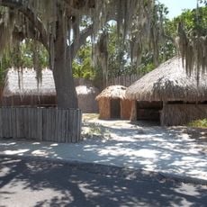
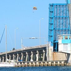
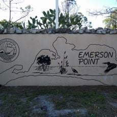
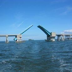
George Emerson Bean arrived in 1892 as the first permanent settler and named the territory after his wife. The following decades transformed the isolated sandbar into a resort destination, with bridge connections to the mainland opening access from the 1920s onward.

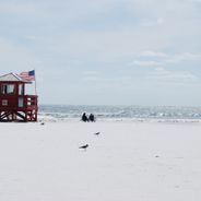
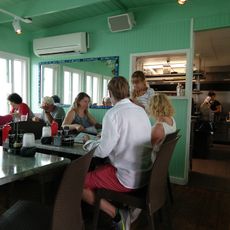
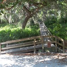
The island operates without traffic lights or roundabouts, relying on stop signs and the relaxed pace of local drivers. Families from the surrounding region share public beach access points with visitors, while anglers claim their spots on the pier in the early morning hours.

A free trolley system links the three communities daily and makes movement possible without a car. The beaches are accessible through numbered public entry points that often have limited parking, so an early start on weekends helps.

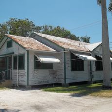
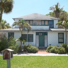
The island enforces strict building height restrictions that prevent multi-story structures and preserve a low profile along the entire shoreline. This regulation emerged from a community desire to maintain the character of mid-20th-century small beach towns rather than allow modern high-rise development.

Location: Florida

Elevation above the sea: 4 m

GPS coordinates: 27.51420,-82.71899

Latest update: December 5, 2025 06:40

Best beaches in Florida for a perfect getaway

Florida, known as the Sunshine State, extends along the Atlantic Ocean and Gulf of Mexico with white sand beaches and warm waters. The coastline includes urban beaches near Miami, natural reserves in the Keys, and family destinations in central Florida. Visitors find locations for swimming, surfing, fishing, and wildlife observation from Pensacola to Key West.

Around this place
Show the full map
Sunshine Skyway Bridge
United States of America

Sunshine Skyway Bridge

13.7 km
Fort De Soto Park
United States of America

Fort De Soto Park

11.4 km
Egmont Key State Park
United States of America

Egmont Key State Park

9.5 km
De Soto National Memorial
United States of America

De Soto National Memorial

7.5 km
Egmont Key Light
United States of America

Egmont Key Light

10.5 km
Rod and Reel Pier
United States of America

Rod and Reel Pier

3.4 km
Madira Bickel Mound State Archeological Site
United States of America

Madira Bickel Mound State Archeological Site

13.7 km
Palmetto Armory
United States of America

Palmetto Armory

14.3 km
Longboat Pass Bridge
United States of America

Longboat Pass Bridge

8.5 km
Palmetto Historic District
United States of America

Palmetto Historic District

13.9 km
Cortez Bridge
United States of America

Cortez Bridge

5.7 km
Emerson Point Preserve
United States of America

Emerson Point Preserve

8.6 km
Palma Sola Botanical Park
United States of America

Palma Sola Botanical Park

5.8 km
Cortez Historic District
United States of America

Cortez Historic District

6.2 km
Bradenton Carnegie Library
United States of America

Bradenton Carnegie Library

14.3 km
Portavant Mound
United States of America

Portavant Mound

9.4 km
Woman's Club of Palmetto
United States of America

Woman's Club of Palmetto

14.2 km
Richardson House
United States of America

Richardson House

14 km
Rufus P. Jordan House
United States of America

Rufus P. Jordan House

9.3 km
Anna Maria Island Historical Society Museum
United States of America

Anna Maria Island Historical Society Museum

2.3 km
Snead Island Bridge
United States of America

Snead Island Bridge

10.9 km
Manatee County Beach
United States of America

Manatee County Beach

1.7 km
De Soto National Memorial Visitor Center
United States of America

De Soto National Memorial Visitor Center

7.5 km
North Beach
United States of America

North Beach

14.1 km
Olympia Theatre
United States of America

Olympia Theatre

14.2 km
East Beach
United States of America

East Beach

13.7 km
Anna Maria Island Bridge
United States of America

Anna Maria Island Bridge

3.1 km
Regina Underwater Archeaological Preserve
United States of America

Regina Underwater Archeaological Preserve

5.3 km
Show the full map

Reviews

Visited this place? Tap the stars to rate it and share your experience / photos with the community! Try now! You can cancel it anytime.

« Anna Maria Island - Barrier island in Florida, United States » is provided by Around Us (aroundus.com). Images and texts are derived from Wikimedia project under a Creative Commons license. You are allowed to copy, distribute, and modify copies of this page, under the conditions set by the license, as long as this note is clearly visible.

Discover hidden gems everywhere you go!

From secret cafés to breathtaking viewpoints, skip the crowded tourist spots and find places that match your style. Our app makes it easy with voice search, smart filtering, route optimization, and insider tips from travelers worldwide. Download now for the complete mobile experience.

Around Us App Screenshot

A unique approach to discovering new places

Le Figaro

All the places worth exploring

France Info

A tailor-made excursion in just a few clicks

20 Minutes