Chest opened
+${chestReward.xp} XP
Explorer
NOUVEAU ×${chestReward.collectible.quantity}
tapez pour fermer
Chest locked

Open chests in the app

Around Us is built for your phone — chests unlock when you walk, explore and capture nearby places.

Enable Location

We need your location to show you interesting places around you

Discover nearby places

Find interesting locations and hidden gems around you

Precise directions

Get accurate directions and distances to places

Your location is never shared with other users. It's only used when you tap the location button.

Log in to your account

Start exploring — it's free

Trusted by 72,878 travelers worldwide

Continue with Google
Continue with Apple
or

We will send you a code to connect

By continuing, you accept our Terms and Conditions and our Privacy Policy

Check your inbox

We've sent a pincode in your inbox. Please enter the code below.

Discussion Reviews Photo
10.5k Popularity

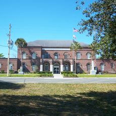
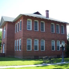
Bell, Administrative division in Gilchrist County, Florida.

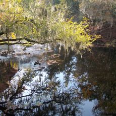
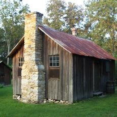
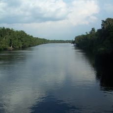
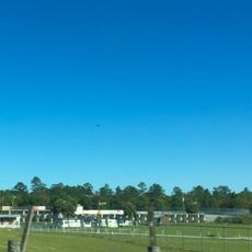
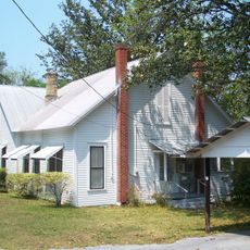
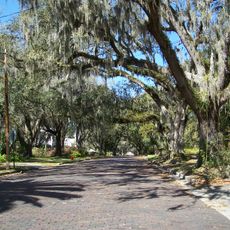
Bell is a small rural community in Gilchrist County, in northern Florida, surrounded by pine forests, open farmland, and natural springs. The area is flat and sparsely developed, with land use split between agriculture and natural open space.

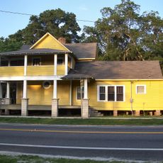
Bell grew during Florida's farming expansion, when tobacco and fruit production shaped the local economy. That early agricultural foundation still shows in the way the land is used today.

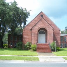
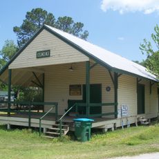
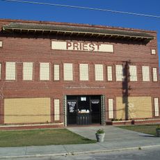
Bell is a farming community where daily life moves at a slow, rural pace shaped by the land and the seasons. Locals gather at small community events where agriculture plays a central role in shared traditions.

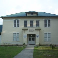
Bell is best reached by car, as the area has no public transport and distances between points of interest can be long. Basic services are available through Gilchrist County, and it helps to plan your visit in advance.

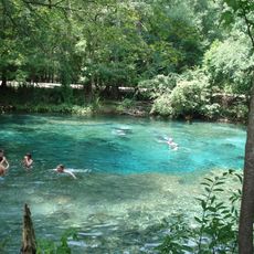
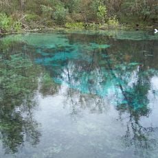
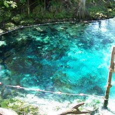
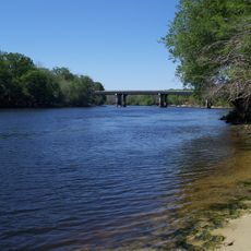
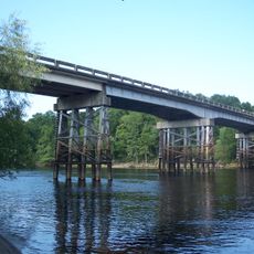
The land around Bell sits above the Floridan Aquifer, one of the largest freshwater underground systems in North America, and several natural springs in the area bring that water to the surface. These springs can be visited and offer a direct look at a geological feature that lies beneath much of Florida.

The community of curious travelers

AroundUs brings together thousands of curated places, local tips, and hidden gems, enriched daily by 60,000 contributors worldwide.

Start exploring
GPS coordinates
29.75551,-82.86262
Latest update
March 3, 2026 08:21
Around this place
Ginnie Springs
United States of America

Ginnie Springs

18.1 km
Ichetucknee Springs State Park
United States of America

Ichetucknee Springs State Park

25 km
O'Leno State Park
United States of America

O'Leno State Park

32.4 km
United States of America

Santa Fe College Teaching Zoo

41.8 km
San Felasco Hammock Preserve State Park
United States of America

San Felasco Hammock Preserve State Park

40.8 km
Fanning Springs State Park
United States of America

Fanning Springs State Park

20.1 km
Dudley Farm Historic State Park
United States of America

Dudley Farm Historic State Park

33 km
City of Hawkinsville
United States of America

City of Hawkinsville

19.5 km
Coca-Cola Bottling Plant
United States of America

Coca-Cola Bottling Plant

16 km
Gilchrist County Courthouse
United States of America

Gilchrist County Courthouse

16.5 km
Bronson Speedway
United States of America

Bronson Speedway

40 km
First Baptist Church
United States of America

First Baptist Church

16.4 km
Old Town Elementary School
United States of America

Old Town Elementary School

21.7 km
Newberry Historic District
United States of America

Newberry Historic District

27 km
Trenton Church of Christ
United States of America

Trenton Church of Christ

16.5 km
Old Town Methodist Church
United States of America

Old Town Methodist Church

20.7 km
Levy County Courthouse
United States of America

Levy County Courthouse

39.7 km
City of Alachua Downtown Historic District
United States of America

City of Alachua Downtown Historic District

35.8 km
Archer Historical Society Museum
United States of America

Archer Historical Society Museum

41.3 km
Fort White Public School Historic District
United States of America

Fort White Public School Historic District

23.8 km
Cannon Farm
United States of America

Cannon Farm

6.9 km
South Brooksville Avenue Historic District
United States of America

South Brooksville Avenue Historic District

23.5 km
Sikes House
United States of America

Sikes House

23.5 km
High Springs Historic District
United States of America

High Springs Historic District

26.9 km
River Ranch Waterpark
United States of America

River Ranch Waterpark

28.6 km
Joe H. Anderson Sr. Bridge
United States of America

Joe H. Anderson Sr. Bridge

19.9 km
Priest Theater
United States of America

Priest Theater

26.8 km
Cannon-McCollister Bridge
United States of America

Cannon-McCollister Bridge

7.1 km
Show the full map
Reviews
Share your experience

No review yet

Discussions
Start a discussion...

No discussion yet

« Bell - Administrative division in Gilchrist County, Florida » is provided by Around Us (aroundus.com). Images and texts are derived from Wikimedia project under a Creative Commons license. You are allowed to copy, distribute, and modify copies of this page, under the conditions set by the license, as long as this note is clearly visible.

Discover hidden gems everywhere you go!

From secret cafés to breathtaking viewpoints, skip the crowded tourist spots and find places that match your style. Our app makes it easy with voice search, smart filtering, route optimization, and insider tips from travelers worldwide. Download now for the complete mobile experience.

Around Us App Screenshot

A unique approach to discovering new places

Le Figaro

All the places worth exploring

France Info

A tailor-made excursion in just a few clicks

20 Minutes

Around Us
Travel Guide & Maps
Download

Send to your phone

QR Code
1

Open the camera app on your mobile.

2

Point at the QR code with your camera. A notification will appear.

3

Tap the notification to open the link.