Enable Location

We need your location to show you interesting places around you

Discover nearby places

Find interesting locations and hidden gems around you

Precise directions

Get accurate directions and distances to places

Your location is never shared with other users. It's only used when you tap the location button.

Log in to your account

Start exploring — it's free

Trusted by 62,609 travelers worldwide

Continue with Google
Continue with Apple
or

We will send you a code to connect

By continuing, you accept our Terms and Conditions and our Privacy Policy

Check your inbox

We've sent a pincode in your inbox. Please enter the code below.

Mission San Francisco de Potano

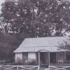
Mission San Francisco de Potano, Spanish colonial mission site near Gainesville, Florida.

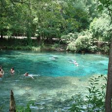
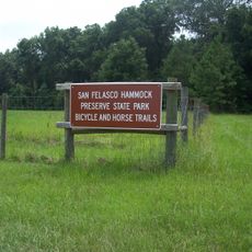
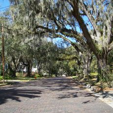
Mission San Francisco de Potano is an archaeological site near Gainesville featuring remains of wooden structures built during the Spanish colonial period. The ruins sit at the edge of San Felasco Hammock Preserve State Park and are accessible to researchers and visitors interested in early colonial history.

Franciscan missionaries founded this site in 1606 as the first permanent religious outpost west of the St. Johns River. The mission played an important role in Spain's colonial expansion throughout Florida during the early 17th century.

The mission was a place where Spanish colonists and the Potano people lived together and interacted. Visitors can sense this cultural crossroads through the archaeological findings that reveal how two communities coexisted at this location.

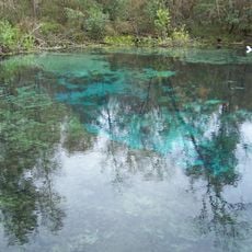
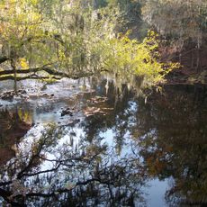
This site is somewhat remote and situated within a natural forest area with limited pathways for exploration. It is best to gather information beforehand about access routes and trail conditions since there are no visitor centers or extensive facilities on the grounds.

Archaeological excavations in 2007 uncovered the exact location of this mission after it had been lost for centuries. This discovery allowed researchers to confirm the mission's existence and pinpoint its location, settling years of historical uncertainty.

The community of curious travelers

AroundUs brings together thousands of curated places, local tips, and hidden gems, enriched daily by 60,000 contributors worldwide.

Start exploring
Location
GPS coordinates
29.88361,-82.56639
Latest update
December 14, 2025 12:26
Around this place
Ginnie Springs
United States of America

Ginnie Springs

13.9 km
Ichetucknee Springs State Park
United States of America

Ichetucknee Springs State Park

22.3 km
Devil's Millhopper Geological State Park
United States of America

Devil's Millhopper Geological State Park

25.7 km
O'Leno State Park
United States of America

O'Leno State Park

4.1 km
United States of America

Santa Fe College Teaching Zoo

25.6 km
Baughman Center
United States of America

Baughman Center

33.3 km
San Felasco Hammock Preserve State Park
United States of America

San Felasco Hammock Preserve State Park

21 km
James G. Pressly Stadium
United States of America

James G. Pressly Stadium

33.1 km
Dudley Farm Historic State Park
United States of America

Dudley Farm Historic State Park

25.4 km
Florida State Parks in Alachua County
United States of America

Florida State Parks in Alachua County

25.7 km
President's House
United States of America

President's House

33 km
Linder Stadium at Ring Tennis Complex
United States of America

Linder Stadium at Ring Tennis Complex

33 km
Kika Silva Pla Planetarium
United States of America

Kika Silva Pla Planetarium

25.9 km
Splitz
United States of America

Splitz

27.9 km
Newberry Historic District
United States of America

Newberry Historic District

26.9 km
Mildred's Big City Food
United States of America

Mildred's Big City Food

31.8 km
Union County Courthouse
United States of America

Union County Courthouse

26.9 km
Liberty Hill Schoolhouse
United States of America

Liberty Hill Schoolhouse

26.9 km
City of Alachua Downtown Historic District
United States of America

City of Alachua Downtown Historic District

12.5 km
Bethel United Methodist Church
United States of America

Bethel United Methodist Church

28.2 km
Townsend Building
United States of America

Townsend Building

26.6 km
Fort White Public School Historic District
United States of America

Fort White Public School Historic District

14.9 km
Cannon Farm
United States of America

Cannon Farm

30.3 km
South Brooksville Avenue Historic District
United States of America

South Brooksville Avenue Historic District

14.8 km
James W. Townsend House
United States of America

James W. Townsend House

26.5 km
Lake Butler Woman's Club
United States of America

Lake Butler Woman's Club

27.2 km
Sikes House
United States of America

Sikes House

14.8 km
High Springs Historic District
United States of America

High Springs Historic District

7.1 km
Show the full map
« Mission San Francisco de Potano - Spanish colonial mission site near Gainesville, Florida » is provided by Around Us (aroundus.com). Images and texts are derived from Wikimedia project under a Creative Commons license. You are allowed to copy, distribute, and modify copies of this page, under the conditions set by the license, as long as this note is clearly visible.

Discover hidden gems everywhere you go!

From secret cafés to breathtaking viewpoints, skip the crowded tourist spots and find places that match your style. Our app makes it easy with voice search, smart filtering, route optimization, and insider tips from travelers worldwide. Download now for the complete mobile experience.

Around Us App Screenshot

A unique approach to discovering new places

Le Figaro

All the places worth exploring

France Info

A tailor-made excursion in just a few clicks

20 Minutes

Around Us
Travel Guide & Maps
Download

Send to your phone

QR Code
1

Open the camera app on your mobile.

2

Point at the QR code with your camera. A notification will appear.

3

Tap the notification to open the link.