Chest opened
+${chestReward.xp} XP
Explorer
NOUVEAU ×${chestReward.collectible.quantity}
tapez pour fermer
Chest locked

Open chests in the app

Around Us is built for your phone — chests unlock when you walk, explore and capture nearby places.

Enable Location

We need your location to show you interesting places around you

Discover nearby places

Find interesting locations and hidden gems around you

Precise directions

Get accurate directions and distances to places

Your location is never shared with other users. It's only used when you tap the location button.

Log in to your account

Start exploring — it's free

Trusted by 72,985 travelers worldwide

Continue with Google
Continue with Apple
or

We will send you a code to connect

By continuing, you accept our Terms and Conditions and our Privacy Policy

Check your inbox

We've sent a pincode in your inbox. Please enter the code below.

Capital Circle
Discussion Reviews Photo
1.5k Popularity

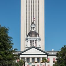
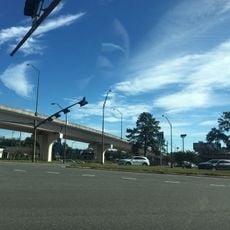
Capital Circle, Beltway in Tallahassee, United States

Capital Circle is a beltway that forms a three-quarter loop around Tallahassee, connecting western, southern, and eastern parts of the city. The roadway features multiple lanes in each direction along with dedicated bicycle lanes and sidewalks throughout.

The beltway underwent major expansion in the late 2000s, transforming from a three-lane road into a six-lane thoroughfare. This upgrade was needed to handle growing traffic volumes across the city.

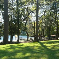
Martha Wellman Park sits at the Tennessee Street intersection, offering green spaces and paved paths where residents walk and spend time outdoors. The park creates a place for everyday activities and casual gatherings.

The road connects directly to Interstate 10 and Tallahassee Regional Airport, making it easy to reach different parts of town quickly. Drivers new to the area should note that the loop has multiple directions, so it pays to plan your route ahead.

A large stormwater management facility along the beltway filters water and reduces flooding throughout the watershed. This engineering project remains invisible to most drivers, but it plays a quiet role in protecting the surrounding area.

The community of curious travelers

AroundUs brings together thousands of curated places, local tips, and hidden gems, enriched daily by 60,000 contributors worldwide.

Start exploring
Location
GPS coordinates
30.48060,-84.23510
Latest update
December 14, 2025 14:42
Around this place
Florida Legislature
United States of America

Florida Legislature

6.5 km
Florida Governor's Mansion
United States of America

Florida Governor's Mansion

5.7 km
Florida State Capitol
United States of America

Florida State Capitol

6.5 km
Alfred B. Maclay Gardens State Park
United States of America

Alfred B. Maclay Gardens State Park

4.5 km
DeSoto Site Historic State Park
United States of America

DeSoto Site Historic State Park

6 km
John G. Riley House
United States of America

John G. Riley House

6.1 km
State Library and Archives of Florida
United States of America

State Library and Archives of Florida

6.7 km
Union Bank
United States of America

Union Bank

6.4 km
St. John's Episcopal Church
United States of America

St. John's Episcopal Church

6 km
The Mary Brogan Museum of Art and Science
United States of America

The Mary Brogan Museum of Art and Science

6.5 km
Los Robles Gate
United States of America

Los Robles Gate

4.8 km
Smoky Hollow Historic District
United States of America

Smoky Hollow Historic District

6.1 km
Tookes House
United States of America

Tookes House

6.3 km
Gov. John W. Martin House
United States of America

Gov. John W. Martin House

5.8 km
Exchange Bank Building
United States of America

Exchange Bank Building

6.3 km
David S. Walker Library
United States of America

David S. Walker Library

6.2 km
Old City Waterworks
United States of America

Old City Waterworks

6.5 km
Veterans Memorial Bridge
United States of America

Veterans Memorial Bridge

3.2 km
Woman's Club of Tallahassee
United States of America

Woman's Club of Tallahassee

4.5 km
Magnolia Heights Historic District
United States of America

Magnolia Heights Historic District

5.4 km
Brokaw-McDougall House
United States of America

Brokaw-McDougall House

5.6 km
Lewis and Lucretia Taylor House
United States of America

Lewis and Lucretia Taylor House

6.2 km
Covington House
United States of America

Covington House

4.4 km
Calhoun Street Historic District
United States of America

Calhoun Street Historic District

5.7 km
Woman's Working Band House
United States of America

Woman's Working Band House

6.5 km
Gallie's Hall and Buildings
United States of America

Gallie's Hall and Buildings

6.4 km
Goodwood Museum and Gardens
United States of America

Goodwood Museum and Gardens

3.3 km
AMC Tallahassee Mall 20
United States of America

AMC Tallahassee Mall 20

5.3 km
Show the full map
Reviews
Share your experience

No review yet

Discussions
Start a discussion...

No discussion yet

« Capital Circle - Beltway in Tallahassee, United States » is provided by Around Us (aroundus.com). Images and texts are derived from Wikimedia project under a Creative Commons license. You are allowed to copy, distribute, and modify copies of this page, under the conditions set by the license, as long as this note is clearly visible.

Discover hidden gems everywhere you go!

From secret cafés to breathtaking viewpoints, skip the crowded tourist spots and find places that match your style. Our app makes it easy with voice search, smart filtering, route optimization, and insider tips from travelers worldwide. Download now for the complete mobile experience.

Around Us App Screenshot

A unique approach to discovering new places

Le Figaro

All the places worth exploring

France Info

A tailor-made excursion in just a few clicks

20 Minutes

Around Us
Travel Guide & Maps
Download

Send to your phone

QR Code
1

Open the camera app on your mobile.

2

Point at the QR code with your camera. A notification will appear.

3

Tap the notification to open the link.