Clay County

Log in to your account

AroundUs is a community-driven map of interesting places, built by curious explorers like you. It grows with every review, story, and photo you share.
Connect to save your favorite spots, contribute locations, and create personalized routes.
By continuing, you accept our Terms and Conditions and our Privacy Policy
Add to collection
Map
Suggest a change
Share

Clay County, County administrative division in Georgia, United States.

Clay County is an administrative division in Georgia that operates through various departments including Information Services, Building Maintenance, and Human Resources. The county administration maintains online platforms for property taxes, vehicle registration, and other administrative services that residents can access directly.

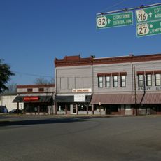
The county was established in the early 1820s with Fort Gaines designated as its administrative center. This settlement served as the foundation for the area's governance and growth throughout the following decades.

Public meetings held regularly throughout the county allow residents to observe local government decisions firsthand. These gatherings reflect how the community stays connected to its administrative processes.

Residents can access county services through the official website, which offers information about property taxes, vehicle registration, and other administrative matters. Checking the website beforehand helps visitors understand which services are available and how to reach them.

The Information Services Department uses geographic information systems to make data more accessible and enhance digital communication across administrative platforms. This technical approach helps translate complex spatial information into simpler formats for the public.

GPS coordinates: 31.57382,-84.98008

Latest update: December 7, 2025 19:27

Around this place
Show the full map
Walter F. George Lake
United States of America

Walter F. George Lake

29.1 km
Kolomoki Mounds State Park
United States of America

Kolomoki Mounds State Park

13.1 km
Shorter Mansion
United States of America

Shorter Mansion

39.2 km
George T. Bagby State Park
United States of America

George T. Bagby State Park

12.5 km
Kendall Manor
United States of America

Kendall Manor

39.1 km
Early County Courthouse
United States of America

Early County Courthouse

22.3 km
Fletcher Henderson House
United States of America

Fletcher Henderson House

27.4 km
Shellman Historic District
United States of America

Shellman Historic District

40.3 km
Coheelee Creek Covered Bridge
United States of America

Coheelee Creek Covered Bridge

31.2 km
Kennedy House
United States of America

Kennedy House

25.7 km
Cato House
United States of America

Cato House

39.1 km
Wellborn
United States of America

Wellborn

38.7 km
Purcell-Killingsworth House
United States of America

Purcell-Killingsworth House

33.2 km
The Tavern
United States of America

The Tavern

38.5 km
Edison Commercial Historic District
United States of America

Edison Commercial Historic District

22.8 km
Drewry-Mitchell-Moorer House
United States of America

Drewry-Mitchell-Moorer House

39.4 km
Arlington United Methodist Church
United States of America

Arlington United Methodist Church

28.3 km
Quitman County Courthouse and Old Jail
United States of America

Quitman County Courthouse and Old Jail

36.8 km
Cuthbert Historic District
United States of America

Cuthbert Historic District

28.5 km
Bray-Barron House
United States of America

Bray-Barron House

39.2 km
Dill House
United States of America

Dill House

7.4 km
Blakely Court Square Historic District
United States of America

Blakely Court Square Historic District

22.3 km
Kiels-McNab House
United States of America

Kiels-McNab House

38.7 km
McNab Bank Building
United States of America

McNab Bank Building

38.7 km
Clay County Courthouse
United States of America

Clay County Courthouse

7.3 km
Calhoun County Courthouse
United States of America

Calhoun County Courthouse

36.3 km
Confederate Flagpole at Blakley
United States of America

Confederate Flagpole at Blakley

22.3 km
Fendall Hall
United States of America

Fendall Hall

39.1 km
Show the full map

Reviews

Visited this place? Tap the stars to rate it and share your experience / photos with the community! Try now! You can cancel it anytime.

« Clay County - County administrative division in Georgia, United States » is provided by Around Us (aroundus.com). Images and texts are derived from Wikimedia project under a Creative Commons license. You are allowed to copy, distribute, and modify copies of this page, under the conditions set by the license, as long as this note is clearly visible.

Discover hidden gems everywhere you go!

From secret cafés to breathtaking viewpoints, skip the crowded tourist spots and find places that match your style. Our app makes it easy with voice search, smart filtering, route optimization, and insider tips from travelers worldwide. Download now for the complete mobile experience.

Around Us App Screenshot

A unique approach to discovering new places

Le Figaro

All the places worth exploring

France Info

A tailor-made excursion in just a few clicks

20 Minutes