Enable Location

We need your location to show you interesting places around you

Discover nearby places

Find interesting locations and hidden gems around you

Precise directions

Get accurate directions and distances to places

Your location is never shared with other users. It's only used when you tap the location button.

Lee County

Log in to your account

Start exploring — it's free

Trusted by travelers worldwide

Continue with Google
Continue with Apple
or

We will send you a code to connect

By continuing, you accept our Terms and Conditions and our Privacy Policy

Check your inbox

We've sent a pincode in your inbox. Please enter the code below.

Lee County, Administrative division in Southwest Florida, United States.

Description

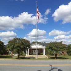
Lee County spans roughly 1,000 square miles along the Gulf Coast, containing developed cities like Fort Myers and Cape Coral alongside protected natural areas. The county features a mix of urban centers and coastal landscapes with extensive green spaces and mangrove ecosystems.

History

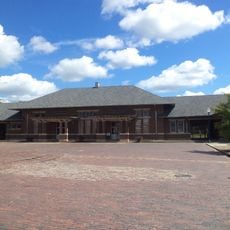
The area was established in 1887 from Monroe County territory, after Fort Myers was built as a military post during the Seminole Wars in 1850. Completion of the Tamiami Trail Bridge in 1924 accelerated the transformation from agricultural land to residential communities.

Culture

The region hosts spring training facilities for two Major League Baseball teams, drawing sports fans to watch games each year.

Practical

The county provides emergency alerts through the AlertLee system to keep residents and visitors informed during hurricane season and other incidents. Regular community notifications help people prepare for weather events common to this coastal area.

Did you know?

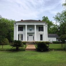
The Edison and Ford Winter Estates in Fort Myers preserve the winter homes of famous inventors and display their personal gardens. These sites reveal how wealthy residents in the early 1900s lived during the cold months away from the North.

Location
Inception
June 9, 1825
Capital city
Leesburg
Shares border with
Sumter County, Crisp County, Worth County, Dougherty County, Terrell County
GPS coordinates
31.78000,-84.14000
Latest update
December 7, 2025 10:06

AroundUs brings together thousands of curated places, local tips, and hidden gems, enriched daily by 60,000 contributors worldwide. Discover all places nearby (Georgia).

Around this place
Jimmy Carter Peanut Statue
United States of America

Jimmy Carter Peanut Statue

37.6 km
Sherwood Baptist Church
United States of America

Sherwood Baptist Church

20.1 km
Lake Blackshear
United States of America

Lake Blackshear

20.2 km
Jimmy Carter National Historical Park
United States of America

Jimmy Carter National Historical Park

39 km
Windsor Hotel
United States of America

Windsor Hotel

33.7 km
Flint RiverQuarium
United States of America

Flint RiverQuarium

22.4 km
Confederate Memorial Park
United States of America

Confederate Memorial Park

17.6 km
Bridge House
United States of America

Bridge House

22.5 km
Heritage Plaza
United States of America

Heritage Plaza

22.1 km
Old St. Teresa Catholic Church
United States of America

Old St. Teresa Catholic Church

22 km
United States Post Office and Courthouse
United States of America

United States Post Office and Courthouse

22.6 km
United States of America

Fort Early

21.8 km
Georgia Rural Telephone Museum
United States of America

Georgia Rural Telephone Museum

20.2 km
Calvary Episcopal Church (Americus, Georgia)
United States of America

Calvary Episcopal Church (Americus, Georgia)

33.1 km
Samuel Farkas House
United States of America

Samuel Farkas House

22.7 km
John A. Davis House
United States of America

John A. Davis House

22.6 km
Albany Theatre
United States of America

Albany Theatre

22.6 km
Lee County Courthouse
United States of America

Lee County Courthouse

6.1 km
Terrell County Courthouse
United States of America

Terrell County Courthouse

29 km
Cordele Commercial Historic District
United States of America

Cordele Commercial Historic District

39.8 km
Sylvester Commercial Historic District
United States of America

Sylvester Commercial Historic District

40.4 km
Liberty Hall Plantation
United States of America

Liberty Hall Plantation

20.2 km
Davis-Exchange Bank Building
United States of America

Davis-Exchange Bank Building

22.6 km
Poulan Library
United States of America

Poulan Library

44.6 km
Worth County Courthouse
United States of America

Worth County Courthouse

40.2 km
Margaret Jones Public Library
United States of America

Margaret Jones Public Library

40.2 km
State Theatre
United States of America

State Theatre

22.5 km
Americus Historic District
United States of America

Americus Historic District

33.2 km
Show the full map
Administrative divisions
« Lee County - Administrative division in Southwest Florida, United States » is provided by Around Us (aroundus.com). Images and texts are derived from Wikimedia project under a Creative Commons license. You are allowed to copy, distribute, and modify copies of this page, under the conditions set by the license, as long as this note is clearly visible.

Discover hidden gems everywhere you go!

From secret cafés to breathtaking viewpoints, skip the crowded tourist spots and find places that match your style. Our app makes it easy with voice search, smart filtering, route optimization, and insider tips from travelers worldwide. Download now for the complete mobile experience.

Around Us App Screenshot

A unique approach to discovering new places

Le Figaro

All the places worth exploring

France Info

A tailor-made excursion in just a few clicks

20 Minutes

Around Us
Travel Guide & Maps
Download

Send to your phone

QR Code
1

Open the camera app on your mobile.

2

Point at the QR code with your camera. A notification will appear.

3

Tap the notification to open the link.