Enable Location

We need your location to show you interesting places around you

Discover nearby places

Find interesting locations and hidden gems around you

Precise directions

Get accurate directions and distances to places

Your location is never shared with other users. It's only used when you tap the location button.

Log in to your account

Start exploring — it's free

Trusted by travelers worldwide

Continue with Google
Continue with Apple
or

We will send you a code to connect

By continuing, you accept our Terms and Conditions and our Privacy Policy

Check your inbox

We've sent a pincode in your inbox. Please enter the code below.

Lanier County, County in southern Georgia, United States

Description

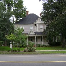
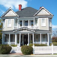
Lanier County is a county in southern Georgia with farmlands, residential areas, and the city of Lakeland serving as its administrative center. Small streams run through the region and support the area's agricultural activities.

History

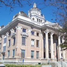
The county was created in 1920 when Georgia's General Assembly combined portions of three neighboring counties. This formation emerged from the need to establish better administration for the region's growing population.

Culture

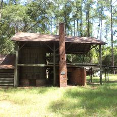
The county maintains farming traditions through seasonal community markets and local gatherings where residents display crops and regional products. These events connect neighbors and show how daily life remains tied to agricultural work.

Practical

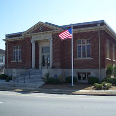
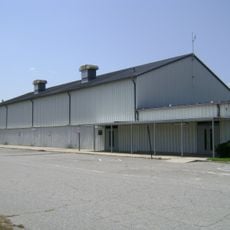
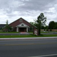
Visitors can access government services and public facilities in Lakeland, the county seat. The flat landscape makes it easy to drive around and explore farms, neighborhoods, and rural roads.

Did you know?

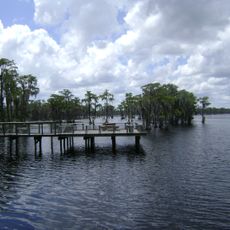
The area sits at an elevation of about 60 meters and is crisscrossed by small streams that form a unique water system. These waterways were crucial in shaping the region's settlement and development as farmland.

Location
Inception
August 7, 1920
Capital city
Lakeland
Elevation above the sea
59 m
Shares border with
Atkinson County, Echols County, Clinch County, Lowndes County, Berrien County
GPS coordinates
31.03789,-83.06265
Latest update
December 14, 2025 20:23

AroundUs brings together thousands of curated places, local tips, and hidden gems, enriched daily by 60,000 contributors worldwide. Discover all places nearby (Georgia).

Around this place
Banks Lake National Wildlife Refuge
United States of America

Banks Lake National Wildlife Refuge

6.5 km
McCranie's Turpentine Still
United States of America

McCranie's Turpentine Still

36.3 km
The Crescent
United States of America

The Crescent

30.6 km
William G. Harrison House
United States of America

William G. Harrison House

25.8 km
The Complex
United States of America

The Complex

30.7 km
West Hall
United States of America

West Hall

30.1 km
First Presbyterian Church
United States of America

First Presbyterian Church

30.1 km
Lowndes County Historical Society Museum
United States of America

Lowndes County Historical Society Museum

31.2 km
Converse-Dalton House
United States of America

Converse-Dalton House

30.8 km
Student Union (Valdosta State University)
United States of America

Student Union (Valdosta State University)

30.3 km
Atkinson County Courthouse
United States of America

Atkinson County Courthouse

35.1 km
Barber-Pittman House
United States of America

Barber-Pittman House

30.6 km
Berrien County Courthouse
United States of America

Berrien County Courthouse

26.1 km
Crestwood
United States of America

Crestwood

29.6 km
Clinch County Courthouse
United States of America

Clinch County Courthouse

29.9 km
Valdosta Commercial Historic District
United States of America

Valdosta Commercial Historic District

30.9 km
East End Historic District
United States of America

East End Historic District

30 km
SOWEGA Building
United States of America

SOWEGA Building

36.1 km
Lowndes County Civic Center
United States of America

Lowndes County Civic Center

28.2 km
Cook County Courthouse
United States of America

Cook County Courthouse

36.4 km
Brookwood North Historic District
United States of America

Brookwood North Historic District

29.9 km
North Patterson Street Historic District
United States of America

North Patterson Street Historic District

30.4 km
Lowndes County Courthouse
United States of America

Lowndes County Courthouse

30.8 km
Southside Historic District
United States of America

Southside Historic District

31.1 km
Fairview Historic District
United States of America

Fairview Historic District

31.4 km
Valdosta Garden Center
United States of America

Valdosta Garden Center

30.6 km
Ashley Cinemas
United States of America

Ashley Cinemas

28.5 km
Dosta Playhouse
United States of America

Dosta Playhouse

30.8 km
Show the full map
Administrative divisions
« Lanier County - County in southern Georgia, United States » is provided by Around Us (aroundus.com). Images and texts are derived from Wikimedia project under a Creative Commons license. You are allowed to copy, distribute, and modify copies of this page, under the conditions set by the license, as long as this note is clearly visible.

Discover hidden gems everywhere you go!

From secret cafés to breathtaking viewpoints, skip the crowded tourist spots and find places that match your style. Our app makes it easy with voice search, smart filtering, route optimization, and insider tips from travelers worldwide. Download now for the complete mobile experience.

Around Us App Screenshot

A unique approach to discovering new places

Le Figaro

All the places worth exploring

France Info

A tailor-made excursion in just a few clicks

20 Minutes

Around Us
Travel Guide & Maps
Download

Send to your phone

QR Code
1

Open the camera app on your mobile.

2

Point at the QR code with your camera. A notification will appear.

3

Tap the notification to open the link.