Enable Location

We need your location to show you interesting places around you

Discover nearby places

Find interesting locations and hidden gems around you

Precise directions

Get accurate directions and distances to places

Your location is never shared with other users. It's only used when you tap the location button.

Hancock County

Log in to your account

Start exploring — it's free

Trusted by travelers worldwide

Continue with Google
Continue with Apple
or

We will send you a code to connect

By continuing, you accept our Terms and Conditions and our Privacy Policy

Check your inbox

We've sent a pincode in your inbox. Please enter the code below.

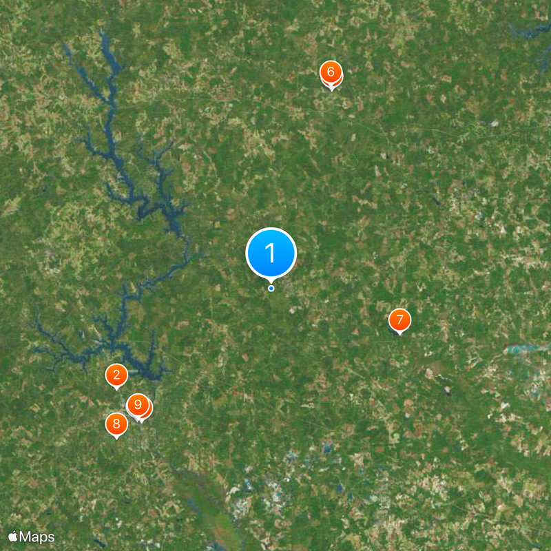
Hancock County, Administrative division in central Georgia, United States.

Description

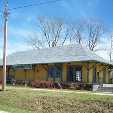
Hancock County is an administrative division in central Georgia that encompasses several small communities and towns spread across its area. Sparta functions as the seat of local government, while the broader region is characterized by forests and river systems winding through the landscape.

History

The county was established in 1793 and named after John Hancock, a signer of the Declaration of Independence. Its growth was tied to the agricultural economy of Georgia's Black Belt region, which drove development for generations.

Culture

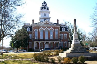
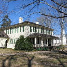
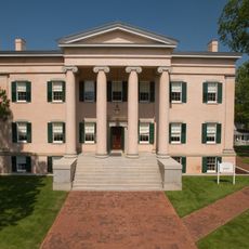
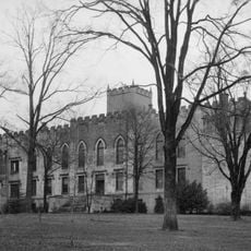
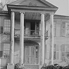
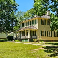
The county maintains several preserved structures from the antebellum period, reflecting the architectural styles and construction methods of the nineteenth century.

Practical

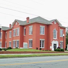
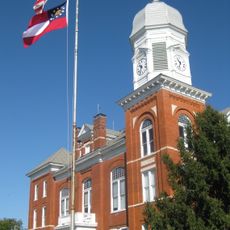
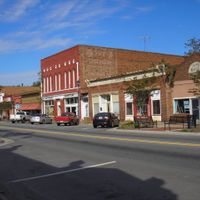
Visitors can find local government services and court facilities in Sparta for administrative matters. The area is well connected by regional highways, making it easy to navigate and access natural spaces throughout the county.

Did you know?

The county's geographical position in central Georgia connects residents to major regional highways while maintaining substantial areas of natural forest and river systems.

Location
Inception
December 17, 1793
Capital city
Sparta
Shares border with
Taliaferro County, Warren County, Glascock County, Washington County, Baldwin County, Putnam County, Greene County
GPS coordinates
33.27000,-83.00000
Latest update
December 20, 2025 15:38

AroundUs brings together thousands of curated places, local tips, and hidden gems, enriched daily by 60,000 contributors worldwide. Discover all places nearby (Georgia).

Around this place
Andalusia
United States of America

Andalusia

29.7 km
Liberty Hall
United States of America

Liberty Hall

33.5 km
Old Governor's Mansion
United States of America

Old Governor's Mansion

30.2 km
Old State Capitol
United States of America

Old State Capitol

30 km
A. H. Stephens State Park
United States of America

A. H. Stephens State Park

34 km
Hamburg State Park
United States of America

Hamburg State Park

22 km
Samuel Rockwell House
United States of America

Samuel Rockwell House

34.7 km
Atkinson Hall, Georgia College
United States of America

Atkinson Hall, Georgia College

30 km
City Cemetery
United States of America

City Cemetery

36.4 km
Milledgeville Historic District
United States of America

Milledgeville Historic District

30.1 km
Springfield Baptist Church (Greensboro, Georgia)
United States of America

Springfield Baptist Church (Greensboro, Georgia)

38 km
Jefferson Hall
United States of America

Jefferson Hall

37.2 km
Jewell Historic District
United States of America

Jewell Historic District

20.4 km
Glascock County Courthouse
United States of America

Glascock County Courthouse

37.9 km
Terrell-Sadler House
United States of America

Terrell-Sadler House

38.8 km
Washington County Courthouse
United States of America

Washington County Courthouse

36.4 km
Siloam Historic District
United States of America

Siloam Historic District

30.4 km
Devereux-Coleman House
United States of America

Devereux-Coleman House

29.7 km
A. H. Stephens State Park
United States of America

A. H. Stephens State Park

33.9 km
Holt Brothers Banking Company Building
United States of America

Holt Brothers Banking Company Building

36.4 km
Mitchell Depot Historical Museum
United States of America

Mitchell Depot Historical Museum

28.2 km
Eatonton Historic District
United States of America

Eatonton Historic District

36.8 km
Warthen Historic District
United States of America

Warthen Historic District

26.1 km
Greene County Courthouse
United States of America

Greene County Courthouse

38.1 km
Greensboro Commercial Historic District
United States of America

Greensboro Commercial Historic District

38.1 km
Maxwell Student Union
United States of America

Maxwell Student Union

30.2 km
Taliaferro County Courthouse
United States of America

Taliaferro County Courthouse

33.1 km
Crawfordville Historic District
United States of America

Crawfordville Historic District

37 km
Show the full map
Administrative divisions
« Hancock County - Administrative division in central Georgia, United States » is provided by Around Us (aroundus.com). Images and texts are derived from Wikimedia project under a Creative Commons license. You are allowed to copy, distribute, and modify copies of this page, under the conditions set by the license, as long as this note is clearly visible.

Discover hidden gems everywhere you go!

From secret cafés to breathtaking viewpoints, skip the crowded tourist spots and find places that match your style. Our app makes it easy with voice search, smart filtering, route optimization, and insider tips from travelers worldwide. Download now for the complete mobile experience.

Around Us App Screenshot

A unique approach to discovering new places

Le Figaro

All the places worth exploring

France Info

A tailor-made excursion in just a few clicks

20 Minutes

Around Us
Travel Guide & Maps
Download

Send to your phone

QR Code
1

Open the camera app on your mobile.

2

Point at the QR code with your camera. A notification will appear.

3

Tap the notification to open the link.