Enable Location

We need your location to show you interesting places around you

Discover nearby places

Find interesting locations and hidden gems around you

Precise directions

Get accurate directions and distances to places

Your location is never shared with other users. It's only used when you tap the location button.

Walton County

Log in to your account

Start exploring — it's free

Trusted by 62,061 travelers worldwide

Continue with Google
Continue with Apple
or

We will send you a code to connect

By continuing, you accept our Terms and Conditions and our Privacy Policy

Check your inbox

We've sent a pincode in your inbox. Please enter the code below.

Walton County, County administrative division in Georgia, United States.

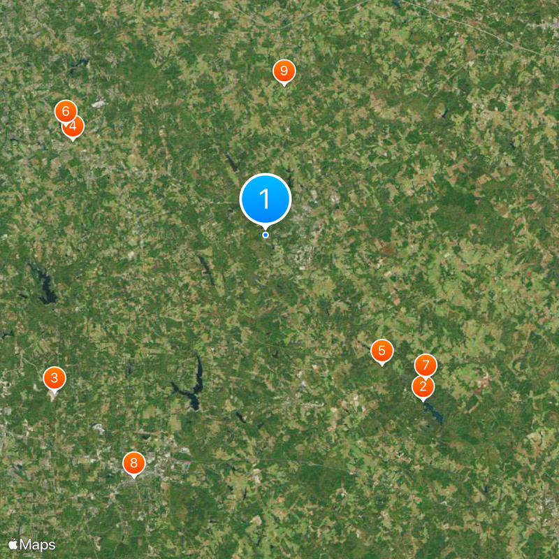
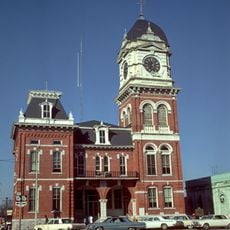
Walton County is a county in Georgia located roughly 30 miles east of Atlanta, where Monroe serves as the administrative center. The landscape includes wooded areas, farmland, and several small towns spread throughout the region.

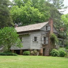
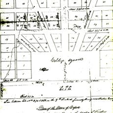
The county was established in 1818 and named after George Walton, a signer of the Declaration of Independence. Over time it evolved from a primarily rural area into a growing community with increasing connections to the Atlanta region.

The county maintains multiple school districts, including Walton County School District and Social Circle City School District, serving its growing population.

Main public services and government offices are centralized in Monroe, where residents and visitors can handle administrative matters. Information about local services is available at town halls or through municipal websites.

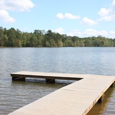
The territory sits at the boundary between two major river basins and contains diverse water resources spanning both watersheds. This geographic feature has shaped the natural landscape and water availability throughout the region.

The community of curious travelers

AroundUs brings together thousands of curated places, local tips, and hidden gems, enriched daily by 60,000 contributors worldwide.

Start exploring
Location
Inception
1818
Capital city
Monroe
Shares border with
Barrow County, Oconee County, Morgan County, Newton County, Rockdale County, Gwinnett County
GPS coordinates
33.78000,-83.74000
Latest update
December 20, 2025 16:10
Around this place
Hard Labor Creek State Park
United States of America

Hard Labor Creek State Park

19.2 km
United States of America

Georgia International Horse Park

22.2 km
Holy Cross Cathedral
United States of America

Holy Cross Cathedral

18.1 km
United States of America

Hard Labor Creek Regional Reservoir

14.6 km
United States of America

Vines Botanical Gardens

19.2 km
United States of America

Hard Labor Creek Observatory

18.2 km
Newton County Courthouse
United States of America

Newton County Courthouse

23.2 km
William Harris Homestead
United States of America

William Harris Homestead

12.8 km
Orna Villa
United States of America

Orna Villa

21 km
Kilgore Mill Covered Bridge and Mill Site
United States of America

Kilgore Mill Covered Bridge and Mill Site

13.3 km
Brick Store
United States of America

Brick Store

19.9 km
Oxford Historic District
United States of America

Oxford Historic District

21.2 km
McDaniel-Tichenor House
United States of America

McDaniel-Tichenor House

2.7 km
United States of America

Dial Mill

17.8 km
United States of America

McDaniel Street Historic District

2.6 km
Walton County Courthouse
United States of America

Walton County Courthouse

3 km
United States of America

Social Circle Historic District

14 km
United States of America

South Madison Avenue-Pannell Road Historic District

3.7 km
United States of America

North Broad Street Historic District

3 km
United States of America

Monroe City Hall

2.9 km
United States of America

Monroe and Walton Mills Historic District

2.9 km
United States of America

Tom Chick House

4.4 km
United States of America

Bostwick Historic District

21.4 km
Monroe Commercial Historic District
United States of America

Monroe Commercial Historic District

3 km
United States of America

William Luther Breedlove Monument

18.7 km
William Harris Homestead
United States of America

William Harris Homestead

12.9 km
United States of America

Cornish Creek Reservoir

15.6 km
United States of America

Big Haynes Creek Recreation Area

18.9 km
Show the full map
« Walton County - County administrative division in Georgia, United States » is provided by Around Us (aroundus.com). Images and texts are derived from Wikimedia project under a Creative Commons license. You are allowed to copy, distribute, and modify copies of this page, under the conditions set by the license, as long as this note is clearly visible.

Discover hidden gems everywhere you go!

From secret cafés to breathtaking viewpoints, skip the crowded tourist spots and find places that match your style. Our app makes it easy with voice search, smart filtering, route optimization, and insider tips from travelers worldwide. Download now for the complete mobile experience.

Around Us App Screenshot

A unique approach to discovering new places

Le Figaro

All the places worth exploring

France Info

A tailor-made excursion in just a few clicks

20 Minutes

Around Us
Travel Guide & Maps
Download

Send to your phone

QR Code
1

Open the camera app on your mobile.

2

Point at the QR code with your camera. A notification will appear.

3

Tap the notification to open the link.