Enable Location

We need your location to show you interesting places around you

Discover nearby places

Find interesting locations and hidden gems around you

Precise directions

Get accurate directions and distances to places

Your location is never shared with other users. It's only used when you tap the location button.

Marion County

Log in to your account

Start exploring — it's free

Trusted by travelers worldwide

Continue with Google
Continue with Apple
or

We will send you a code to connect

By continuing, you accept our Terms and Conditions and our Privacy Policy

Check your inbox

We've sent a pincode in your inbox. Please enter the code below.

Marion County, County administration hub in eastern South Carolina, US

Description

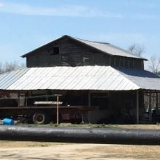
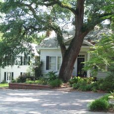
Marion County is an administrative area in eastern South Carolina covering forests, farmland, and residential communities situated between Florence and Myrtle Beach. The region includes several small towns and is shaped by a network of rivers and streams.

History

The area was established in 1844 and named after Francis Marion, a military leader who commanded local militia units during the American Revolutionary War. This founding shaped how the region developed its communities and institutions.

Culture

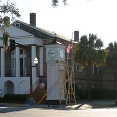
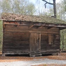
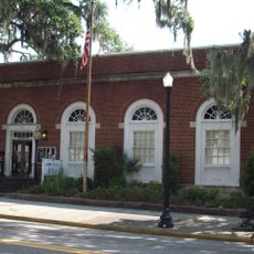
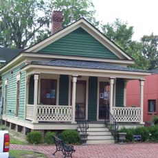
The area contains historic buildings and public spaces that reflect how people constructed and organized their communities in the 1800s. You can walk through different towns and see these structures, which help you understand how the region developed over time.

Practical

Visitors can reach the various towns and public buildings by traveling through the region using local roads that connect the communities. Spring and fall offer the most comfortable conditions for exploring the area on foot or by vehicle.

Did you know?

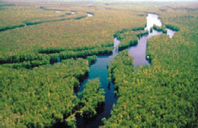
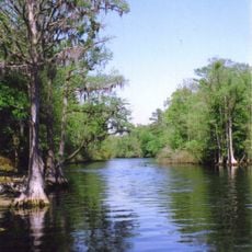
A network of small rivers and streams runs through the region and connects to the Great Pee Dee River, creating waterways that historically supported farming and outdoor activities. This water system remains important in shaping how the land looks and functions.

GPS coordinates
34.05720,-79.39876
Latest update
December 7, 2025 20:23

AroundUs brings together thousands of curated places, local tips, and hidden gems, enriched daily by 60,000 contributors worldwide. Discover all places nearby (Marion County).

Around this place
Lumber River
United States of America

Lumber River

67 km
Old Horry County Courthouse
United States of America

Old Horry County Courthouse

40.9 km
Slave Houses, Gregg Plantation
United States of America

Slave Houses, Gregg Plantation

27.2 km
Rankin-Harwell House
United States of America

Rankin-Harwell House

30.3 km
Galivants Ferry Historic District
United States of America

Galivants Ferry Historic District

14.2 km
Marion High School
United States of America

Marion High School

14.2 km
Conway Downtown Historic District
United States of America

Conway Downtown Historic District

40.7 km
United States Post Office
United States of America

United States Post Office

40.6 km
Kingston Presbyterian Church
United States of America

Kingston Presbyterian Church

40.9 km
Burroughs School
United States of America

Burroughs School

40 km
Christ Episcopal Church
United States of America

Christ Episcopal Church

28 km
Paul Quattlebaum House
United States of America

Paul Quattlebaum House

41 km
Claussen House
United States of America

Claussen House

22.1 km
Hopewell Presbyterian Church and Hopewell Cemetery
United States of America

Hopewell Presbyterian Church and Hopewell Cemetery

22.2 km
H.W. Ambrose House
United States of America

H.W. Ambrose House

39.2 km
Dillard Barn
United States of America

Dillard Barn

19.4 km
C.P. Quattlebaum Office
United States of America

C.P. Quattlebaum Office

40.9 km
Beaty-Little House
United States of America

Beaty-Little House

40.5 km
Arthur M. Burroughs House
United States of America

Arthur M. Burroughs House

40.4 km
Mullins Commercial Historic District
United States of America

Mullins Commercial Historic District

21 km
C.P. Quattlebaum House
United States of America

C.P. Quattlebaum House

41 km
Conway Residential Historic District
United States of America

Conway Residential Historic District

40.2 km
Beaty-Spivey House
United States of America

Beaty-Spivey House

40.7 km
J.W. Holliday Jr. House
United States of America

J.W. Holliday Jr. House

40.2 km
W. H. Winborne House
United States of America

W. H. Winborne House

40.4 km
J.C. Teasley House
United States of America

J.C. Teasley House

21.4 km
Main Street Theater
United States of America

Main Street Theater

40.8 km
Marion Historic District
United States of America

Marion Historic District

13.4 km
Show the full map
« Marion County - County administration hub in eastern South Carolina, US » is provided by Around Us (aroundus.com). Images and texts are derived from Wikimedia project under a Creative Commons license. You are allowed to copy, distribute, and modify copies of this page, under the conditions set by the license, as long as this note is clearly visible.

Discover hidden gems everywhere you go!

From secret cafés to breathtaking viewpoints, skip the crowded tourist spots and find places that match your style. Our app makes it easy with voice search, smart filtering, route optimization, and insider tips from travelers worldwide. Download now for the complete mobile experience.

Around Us App Screenshot

A unique approach to discovering new places

Le Figaro

All the places worth exploring

France Info

A tailor-made excursion in just a few clicks

20 Minutes

Around Us
Travel Guide & Maps
Download

Send to your phone

QR Code
1

Open the camera app on your mobile.

2

Point at the QR code with your camera. A notification will appear.

3

Tap the notification to open the link.