Chest opened
+${chestReward.xp} XP
Explorer
NOUVEAU ×${chestReward.collectible.quantity}
tapez pour fermer
Chest locked

Open chests in the app

Around Us is built for your phone — chests unlock when you walk, explore and capture nearby places.

Enable Location

We need your location to show you interesting places around you

Discover nearby places

Find interesting locations and hidden gems around you

Precise directions

Get accurate directions and distances to places

Your location is never shared with other users. It's only used when you tap the location button.

Templeton

Log in to your account

Start exploring — it's free

Trusted by 72,893 travelers worldwide

Continue with Google
Continue with Apple
or

We will send you a code to connect

By continuing, you accept our Terms and Conditions and our Privacy Policy

Check your inbox

We've sent a pincode in your inbox. Please enter the code below.

Discussion Reviews 1 Photos
27k Popularity

Templeton, Census-designated place in San Luis Obispo County, United States.

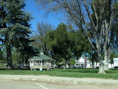
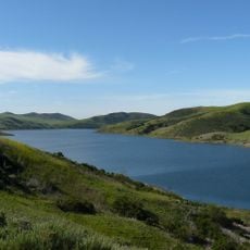
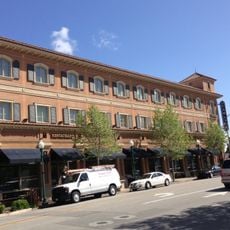
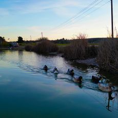
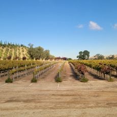
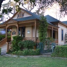
Templeton is a small community located along Highway 101 between Paso Robles and Atascadero, with a Main Street featuring brick buildings at an elevation of about 246 meters (807 feet). The town sits at the heart of San Luis Obispo County's agricultural region.

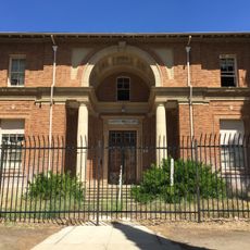
The community was established in 1886 as a terminus for the Southern Pacific Railroad, marking the beginning of settlement in this agricultural valley. It was named after Charles Crocker Jr., though railroad founder Charles Crocker had initially planned a different name.

The Templeton Farmers Market opens every Saturday morning and serves as the county's largest agricultural marketplace, where local farmers and artisans sell their goods directly to shoppers.

The best time to visit is early on a Saturday morning for the farmers market and local shops. Driving along Highway 101 makes access straightforward, with parking readily available near the main commercial area.

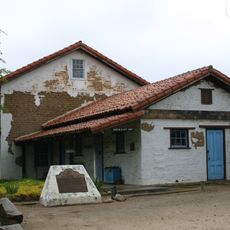
The Templeton Feed and Grain building stands as the town's largest structure and has long served regional agricultural operations. This historic storage facility still displays railroad-era architecture and remains a recognizable landmark in the community.

The community of curious travelers

AroundUs brings together thousands of curated places, local tips, and hidden gems, enriched daily by 60,000 contributors worldwide.

Start exploring
Elevation above the sea
246 m
GPS coordinates
35.55390,-120.70900
Latest update
December 20, 2025 14:22
Around this place
Mission San Miguel Arcángel
United States of America

Mission San Miguel Arcángel

21.2 km
Charles Paddock Zoo
United States of America

Charles Paddock Zoo

10.3 km
Santa Margarita de Cortona Asistencia
United States of America

Santa Margarita de Cortona Asistencia

19.2 km
Whale Rock Reservoir
United States of America

Whale Rock Reservoir

18.2 km
Carlton Hotel
United States of America

Carlton Hotel

8 km
Rios-Caledonia Adobe
United States of America

Rios-Caledonia Adobe

20.5 km
Atascadero Printery
United States of America

Atascadero Printery

7.9 km
Estrella Adobe Church
United States of America

Estrella Adobe Church

15.4 km
Paso Robles Carnegie Library
United States of America

Paso Robles Carnegie Library

8.2 km
Bank of Italy
United States of America

Bank of Italy

8.4 km
Atascadero Administration Building
United States of America

Atascadero Administration Building

8.1 km
Franklin Hot Springs
United States of America

Franklin Hot Springs

7.1 km
Sculpterra Winery and Sculpture Garden
United States of America

Sculpterra Winery and Sculpture Garden

10.3 km
Call-Booth House
United States of America

Call-Booth House

8.3 km
United States of America

Atascadero Lake

10.7 km
United States of America

Devils Gap

10.7 km
United States of America

The Links at Paso Robles

16.5 km
United States of America

Hunter Ranch Golf Course

13.2 km
United States of America

River Oaks Golf Course (Paso Robles)

11.1 km
United States of America

Chalk Mountain Golf Course

10.8 km
United States of America

Vina Robles Amphitheater

12.5 km
United States of America

PARK STREET GALLERY

8.4 km
United States of America

Bruce Munro: Light at Sen­so­rio

13.4 km
United States of America

Creston-Eureka Grade

9 km
United States of America

Scenic viewpoint

17.6 km
United States of America

Scenic viewpoint

19 km
United States of America

Scenic viewpoint

18.8 km
United States of America

Scenic viewpoint

15.7 km
Show the full map
Reviews
Share your experience

No review yet

Discussions
Start a discussion...

No discussion yet

« Templeton - Census-designated place in San Luis Obispo County, United States » is provided by Around Us (aroundus.com). Images and texts are derived from Wikimedia project under a Creative Commons license. You are allowed to copy, distribute, and modify copies of this page, under the conditions set by the license, as long as this note is clearly visible.

Discover hidden gems everywhere you go!

From secret cafés to breathtaking viewpoints, skip the crowded tourist spots and find places that match your style. Our app makes it easy with voice search, smart filtering, route optimization, and insider tips from travelers worldwide. Download now for the complete mobile experience.

Around Us App Screenshot

A unique approach to discovering new places

Le Figaro

All the places worth exploring

France Info

A tailor-made excursion in just a few clicks

20 Minutes

Around Us
Travel Guide & Maps
Download

Send to your phone

QR Code
1

Open the camera app on your mobile.

2

Point at the QR code with your camera. A notification will appear.

3

Tap the notification to open the link.