Mission San Miguel Arcángel

Log in to your account

AroundUs is a community-driven map of interesting places, built by curious explorers like you. It grows with every review, story, and photo you share.
Connect to save your favorite spots, contribute locations, and create personalized routes.
Continue with Google
Continue with Apple
Continue with X
Continue with Facebook
Continue with email
By continuing, you accept our Terms and Conditions and our Privacy Policy
Create an account
Add to collection
Map
Suggest a change
Share

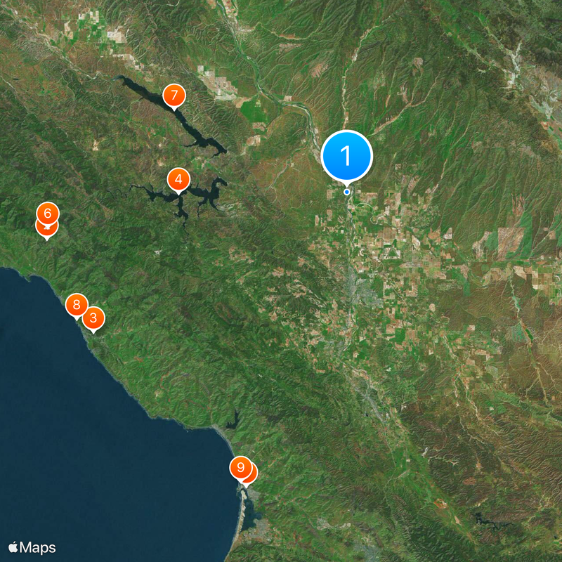
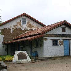
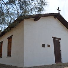
Mission San Miguel Arcángel, Spanish colonial mission in San Miguel, United States

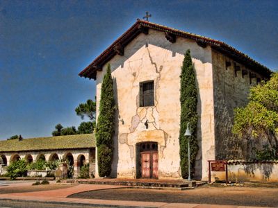
Mission San Miguel Arcángel is a Spanish colonial church in San Miguel, California, built between 1816 and 1818 with adobe bricks and walls several feet thick. The compound includes the church as well as a museum, priests' quarters, and a cemetery, all arranged around an open courtyard.

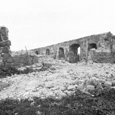
Father Fermín Lasuén founded this station in 1797 as the sixteenth in the chain of California missions, meant to secure the connection between the northern and southern outposts. An earthquake in 2003 damaged the buildings heavily, leading to extensive restoration work that closed the site to visitors for many years.

The interior frescos display scenes and patterns created under the guidance of Esteban Munras, an artist from Catalonia who worked alongside native painters. These murals cover the church walls and ceiling with bold colors that have remained unchanged for nearly two centuries.

The compound is open daily and offers both self-guided walks and guided tours through the museum and church. The best light for photographing the frescos occurs in late morning when natural sunlight enters through the windows.

The church interior preserves its original wall paintings, which have never been painted over or renewed, unlike most other missions along the California coast. The burial registry records over 2,200 names with remarkable detail about the age, origin, and cause of death of those interred.

Location: San Luis Obispo County

GPS coordinates: 35.74441,-120.69795

Latest update: December 20, 2025 12:22

Photos
Around this place
Hearst Castle
United States of America

Hearst Castle

43 km
Nitt Witt Ridge
United States of America

Nitt Witt Ridge

41 km
Lake Nacimiento
United States of America

Lake Nacimiento

23.8 km
DSRV-2 Avalon
United States of America

DSRV-2 Avalon

44 km
Hearst Ranch
United States of America

Hearst Ranch

42.6 km
Lake San Antonio
United States of America

Lake San Antonio

27.1 km
Hearst San Simeon State Park
United States of America

Hearst San Simeon State Park

42.3 km
Morro Strand State Beach
United States of America

Morro Strand State Beach

43.7 km
Cayucos State Beach
United States of America

Cayucos State Beach

37.9 km
Charles Paddock Zoo
United States of America

Charles Paddock Zoo

31 km
Santa Margarita de Cortona Asistencia
United States of America

Santa Margarita de Cortona Asistencia

39.1 km
Whale Rock Reservoir
United States of America

Whale Rock Reservoir

35.5 km
Harmony Headlands State Park
United States of America

Harmony Headlands State Park

39.9 km
Carlton Hotel
United States of America

Carlton Hotel

28.5 km
Morro Rock Beach
United States of America

Morro Rock Beach

44.2 km
Rios-Caledonia Adobe
United States of America

Rios-Caledonia Adobe

713 m
Estero Bluffs State Park
United States of America

Estero Bluffs State Park

39.2 km
Kenneth S. Norris Rancho Marino Reserve
United States of America

Kenneth S. Norris Rancho Marino Reserve

41.9 km
Estrella Adobe Church
United States of America

Estrella Adobe Church

8.8 km
Paso Robles Carnegie Library
United States of America

Paso Robles Carnegie Library

13.2 km
Bank of Italy
United States of America

Bank of Italy

13 km
United States of America

Parkfield Interventional EQ Fieldwork

29.4 km
Atascadero Administration Building
United States of America

Atascadero Administration Building

28.5 km
Franklin Hot Springs
United States of America

Franklin Hot Springs

18.1 km
Sculpterra Winery and Sculpture Garden
United States of America

Sculpterra Winery and Sculpture Garden

17.9 km
Cayucos Beach
United States of America

Cayucos Beach

37.9 km
Call-Booth House
United States of America

Call-Booth House

13 km
Cayucos State Beach
United States of America

Cayucos State Beach

38 km
Show the full map
Reviews

Visited this place? Tap the stars to rate it and share your experience / photos with the community! Try now! You can cancel it anytime.

« Mission San Miguel Arcángel - Spanish colonial mission in San Miguel, United States » is provided by Around Us (aroundus.com). Images and texts are derived from Wikimedia project under a Creative Commons license. You are allowed to copy, distribute, and modify copies of this page, under the conditions set by the license, as long as this note is clearly visible.

Discover hidden gems everywhere you go!

From secret cafés to breathtaking viewpoints, skip the crowded tourist spots and find places that match your style. Our app makes it easy with voice search, smart filtering, route optimization, and insider tips from travelers worldwide. Download now for the complete mobile experience.

Around Us App Screenshot

A unique approach to discovering new places

Le Figaro

All the places worth exploring

France Info

A tailor-made excursion in just a few clicks

20 Minutes