Hearst San Simeon State Park

Log in to your account

AroundUs is a community-driven map of interesting places, built by curious explorers like you. It grows with every review, story, and photo you share.
Connect to save your favorite spots, contribute locations, and create personalized routes.
Continue with Google
Continue with Apple
Continue with X
Continue with Facebook
Continue with email
By continuing, you accept our Terms and Conditions and our Privacy Policy
Create an account
Add to collection
Map
Suggest a change
Share

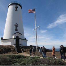
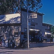
Hearst San Simeon State Park, Coastal state park in San Luis Obispo County, California.

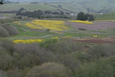
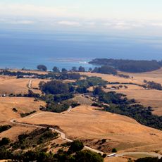
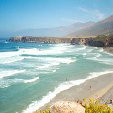
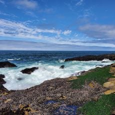
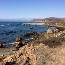
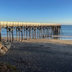
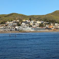
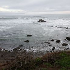
Hearst San Simeon State Park is a coastal preserve spanning approximately 3,409 acres along the Pacific shoreline, with rocky cliffs, wetlands, riparian woodlands, and natural areas supporting varied plant and animal life. The park contains different zones including developed campgrounds, undisturbed habitats, and the archaeological preserve.

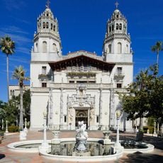
The park was established in 1932 to preserve land that had been part of newspaper publisher William Randolph Hearst's private estate holdings. This creation transformed the area from private property into public conservation land.

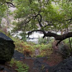
The Pa-nu Cultural Preserve contains archaeological sites that reflect the deep connection between the Chumash people and this coastal region over thousands of years. Visitors walking through this area can sense the historical presence of Indigenous communities in the landscape.

The park provides two distinct camping options ranging from fully developed facilities to more primitive sites with basic amenities. Access and available activities vary by season, so visitors should check ahead about open areas and current trail conditions.

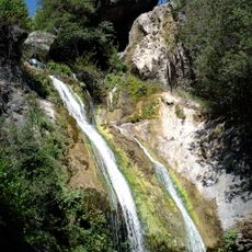
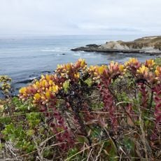
The San Simeon Natural Preserve contains rare mima mound formations whose origins remain scientifically puzzling, along with substantial winter populations of monarch butterflies. These two natural features make this preserve particularly notable from an ecological standpoint.

Location: San Luis Obispo County

Inception: 1932

Website: https://parks.ca.gov/?page_id=590

GPS coordinates: 35.58361,-121.12167

Latest update: December 8, 2025 19:56

Photos
Around this place
Hearst Castle
United States of America

Hearst Castle

12.1 km
Morro Rock
United States of America

Morro Rock

33.2 km
Nitt Witt Ridge
United States of America

Nitt Witt Ridge

3.1 km
Lake Nacimiento
United States of America

Lake Nacimiento

23 km
DSRV-2 Avalon
United States of America

DSRV-2 Avalon

33.9 km
Hearst Ranch
United States of America

Hearst Ranch

13.6 km
Lake San Antonio
United States of America

Lake San Antonio

32.8 km
The Hacienda
United States of America

The Hacienda

48.8 km
Morro Strand State Beach
United States of America

Morro Strand State Beach

32.9 km
Piedras Blancas Light Station
United States of America

Piedras Blancas Light Station

17.3 km
William Randolph Hearst Memorial State Beach
United States of America

William Randolph Hearst Memorial State Beach

8.9 km
Cayucos State Beach
United States of America

Cayucos State Beach

24.7 km
Salmon Creek Falls
United States of America

Salmon Creek Falls

33.5 km
Sand Dollar Beach
United States of America

Sand Dollar Beach

49.2 km
Silver Peak Wilderness
United States of America

Silver Peak Wilderness

32.1 km
Whale Rock Reservoir
United States of America

Whale Rock Reservoir

26.6 km
Harmony Headlands State Park
United States of America

Harmony Headlands State Park

16.6 km
Morro Rock Beach
United States of America

Morro Rock Beach

33.1 km
Rios-Caledonia Adobe
United States of America

Rios-Caledonia Adobe

41.9 km
Estero Bluffs State Park
United States of America

Estero Bluffs State Park

22.9 km
Kenneth S. Norris Rancho Marino Reserve
United States of America

Kenneth S. Norris Rancho Marino Reserve

7.4 km
Sebastian Store
United States of America

Sebastian Store

9.2 km
William Randolph Hearst Memorial Beach
United States of America

William Randolph Hearst Memorial Beach

9 km
Fort Hunter Liggett
United States of America

Fort Hunter Liggett

42.2 km
Cayucos Beach
United States of America

Cayucos Beach

24.7 km
Call-Booth House
United States of America

Call-Booth House

38.8 km
Cayucos State Beach
United States of America

Cayucos State Beach

24.9 km
Camp Roberts Historical Museum
United States of America

Camp Roberts Historical Museum

41 km
Show the full map
Reviews

Visited this place? Tap the stars to rate it and share your experience / photos with the community! Try now! You can cancel it anytime.

« Hearst San Simeon State Park - Coastal state park in San Luis Obispo County, California » is provided by Around Us (aroundus.com). Images and texts are derived from Wikimedia project under a Creative Commons license. You are allowed to copy, distribute, and modify copies of this page, under the conditions set by the license, as long as this note is clearly visible.

Discover hidden gems everywhere you go!

From secret cafés to breathtaking viewpoints, skip the crowded tourist spots and find places that match your style. Our app makes it easy with voice search, smart filtering, route optimization, and insider tips from travelers worldwide. Download now for the complete mobile experience.

Around Us App Screenshot

A unique approach to discovering new places

Le Figaro

All the places worth exploring

France Info

A tailor-made excursion in just a few clicks

20 Minutes