Enable Location

We need your location to show you interesting places around you

Discover nearby places

Find interesting locations and hidden gems around you

Precise directions

Get accurate directions and distances to places

Your location is never shared with other users. It's only used when you tap the location button.

Estero Bluffs State Park

Log in to your account

Start exploring — it's free

Trusted by 61,999 travelers worldwide

Continue with Google
Continue with Apple
or

We will send you a code to connect

By continuing, you accept our Terms and Conditions and our Privacy Policy

Check your inbox

We've sent a pincode in your inbox. Please enter the code below.

Estero Bluffs State Park

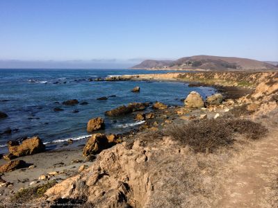
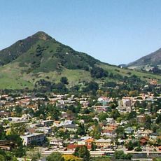
Estero Bluffs State Park, Coastal state park in San Luis Obispo County, United States.

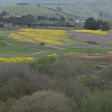
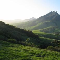
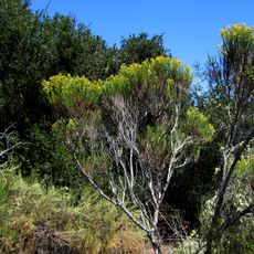
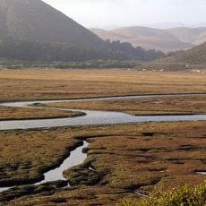
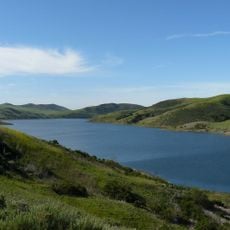
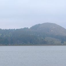
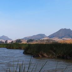
Estero Bluffs is a 353-acre coastal park stretching from the highway to the Pacific Ocean, dominated by grassland and marine terraces with a diverse landscape. The property includes wetlands and low bluffs that form the main features along the shoreline.

The property was purchased by the Trust for Public Land in 2000 and transferred to California State Parks two years later for permanent protection. A conservation agreement has ensured the land remains undeveloped since that handover.

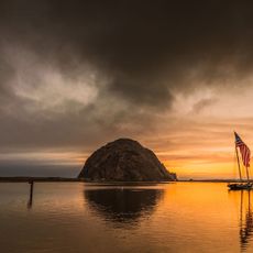
The name 'estero' comes from Spanish, referring to a salt marsh, reflecting the area's deep connection to coastal waters and tidal lands. The grasslands and wetlands here served as hunting and living grounds for indigenous peoples for thousands of years, with their presence still evident in the landscape today.

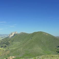
The park is open year-round with several hiking trails along the coast offering different difficulty levels and distances for various abilities. Sturdy footwear is recommended since trails cross grassland and run along cliff edges, with conditions that change with the seasons.

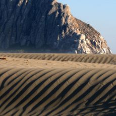
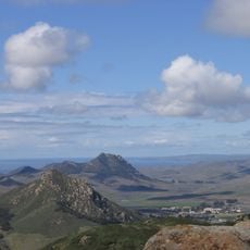
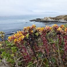
The park contains rare rock formations from the Franciscan Assemblage dating back to the Jurassic Period, lifted to their current height by tectonic forces over millions of years. These geological structures form the visible cliffs and reveal the dynamic earth history of this coastal region.

The community of curious travelers

AroundUs brings together thousands of curated places, local tips, and hidden gems, enriched daily by 60,000 contributors worldwide.

Start exploring
Inception
2000
Phone
GPS coordinates
35.44806,-120.93194
Latest update
December 14, 2025 13:06
Around this place
California Men's Colony
United States of America

California Men's Colony

25.3 km
Morro Rock
United States of America

Morro Rock

10.5 km
Nitt Witt Ridge
United States of America

Nitt Witt Ridge

19.8 km
Montaña de Oro State Park
United States of America

Montaña de Oro State Park

21.5 km
DSRV-2 Avalon
United States of America

DSRV-2 Avalon

11.1 km
Hearst San Simeon State Park
United States of America

Hearst San Simeon State Park

22.9 km
Bishop Peak
United States of America

Bishop Peak

26.7 km
Morro Bay State Park
United States of America

Morro Bay State Park

14.8 km
Morro Strand State Beach
United States of America

Morro Strand State Beach

10.2 km
Cayucos State Beach
United States of America

Cayucos State Beach

2.4 km
Charles Paddock Zoo
United States of America

Charles Paddock Zoo

23.8 km
Cerro San Luis Obispo
United States of America

Cerro San Luis Obispo

29.3 km
Los Osos Oaks State Natural Reserve
United States of America

Los Osos Oaks State Natural Reserve

19.1 km
Hollister Peak
United States of America

Hollister Peak

17.5 km
Elfin Forest Natural Area
United States of America

Elfin Forest Natural Area

15.9 km
Whale Rock Reservoir
United States of America

Whale Rock Reservoir

5.5 km
Harmony Headlands State Park
United States of America

Harmony Headlands State Park

6.5 km
Carlton Hotel
United States of America

Carlton Hotel

24.2 km
Cerro Cabrillo
United States of America

Cerro Cabrillo

15.1 km
Black Hill
United States of America

Black Hill

13.5 km
Chumash Peak
United States of America

Chumash Peak

25.8 km
Morro Bay State Park Museum of Natural History
United States of America

Morro Bay State Park Museum of Natural History

13.8 km
San Luis Obispo Botanical Garden
United States of America

San Luis Obispo Botanical Garden

22.6 km
Leaning Pine Arboretum
United States of America

Leaning Pine Arboretum

28.8 km
Kenneth S. Norris Rancho Marino Reserve
United States of America

Kenneth S. Norris Rancho Marino Reserve

15.8 km
Atascadero Administration Building
United States of America

Atascadero Administration Building

24.4 km
Cerro Romauldo
United States of America

Cerro Romauldo

23.9 km
Call-Booth House
United States of America

Call-Booth House

29.2 km
Show the full map
« Estero Bluffs State Park - Coastal state park in San Luis Obispo County, United States » is provided by Around Us (aroundus.com). Images and texts are derived from Wikimedia project under a Creative Commons license. You are allowed to copy, distribute, and modify copies of this page, under the conditions set by the license, as long as this note is clearly visible.

Discover hidden gems everywhere you go!

From secret cafés to breathtaking viewpoints, skip the crowded tourist spots and find places that match your style. Our app makes it easy with voice search, smart filtering, route optimization, and insider tips from travelers worldwide. Download now for the complete mobile experience.

Around Us App Screenshot

A unique approach to discovering new places

Le Figaro

All the places worth exploring

France Info

A tailor-made excursion in just a few clicks

20 Minutes

Around Us
Travel Guide & Maps
Download

Send to your phone

QR Code
1

Open the camera app on your mobile.

2

Point at the QR code with your camera. A notification will appear.

3

Tap the notification to open the link.