Enable Location

We need your location to show you interesting places around you

Discover nearby places

Find interesting locations and hidden gems around you

Precise directions

Get accurate directions and distances to places

Your location is never shared with other users. It's only used when you tap the location button.

Cerro San Luis Obispo

Log in to your account

Start exploring — it's free

Trusted by 61,367 travelers worldwide

Continue with Google
Continue with Apple
or

We will send you a code to connect

By continuing, you accept our Terms and Conditions and our Privacy Policy

Check your inbox

We've sent a pincode in your inbox. Please enter the code below.

Cerro San Luis Obispo

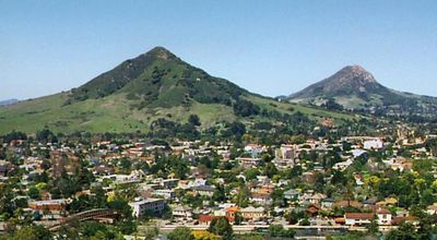
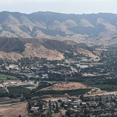
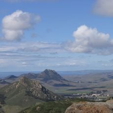
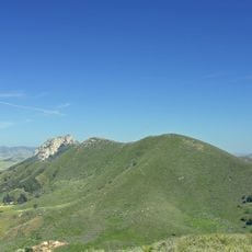
Cerro San Luis Obispo, Summit and hiking trail in San Luis Obispo, California
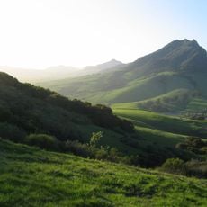
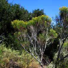
Description

Cerro San Luis Obispo is a 1,292-foot mountain featuring multiple trails that weave through prickly pear cactus and sage brush, linking downtown San Luis Obispo to its western peak. The slopes support various plant species that shape the terrain and offer views down toward the city.

History

Around 1900, Civil War veteran G.W. Chandler established citrus groves on the slopes, and some of those lemon and orange trees remain visible today. This early agricultural history shaped the land and is still apparent in the older tree growth.

Culture

The mountain displays a prominent white letter M on its eastern face, representing Mission College Preparatory Catholic High School below. This marker has become a recognizable symbol for the school and shapes how locals view the peak.

Practical

The main trailhead is located at Marsh Street and offers a four-mile round trip with around 1,100 feet of elevation gain to the summit. The path is popular with hikers of varying fitness levels and provides multiple route options.

Did you know?

The peak forms part of the Nine Sisters volcanic chain, containing an igneous rock core that pushed through Franciscan sedimentary formations. This geological makeup distinguishes it from surrounding hills and makes it significant to earth science.

Location
GPS coordinates
35.28275,-120.68045
Latest update
December 10, 2025 20:04

AroundUs brings together thousands of curated places, local tips, and hidden gems, enriched daily by 60,000 contributors worldwide. Discover all places nearby (California).

Around this place
Show the full map
« Cerro San Luis Obispo - Summit and hiking trail in San Luis Obispo, California » is provided by Around Us (aroundus.com). Images and texts are derived from Wikimedia project under a Creative Commons license. You are allowed to copy, distribute, and modify copies of this page, under the conditions set by the license, as long as this note is clearly visible.

Discover hidden gems everywhere you go!

From secret cafés to breathtaking viewpoints, skip the crowded tourist spots and find places that match your style. Our app makes it easy with voice search, smart filtering, route optimization, and insider tips from travelers worldwide. Download now for the complete mobile experience.

Around Us App Screenshot

A unique approach to discovering new places

Le Figaro

All the places worth exploring

France Info

A tailor-made excursion in just a few clicks

20 Minutes

Around Us
Travel Guide & Maps
Download

Send to your phone

QR Code
1

Open the camera app on your mobile.

2

Point at the QR code with your camera. A notification will appear.

3

Tap the notification to open the link.