Enable Location

We need your location to show you interesting places around you

Discover nearby places

Find interesting locations and hidden gems around you

Precise directions

Get accurate directions and distances to places

Your location is never shared with other users. It's only used when you tap the location button.

Harmony Headlands State Park

Log in to your account

Start exploring — it's free

Trusted by 62,630 travelers worldwide

Continue with Google
Continue with Apple
or

We will send you a code to connect

By continuing, you accept our Terms and Conditions and our Privacy Policy

Check your inbox

We've sent a pincode in your inbox. Please enter the code below.

Harmony Headlands State Park

Harmony Headlands State Park, Coastal state park in San Luis Obispo County, United States

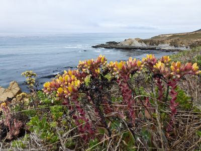
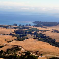
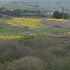
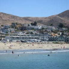
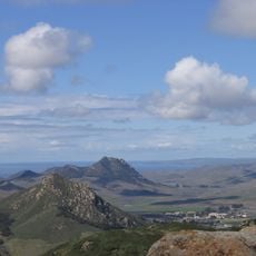
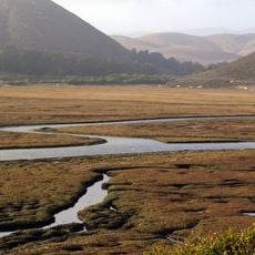
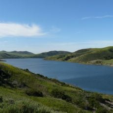
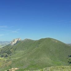
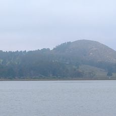
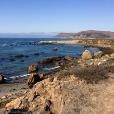
Harmony Headlands State Park is a coastal preserve in California with steep hills, grassy plateaus, and natural trails that lead to ocean viewpoints. The 784-acre site stretches along the shoreline with varying terrain between grasslands and coastal bluffs.

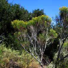
The area became a state park in 2003 to protect California's natural coastal ecosystems for future generations. This protection preserved a significant stretch of undeveloped shoreline from intensive development.

Indigenous peoples lived along this coast for thousands of years, relying on the ocean's resources and developing deep ties to the landscape. Visitors walking through the hills and along the cliffs can sense this ancient connection to the land.

The park sits right off Highway 1 with parking areas and trails suited for different ability levels. Good footwear helps on routes crossing grassland and rocky ground.

The park deliberately lacks modern facilities such as visitor centers, restaurants, or restrooms to preserve its natural character. This approach lets visitors experience one of California's few remaining undeveloped coastal stretches.

The community of curious travelers

AroundUs brings together thousands of curated places, local tips, and hidden gems, enriched daily by 60,000 contributors worldwide.

Start exploring
Inception
2003
GPS coordinates
35.47780,-120.99300
Latest update
December 13, 2025 11:43
Around this place
Hearst Castle
United States of America

Hearst Castle

28 km
Morro Rock
United States of America

Morro Rock

16.6 km
Nitt Witt Ridge
United States of America

Nitt Witt Ridge

13.5 km
Lake Nacimiento
United States of America

Lake Nacimiento

29.7 km
Montaña de Oro State Park
United States of America

Montaña de Oro State Park

26.6 km
DSRV-2 Avalon
United States of America

DSRV-2 Avalon

17.3 km
Hearst Ranch
United States of America

Hearst Ranch

29.3 km
Hearst San Simeon State Park
United States of America

Hearst San Simeon State Park

16.6 km
Morro Bay State Park
United States of America

Morro Bay State Park

21 km
Morro Strand State Beach
United States of America

Morro Strand State Beach

16.4 km
William Randolph Hearst Memorial State Beach
United States of America

William Randolph Hearst Memorial State Beach

25.5 km
Cayucos State Beach
United States of America

Cayucos State Beach

8.5 km
Charles Paddock Zoo
United States of America

Charles Paddock Zoo

29.3 km
Los Osos Oaks State Natural Reserve
United States of America

Los Osos Oaks State Natural Reserve

25.1 km
Hollister Peak
United States of America

Hollister Peak

23.9 km
Elfin Forest Natural Area
United States of America

Elfin Forest Natural Area

22 km
Whale Rock Reservoir
United States of America

Whale Rock Reservoir

11.2 km
Carlton Hotel
United States of America

Carlton Hotel

29.3 km
Cerro Cabrillo
United States of America

Cerro Cabrillo

21.4 km
Black Hill
United States of America

Black Hill

19.8 km
Morro Bay State Park Museum of Natural History
United States of America

Morro Bay State Park Museum of Natural History

19.9 km
San Luis Obispo Botanical Garden
United States of America

San Luis Obispo Botanical Garden

29 km
Estero Bluffs State Park
United States of America

Estero Bluffs State Park

6.5 km
Kenneth S. Norris Rancho Marino Reserve
United States of America

Kenneth S. Norris Rancho Marino Reserve

9.4 km
Sebastian Store
United States of America

Sebastian Store

25.7 km
Atascadero Administration Building
United States of America

Atascadero Administration Building

29.5 km
Cerro Romauldo
United States of America

Cerro Romauldo

30.3 km
Call-Booth House
United States of America

Call-Booth House

31.6 km
Show the full map
« Harmony Headlands State Park - Coastal state park in San Luis Obispo County, United States » is provided by Around Us (aroundus.com). Images and texts are derived from Wikimedia project under a Creative Commons license. You are allowed to copy, distribute, and modify copies of this page, under the conditions set by the license, as long as this note is clearly visible.

Discover hidden gems everywhere you go!

From secret cafés to breathtaking viewpoints, skip the crowded tourist spots and find places that match your style. Our app makes it easy with voice search, smart filtering, route optimization, and insider tips from travelers worldwide. Download now for the complete mobile experience.

Around Us App Screenshot

A unique approach to discovering new places

Le Figaro

All the places worth exploring

France Info

A tailor-made excursion in just a few clicks

20 Minutes

Around Us
Travel Guide & Maps
Download

Send to your phone

QR Code
1

Open the camera app on your mobile.

2

Point at the QR code with your camera. A notification will appear.

3

Tap the notification to open the link.