·

Enable Location

We need your location to show you interesting places around you

Discover nearby places

Find interesting locations and hidden gems around you

Precise directions

Get accurate directions and distances to places

Your location is never shared with other users. It's only used when you tap the location button.

Silver Peak Wilderness

Log in to your account

Start exploring — it's free

Trusted by 62,647 travelers worldwide

Continue with Google
Continue with Apple
or

We will send you a code to connect

By continuing, you accept our Terms and Conditions and our Privacy Policy

Check your inbox

We've sent a pincode in your inbox. Please enter the code below.

Silver Peak Wilderness

Silver Peak Wilderness, Wilderness area in Monterey County, California, US

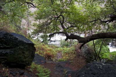
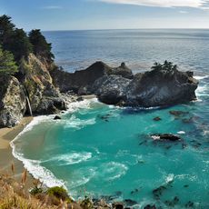
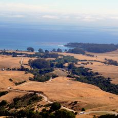
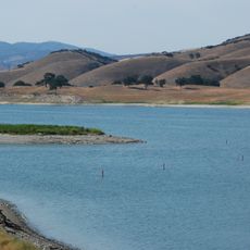
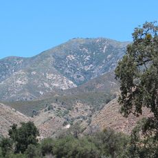
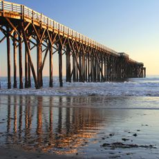
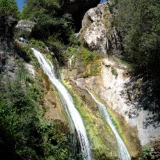
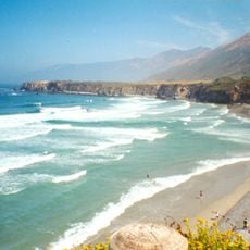
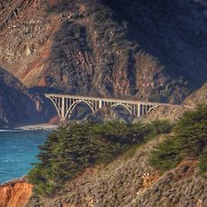
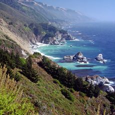
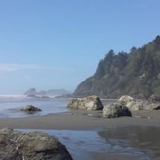
Silver Peak Wilderness is a protected area in the Santa Lucia Mountains that stretches from the Pacific coast to elevations around 3,600 feet. The land contains various habitats with trails running through the entire area, allowing visitors to traverse the landscape.

The area received federal protection in 1992 through legislation, and additional land was added in 2002 to expand the protected boundaries. These actions helped preserve this coastal mountain region for the future.

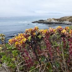
The area draws visitors who want to see rare plant species like Sargent cypress and Santa Lucia fir in their natural setting. People use the trails to explore these special trees and experience the plant diversity found in the mountains.

To visit the area, you need a permit for overnight camping, and motorized vehicles plus mountain bikes are not allowed. Visitors should plan for day hikes or multi-day backpacking trips and prepare routes in advance.

The area is home to the world's southernmost natural grove of coastal redwoods, a rare tree type normally found much further north. These southern groves show how plants have adapted to the specific conditions of this coastal mountain region.

The community of curious travelers

AroundUs brings together thousands of curated places, local tips, and hidden gems, enriched daily by 60,000 contributors worldwide.

Start exploring
Location
Inception
1992
GPS coordinates
35.83330,-121.30000
Latest update
December 12, 2025 14:22
Around this place
Hearst Castle
United States of America

Hearst Castle

20.4 km
Big Sur
United States of America

Big Sur

42.3 km
McWay Falls
United States of America

McWay Falls

49.3 km
Nitt Witt Ridge
United States of America

Nitt Witt Ridge

35 km
Julia Pfeiffer Burns State Park
United States of America

Julia Pfeiffer Burns State Park

50 km
Lake Nacimiento
United States of America

Lake Nacimiento

32.2 km
Tassajara Hot Springs
United States of America

Tassajara Hot Springs

49.9 km
Hearst Ranch
United States of America

Hearst Ranch

19.1 km
Limekiln State Park
United States of America

Limekiln State Park

27.8 km
Lake San Antonio
United States of America

Lake San Antonio

30 km
Hearst San Simeon State Park
United States of America

Hearst San Simeon State Park

32.1 km
Junipero Serra Peak
United States of America

Junipero Serra Peak

36.4 km
Piedras Blancas Light Station
United States of America

Piedras Blancas Light Station

18.7 km
William Randolph Hearst Memorial State Beach
United States of America

William Randolph Hearst Memorial State Beach

23.5 km
Salmon Creek Falls
United States of America

Salmon Creek Falls

4.9 km
Sand Dollar Beach
United States of America

Sand Dollar Beach

18.2 km
Big Creek Bridge
United States of America

Big Creek Bridge

37.8 km
Big Creek State Marine Reserve and Big Creek State Marine Conservation Area
United States of America

Big Creek State Marine Reserve and Big Creek State Marine Conservation Area

44 km
Adelaida Vineyards & Winery
United States of America

Adelaida Vineyards & Winery

49.6 km
Harmony Headlands State Park
United States of America

Harmony Headlands State Park

48.3 km
King City High School Auditorium
United States of America

King City High School Auditorium

44.6 km
Kenneth S. Norris Rancho Marino Reserve
United States of America

Kenneth S. Norris Rancho Marino Reserve

39.5 km
Sebastian Store
United States of America

Sebastian Store

23.3 km
1 (Las Cruces - San Francisco)
United States of America

1 (Las Cruces - San Francisco)

36.4 km
Fort Hunter Liggett
United States of America

Fort Hunter Liggett

14.6 km
DAOU Vineyards & Winery
United States of America

DAOU Vineyards & Winery

51.3 km
Camp Roberts Historical Museum
United States of America

Camp Roberts Historical Museum

49.8 km
Moonstone Beach
United States of America

Moonstone Beach

33.3 km
Show the full map
« Silver Peak Wilderness - Wilderness area in Monterey County, California, US » is provided by Around Us (aroundus.com). Images and texts are derived from Wikimedia project under a Creative Commons license. You are allowed to copy, distribute, and modify copies of this page, under the conditions set by the license, as long as this note is clearly visible.

Discover hidden gems everywhere you go!

From secret cafés to breathtaking viewpoints, skip the crowded tourist spots and find places that match your style. Our app makes it easy with voice search, smart filtering, route optimization, and insider tips from travelers worldwide. Download now for the complete mobile experience.

Around Us App Screenshot

A unique approach to discovering new places

Le Figaro

All the places worth exploring

France Info

A tailor-made excursion in just a few clicks

20 Minutes

Around Us
Travel Guide & Maps
Download

Send to your phone

QR Code
1

Open the camera app on your mobile.

2

Point at the QR code with your camera. A notification will appear.

3

Tap the notification to open the link.