Enable Location

We need your location to show you interesting places around you

Discover nearby places

Find interesting locations and hidden gems around you

Precise directions

Get accurate directions and distances to places

Your location is never shared with other users. It's only used when you tap the location button.

Junipero Serra Peak

Log in to your account

Start exploring — it's free

Trusted by 62,015 travelers worldwide

Continue with Google
Continue with Apple
or

We will send you a code to connect

By continuing, you accept our Terms and Conditions and our Privacy Policy

Check your inbox

We've sent a pincode in your inbox. Please enter the code below.

Junipero Serra Peak

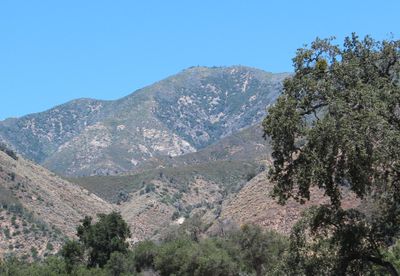
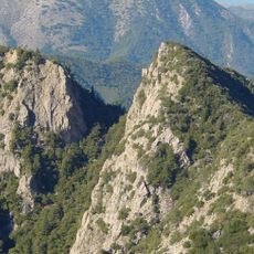
Junipero Serra Peak, Mountain summit in Santa Lucia Range, California, US

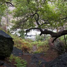
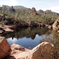
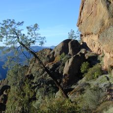
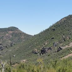
Junipero Serra Peak is the highest point in Monterey County, rising above the Santa Lucia Range. The mountain is covered with chaparral shrubs and pine forests that extend all the way to its summit.

The mountain was formerly known as Santa Lucia Peak until it was renamed in 1906 by the United States Board on Geographic Names. The change followed a recommendation from the Sierra Club, which sought to link it with a historical religious figure.

The Salinan people held deep ties to this mountain as part of their ancestral lands in the region. Spanish missionaries who arrived later introduced new names tied to religious figures throughout the area.

The hike is demanding and requires sturdy boots, plenty of water, and long sleeves for protection against poison oak. Start early to give yourself enough daylight for both the climb and the return journey.

In the 1880s, astronomers built a trail to the summit to observe a total solar eclipse. A few years later, the same group returned to study Venus as it passed in front of the sun.

The community of curious travelers

AroundUs brings together thousands of curated places, local tips, and hidden gems, enriched daily by 60,000 contributors worldwide.

Start exploring
Location
GPS coordinates
36.14569,-121.41913
Latest update
December 10, 2025 15:49
Around this place
Big Sur
United States of America

Big Sur

19.1 km
McWay Falls
United States of America

McWay Falls

22.7 km
Julia Pfeiffer Burns State Park
United States of America

Julia Pfeiffer Burns State Park

22.7 km
Pfeiffer Big Sur State Park
United States of America

Pfeiffer Big Sur State Park

34.5 km
Mission Nuestra Señora de la Soledad
United States of America

Mission Nuestra Señora de la Soledad

29.4 km
Tassajara Zen Mountain Center
United States of America

Tassajara Zen Mountain Center

29.3 km
Tassajara Hot Springs
United States of America

Tassajara Hot Springs

15.3 km
Limekiln State Park
United States of America

Limekiln State Park

17.5 km
Andrew Molera State Park
United States of America

Andrew Molera State Park

40.2 km
Ventana Wilderness
United States of America

Ventana Wilderness

25.1 km
Pfeiffer Beach
United States of America

Pfeiffer Beach

37.3 km
United States of America

Chalone Vineyard

39.9 km
Salmon Creek Falls
United States of America

Salmon Creek Falls

36.8 km
Sand Dollar Beach
United States of America

Sand Dollar Beach

25.1 km
Big Creek Bridge
United States of America

Big Creek Bridge

18.3 km
Big Creek State Marine Reserve and Big Creek State Marine Conservation Area
United States of America

Big Creek State Marine Reserve and Big Creek State Marine Conservation Area

19.4 km
San Clemente Dam
United States of America

San Clemente Dam

41.4 km
Silver Peak Wilderness
United States of America

Silver Peak Wilderness

36.4 km
King City High School Auditorium
United States of America

King City High School Auditorium

26.8 km
1 (Las Cruces - San Francisco)
United States of America

1 (Las Cruces - San Francisco)

4.4 km
Odd Fellows Hall
United States of America

Odd Fellows Hall

40.4 km
Mission Soledad Museum
United States of America

Mission Soledad Museum

29.4 km
Bear Gulch Reservoir
United States of America

Bear Gulch Reservoir

41.8 km
Juniper Canyon Trail
United States of America

Juniper Canyon Trail

42.3 km
Fort Hunter Liggett
United States of America

Fort Hunter Liggett

27.4 km
Chalone Peak Lookout
United States of America

Chalone Peak Lookout

39.1 km
Keyhole Arch
United States of America

Keyhole Arch

37.2 km
Manzoni Estate Vineyard
United States of America

Manzoni Estate Vineyard

36.6 km
Show the full map
« Junipero Serra Peak - Mountain summit in Santa Lucia Range, California, US » is provided by Around Us (aroundus.com). Images and texts are derived from Wikimedia project under a Creative Commons license. You are allowed to copy, distribute, and modify copies of this page, under the conditions set by the license, as long as this note is clearly visible.

Discover hidden gems everywhere you go!

From secret cafés to breathtaking viewpoints, skip the crowded tourist spots and find places that match your style. Our app makes it easy with voice search, smart filtering, route optimization, and insider tips from travelers worldwide. Download now for the complete mobile experience.

Around Us App Screenshot

A unique approach to discovering new places

Le Figaro

All the places worth exploring

France Info

A tailor-made excursion in just a few clicks

20 Minutes

Around Us
Travel Guide & Maps
Download

Send to your phone

QR Code
1

Open the camera app on your mobile.

2

Point at the QR code with your camera. A notification will appear.

3

Tap the notification to open the link.