Pfeiffer Big Sur State Park

Log in to your account

AroundUs is a community-driven map of interesting places, built by curious explorers like you. It grows with every review, story, and photo you share.
Connect to save your favorite spots, contribute locations, and create personalized routes.
Continue with Google
Continue with Apple
Continue with X
Continue with Facebook
Continue with email
By continuing, you accept our Terms and Conditions and our Privacy Policy
Create an account
Add to collection
Map
Suggest a change
Share

Pfeiffer Big Sur State Park, State park in Monterey County, United States.

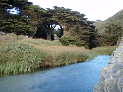
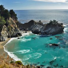
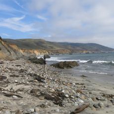
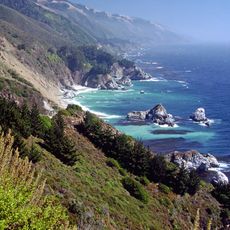
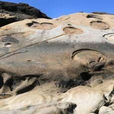
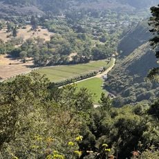
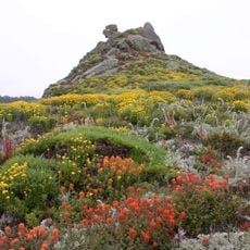
Pfeiffer Big Sur State Park is a protected area in Monterey County, California, covering more than 1,000 acres along the Big Sur River and connecting forests of coast redwoods with hillsides and river valleys. Several walking trails pass through the redwood groves and climb to viewpoints on the wooded slopes.

John Pfeiffer sold around 700 acres of his land to the state of California in 1933 after refusing a purchase offer for real estate development, laying the foundation for the protected area today. Over the following decades the territory expanded through additional land transfers and purchases.

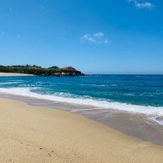
California residents visit the area for weekend camping trips and holidays when the riverside sites fill up quickly with families exploring the forest trails together. On warm summer days many visitors use the shallow parts of the river to wade or sit by the water.

The riverside camping sites require advance reservations through the state booking system, especially on weekends and during summer months. Most walking trails start near the camping areas and are accessible for all fitness levels, though the higher routes become steeper.

A single coast redwood within the boundaries carries the name Colonial Tree and is estimated to be around 1,200 years old. This tree has survived several centuries of climate shifts and forest fires and ranks among the oldest living organisms in the region.

Location: Monterey County

Inception: 1933

Phone: +18316671112

Website: http://parks.ca.gov/?page_id=570

GPS coordinates: 36.24760,-121.78200

Latest update: December 20, 2025 14:18

Photos
Around this place
Big Sur
United States of America

Big Sur

21 km
Bixby Creek Bridge
United States of America

Bixby Creek Bridge

17.5 km
McWay Falls
United States of America

McWay Falls

14 km
Julia Pfeiffer Burns State Park
United States of America

Julia Pfeiffer Burns State Park

13.4 km
Tassajara Zen Mountain Center
United States of America

Tassajara Zen Mountain Center

21.9 km
Tassajara Hot Springs
United States of America

Tassajara Hot Springs

20.9 km
Point Sur Lighthouse
United States of America

Point Sur Lighthouse

12.3 km
Garrapata State Park
United States of America

Garrapata State Park

27.2 km
Andrew Molera State Park
United States of America

Andrew Molera State Park

6.1 km
Ventana Wilderness
United States of America

Ventana Wilderness

10.3 km
Junipero Serra Peak
United States of America

Junipero Serra Peak

34.5 km
Point Sur State Historic Park
United States of America

Point Sur State Historic Park

12.4 km
Pfeiffer Beach
United States of America

Pfeiffer Beach

3.3 km
Rocky Creek Bridge
United States of America

Rocky Creek Bridge

18.2 km
Deetjen's Big Sur Inn
United States of America

Deetjen's Big Sur Inn

4.4 km
Big Creek Bridge
United States of America

Big Creek Bridge

25.6 km
Big Creek State Marine Reserve and Big Creek State Marine Conservation Area
United States of America

Big Creek State Marine Reserve and Big Creek State Marine Conservation Area

19.3 km
San Clemente Dam
United States of America

San Clemente Dam

22 km
United States of America

Palo Corona Ranch

33.7 km
Geological history of Point Lobos
United States of America

Geological history of Point Lobos

33.3 km
Palo Corona Regional Park
United States of America

Palo Corona Regional Park

22.4 km
Whalers Cabin
United States of America

Whalers Cabin

33.1 km
Point Lobos State Reserve
United States of America

Point Lobos State Reserve

33.3 km
Monastery Beach
United States of America

Monastery Beach

33.4 km
Berwick Manor and Orchard
United States of America

Berwick Manor and Orchard

30.8 km
Keyhole Arch
United States of America

Keyhole Arch

3.3 km
Hidden Beach
United States of America

Hidden Beach

32.6 km
Wreck Beach
United States of America

Wreck Beach

2.1 km
Show the full map
Reviews

Visited this place? Tap the stars to rate it and share your experience / photos with the community! Try now! You can cancel it anytime.

« Pfeiffer Big Sur State Park - State park in Monterey County, United States » is provided by Around Us (aroundus.com). Images and texts are derived from Wikimedia project under a Creative Commons license. You are allowed to copy, distribute, and modify copies of this page, under the conditions set by the license, as long as this note is clearly visible.

Discover hidden gems everywhere you go!

From secret cafés to breathtaking viewpoints, skip the crowded tourist spots and find places that match your style. Our app makes it easy with voice search, smart filtering, route optimization, and insider tips from travelers worldwide. Download now for the complete mobile experience.

Around Us App Screenshot

A unique approach to discovering new places

Le Figaro

All the places worth exploring

France Info

A tailor-made excursion in just a few clicks

20 Minutes