Enable Location

We need your location to show you interesting places around you

Discover nearby places

Find interesting locations and hidden gems around you

Precise directions

Get accurate directions and distances to places

Your location is never shared with other users. It's only used when you tap the location button.

Point Sur State Historic Park

Log in to your account

Start exploring — it's free

Trusted by 64,631 travelers worldwide

Continue with Google
Continue with Apple
or

We will send you a code to connect

By continuing, you accept our Terms and Conditions and our Privacy Policy

Check your inbox

We've sent a pincode in your inbox. Please enter the code below.

Point Sur State Historic Park
Discussion Reviews 1 Photos
6.3k Popularity

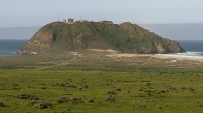
Point Sur State Historic Park, Maritime lighthouse compound in Monterey County, US.

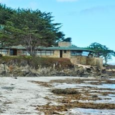
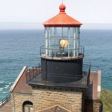
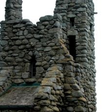
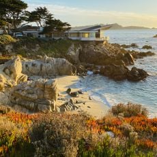
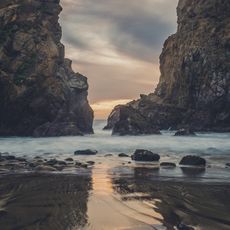
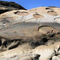
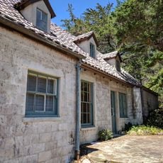
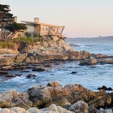
Point Sur State Historic Park is a historic lighthouse complex in Monterey County, California, set on a volcanic rock formation that rises from the shoreline along Highway 1. The granite tower stands alongside former keeper residences, a barn, a storehouse, and several other structures that once served the station.

Several shipwrecks along this stretch of coast led to the decision to build a lighthouse here, and the station first began operating in 1889. The site was staffed continuously for decades before eventually passing into state hands as a historic park.

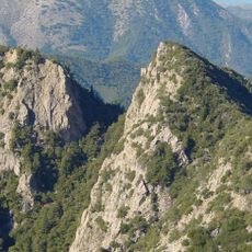
The name Point Sur refers to the rocky headland itself, which rises sharply from the coast and gives the site its character. Visitors on a tour can still see the schoolhouse and garden areas where the keepers and their families lived out their daily routines far from the nearest town.

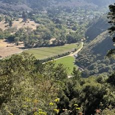
Access to the site is only possible through guided tours that start from a parking area along Highway 1. The path over the headland is uneven and often windy, so solid footwear and a windproof layer are worth bringing regardless of the season.

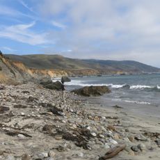
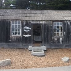
The rock on which the lighthouse stands is connected to the mainland only by a sandbar that shifts with the tides, giving the place an almost island-like feel at certain times. During the years when the station was staffed, the lighthouse keeper's children attended school right on the rock, taught by a teacher who also lived on site.

The community of curious travelers

AroundUs brings together thousands of curated places, local tips, and hidden gems, enriched daily by 60,000 contributors worldwide.

Start exploring
Location
GPS coordinates
36.30698,-121.89828
Latest update
March 3, 2026 22:40
Around this place
Bixby Creek Bridge
United States of America

Bixby Creek Bridge

7.2 km
Mission San Carlos Borromeo de Carmelo
United States of America

Mission San Carlos Borromeo de Carmelo

26.3 km
McWay Falls
United States of America

McWay Falls

26.2 km
Julia Pfeiffer Burns State Park
United States of America

Julia Pfeiffer Burns State Park

25.7 km
Pfeiffer Big Sur State Park
United States of America

Pfeiffer Big Sur State Park

12.4 km
Mrs. Clinton Walker House
United States of America

Mrs. Clinton Walker House

26.5 km
Point Sur Lighthouse
United States of America

Point Sur Lighthouse

222 m
Garrapata State Park
United States of America

Garrapata State Park

18.1 km
Andrew Molera State Park
United States of America

Andrew Molera State Park

6.4 km
Tor House and Hawk Tower
United States of America

Tor House and Hawk Tower

26.3 km
Ventana Wilderness
United States of America

Ventana Wilderness

21.7 km
Butterfly House
United States of America

Butterfly House

26.3 km
Carmel River State Beach
United States of America

Carmel River State Beach

25.2 km
Pfeiffer Beach
United States of America

Pfeiffer Beach

10.5 km
Driftwood Cottage
United States of America

Driftwood Cottage

26.1 km
Rocky Creek Bridge
United States of America

Rocky Creek Bridge

8.1 km
United States of America

Sunset Center

27.3 km
San Clemente Dam
United States of America

San Clemente Dam

22.2 km
Golden Bough Playhouse
United States of America

Golden Bough Playhouse

27.4 km
United States of America

Palo Corona Ranch

25.2 km
Geological history of Point Lobos
United States of America

Geological history of Point Lobos

23.7 km
Outlands in the Eighty Acres
United States of America

Outlands in the Eighty Acres

26.9 km
Palo Corona Regional Park
United States of America

Palo Corona Regional Park

12.8 km
Whalers Cabin
United States of America

Whalers Cabin

23.8 km
Seaburst House
United States of America

Seaburst House

26.5 km
Point Lobos State Reserve
United States of America

Point Lobos State Reserve

23.7 km
Keyhole Arch
United States of America

Keyhole Arch

10.6 km
Carmel Beach
United States of America

Carmel Beach

27.2 km
Show the full map
Reviews
Share your experience

No review yet

Discussions
Start a discussion...

No discussion yet

« Point Sur State Historic Park - Maritime lighthouse compound in Monterey County, US » is provided by Around Us (aroundus.com). Images and texts are derived from Wikimedia project under a Creative Commons license. You are allowed to copy, distribute, and modify copies of this page, under the conditions set by the license, as long as this note is clearly visible.

Discover hidden gems everywhere you go!

From secret cafés to breathtaking viewpoints, skip the crowded tourist spots and find places that match your style. Our app makes it easy with voice search, smart filtering, route optimization, and insider tips from travelers worldwide. Download now for the complete mobile experience.

Around Us App Screenshot

A unique approach to discovering new places

Le Figaro

All the places worth exploring

France Info

A tailor-made excursion in just a few clicks

20 Minutes

Around Us
Travel Guide & Maps
Download

Send to your phone

QR Code
1

Open the camera app on your mobile.

2

Point at the QR code with your camera. A notification will appear.

3

Tap the notification to open the link.