Ventana Wilderness

Log in to your account

AroundUs is a community-driven map of interesting places, built by curious explorers like you. It grows with every review, story, and photo you share.
Connect to save your favorite spots, contribute locations, and create personalized routes.
Continue with Google
Continue with Apple
Continue with X
Continue with Facebook
Continue with email
By continuing, you accept our Terms and Conditions and our Privacy Policy
Create an account
Add to collection
Map
Suggest a change
Share

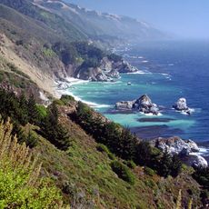
Ventana Wilderness, Protected wilderness area in Los Padres National Forest, California

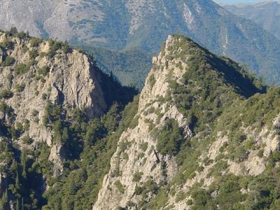
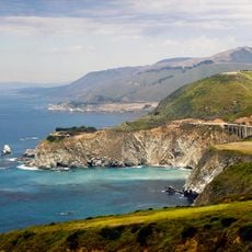
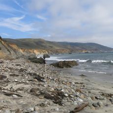
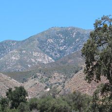
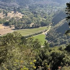
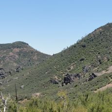
The Ventana Wilderness covers a large area of dense forests, steep canyons, and mountain ridges in the northern Santa Lucia mountains. The protected land includes varied habitats with different elevations and vegetation types.

The area received federal protection in 1964 through the Wilderness Act and was expanded several times in the following decades. These expansions reflected growing efforts to preserve more of the mountain landscape.

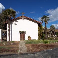
Indigenous peoples lived in this region for thousands of years and created mountain paths that eventually became sections of today's hiking trails. These routes remain visible reminders of how people once moved through this landscape.

Visitors need permits for overnight stays, and motorized equipment plus aircraft landings are prohibited. Good footwear and preparation are essential because trails are demanding and weather conditions can be rough.

Natural hot springs at Sykes Hot Springs emerge from underground sources and form pools where hikers can rest after long mountain journeys. These warm waters are a surprising oasis in the rugged mountain landscape.

Location: California

Operator: US Forest Service;BLM

GPS coordinates: 36.25000,-121.66700

Latest update: December 8, 2025 19:53

Photos
Around this place
Big Sur
United States of America

Big Sur

16.3 km
Bixby Creek Bridge
United States of America

Bixby Creek Bridge

25 km
McWay Falls
United States of America

McWay Falls

10.2 km
Julia Pfeiffer Burns State Park
United States of America

Julia Pfeiffer Burns State Park

9.1 km
Pfeiffer Big Sur State Park
United States of America

Pfeiffer Big Sur State Park

10.3 km
Mission Nuestra Señora de la Soledad
United States of America

Mission Nuestra Señora de la Soledad

32.8 km
Tassajara Zen Mountain Center
United States of America

Tassajara Zen Mountain Center

15 km
Tassajara Hot Springs
United States of America

Tassajara Hot Springs

10.7 km
Point Sur Lighthouse
United States of America

Point Sur Lighthouse

21.7 km
Limekiln State Park
United States of America

Limekiln State Park

29.9 km
Andrew Molera State Park
United States of America

Andrew Molera State Park

15.4 km
The Hacienda
United States of America

The Hacienda

46.5 km
Junipero Serra Peak
United States of America

Junipero Serra Peak

25.1 km
Point Sur State Historic Park
United States of America

Point Sur State Historic Park

21.7 km
Pfeiffer Beach
United States of America

Pfeiffer Beach

13.6 km
Rocky Creek Bridge
United States of America

Rocky Creek Bridge

25.5 km
Deetjen's Big Sur Inn
United States of America

Deetjen's Big Sur Inn

8.3 km
Sand Dollar Beach
United States of America

Sand Dollar Beach

40.5 km
Big Creek Bridge
United States of America

Big Creek Bridge

20.9 km
Big Creek State Marine Reserve and Big Creek State Marine Conservation Area
United States of America

Big Creek State Marine Reserve and Big Creek State Marine Conservation Area

14.5 km
San Clemente Dam
United States of America

San Clemente Dam

21 km
Palo Corona Regional Park
United States of America

Palo Corona Regional Park

28.8 km
King City High School Auditorium
United States of America

King City High School Auditorium

48.2 km
Odd Fellows Hall
United States of America

Odd Fellows Hall

35 km
Mission Soledad Museum
United States of America

Mission Soledad Museum

32.8 km
Fort Hunter Liggett
United States of America

Fort Hunter Liggett

51.4 km
Chalone Peak Lookout
United States of America

Chalone Peak Lookout

47.6 km
Keyhole Arch
United States of America

Keyhole Arch

13.6 km
Show the full map
Reviews

Visited this place? Tap the stars to rate it and share your experience / photos with the community! Try now! You can cancel it anytime.

« Ventana Wilderness - Protected wilderness area in Los Padres National Forest, California » is provided by Around Us (aroundus.com). Images and texts are derived from Wikimedia project under a Creative Commons license. You are allowed to copy, distribute, and modify copies of this page, under the conditions set by the license, as long as this note is clearly visible.

Discover hidden gems everywhere you go!

From secret cafés to breathtaking viewpoints, skip the crowded tourist spots and find places that match your style. Our app makes it easy with voice search, smart filtering, route optimization, and insider tips from travelers worldwide. Download now for the complete mobile experience.

Around Us App Screenshot

A unique approach to discovering new places

Le Figaro

All the places worth exploring

France Info

A tailor-made excursion in just a few clicks

20 Minutes