Limekiln State Park

Log in to your account

AroundUs is a community-driven map of interesting places, built by curious explorers like you. It grows with every review, story, and photo you share.
Connect to save your favorite spots, contribute locations, and create personalized routes.
Continue with Google
Continue with Apple
Continue with X
Continue with Facebook
Continue with email
By continuing, you accept our Terms and Conditions and our Privacy Policy
Create an account
Add to collection
Map
Suggest a change
Share

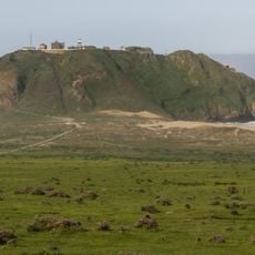
Limekiln State Park, State park in Monterey County, United States

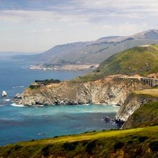
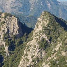
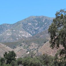
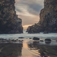
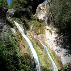
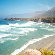
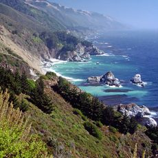
Limekiln State Park is a protected nature reserve situated in one of the steepest coastal canyons on the United States mainland. The park contains ancient redwood forests, exposed limestone layers, and seasonal waterfalls that flow through deep ravines.

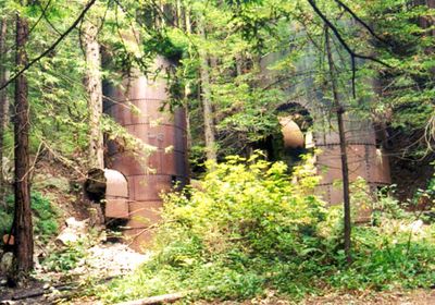
In the late 1880s, a company operated four kilns here to process limestone for San Francisco's construction boom. The site was later abandoned, but the kiln structures remain as reminders of that industrial period.

The old limestone kilns on the site tell visitors about 19th-century industrial work and how people extracted minerals from this coastal area. They show what daily labor looked like for workers in early California.

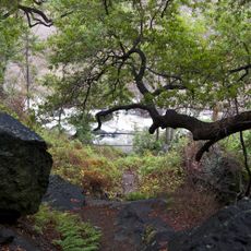
The park offers camping spots under redwoods and with ocean views, along with hiking trails to waterfalls and creek areas. Visitors should wear sturdy shoes since trails can be steep and slippery, especially after rain.

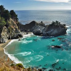
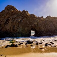
A waterfall nearly 100 feet tall flows year-round through a narrow redwood canyon, creating a rare spot where forest ecosystems meet coastal rock formations. This steady water source is unusual for this otherwise dry region.

Location: Monterey County

Inception: 1994

Website: https://parks.ca.gov/?page_id=577

GPS coordinates: 36.01000,-121.51833

Latest update: December 7, 2025 20:44

Photos
Around this place
Big Sur
United States of America

Big Sur

14.5 km
McWay Falls
United States of America

McWay Falls

21.5 km
Mission San Antonio de Padua
United States of America

Mission San Antonio de Padua

24.2 km
Julia Pfeiffer Burns State Park
United States of America

Julia Pfeiffer Burns State Park

22.3 km
Pfeiffer Big Sur State Park
United States of America

Pfeiffer Big Sur State Park

35.5 km
Mission Nuestra Señora de la Soledad
United States of America

Mission Nuestra Señora de la Soledad

46.3 km
Tassajara Zen Mountain Center
United States of America

Tassajara Zen Mountain Center

40.6 km
Tassajara Hot Springs
United States of America

Tassajara Hot Springs

25.1 km
Point Sur Lighthouse
United States of America

Point Sur Lighthouse

47.4 km
Hearst Ranch
United States of America

Hearst Ranch

46.9 km
Andrew Molera State Park
United States of America

Andrew Molera State Park

41.5 km
Ventana Wilderness
United States of America

Ventana Wilderness

29.9 km
The Hacienda
United States of America

The Hacienda

24.8 km
Junipero Serra Peak
United States of America

Junipero Serra Peak

17.5 km
Piedras Blancas Light Station
United States of America

Piedras Blancas Light Station

43.8 km
Point Sur State Historic Park
United States of America

Point Sur State Historic Park

47.5 km
Pfeiffer Beach
United States of America

Pfeiffer Beach

37 km
Deetjen's Big Sur Inn
United States of America

Deetjen's Big Sur Inn

31.1 km
Salmon Creek Falls
United States of America

Salmon Creek Falls

26 km
Sand Dollar Beach
United States of America

Sand Dollar Beach

10.6 km
Big Creek Bridge
United States of America

Big Creek Bridge

10 km
Big Creek State Marine Reserve and Big Creek State Marine Conservation Area
United States of America

Big Creek State Marine Reserve and Big Creek State Marine Conservation Area

16.2 km
San Clemente Dam
United States of America

San Clemente Dam

50.4 km
Silver Peak Wilderness
United States of America

Silver Peak Wilderness

27.8 km
King City High School Auditorium
United States of America

King City High School Auditorium

41.3 km
Mission Soledad Museum
United States of America

Mission Soledad Museum

46.3 km
Fort Hunter Liggett
United States of America

Fort Hunter Liggett

26.7 km
Keyhole Arch
United States of America

Keyhole Arch

37 km
Show the full map
Reviews

Visited this place? Tap the stars to rate it and share your experience / photos with the community! Try now! You can cancel it anytime.

« Limekiln State Park - State park in Monterey County, United States » is provided by Around Us (aroundus.com). Images and texts are derived from Wikimedia project under a Creative Commons license. You are allowed to copy, distribute, and modify copies of this page, under the conditions set by the license, as long as this note is clearly visible.

Discover hidden gems everywhere you go!

From secret cafés to breathtaking viewpoints, skip the crowded tourist spots and find places that match your style. Our app makes it easy with voice search, smart filtering, route optimization, and insider tips from travelers worldwide. Download now for the complete mobile experience.

Around Us App Screenshot

A unique approach to discovering new places

Le Figaro

All the places worth exploring

France Info

A tailor-made excursion in just a few clicks

20 Minutes