·

Enable Location

We need your location to show you interesting places around you

Discover nearby places

Find interesting locations and hidden gems around you

Precise directions

Get accurate directions and distances to places

Your location is never shared with other users. It's only used when you tap the location button.

Big Sur

Log in to your account

Start exploring — it's free

Trusted by 62,646 travelers worldwide

Continue with Google
Continue with Apple
or

We will send you a code to connect

By continuing, you accept our Terms and Conditions and our Privacy Policy

Check your inbox

We've sent a pincode in your inbox. Please enter the code below.

Big Sur, Coastal region along Pacific Highway 1 in California, United States.

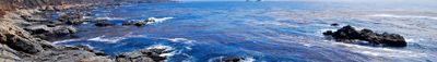
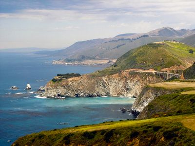
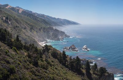
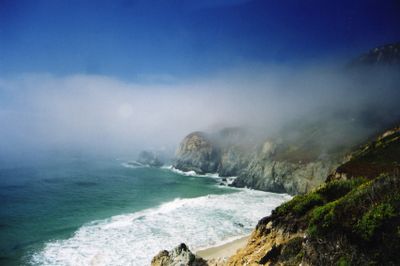
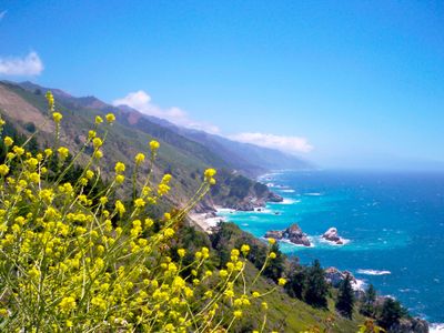
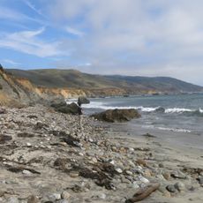
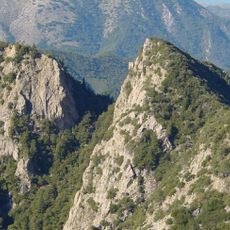
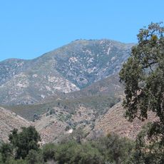
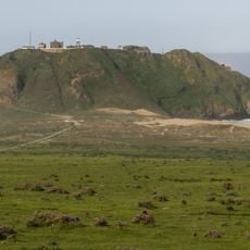
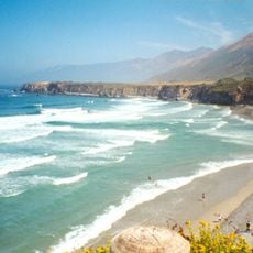
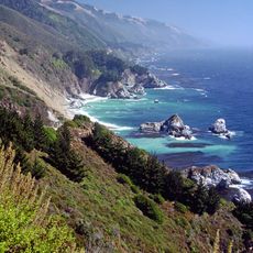
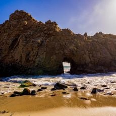
Big Sur is a coastal section along Highway 1 in central California stretching roughly 90 miles between Carmel and San Simeon. Steep rock faces drop directly into the ocean while dense forests of redwoods and coastal pines cover the mountain slopes further inland.

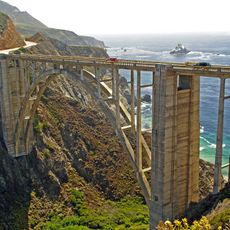
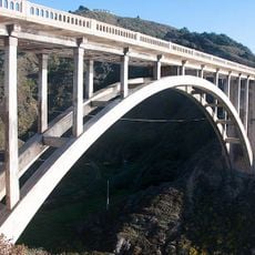
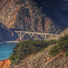
Highway 1 was completed in the 1930s and made continuous car travel along this coast possible for the first time. The Bixby Creek Bridge, opened in 1932, became one of the most recognized bridge structures on the road and crosses a deep canyon near the northern edge of the region.

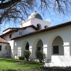
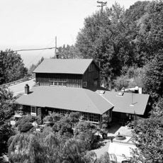
The Henry Miller Memorial Library hosts readings, film screenings and concerts in a wooden house surrounded by redwood trees. Restaurants and art galleries along the coast display works by local painters, photographers and craftspeople who often live and work in the area.

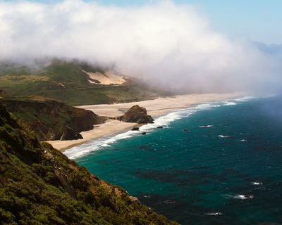
Several state parks along the route offer hiking trails, campsites and access to small beaches reached by stairs or short paths. The road often runs narrow and winding, requiring slow driving especially in fog or after heavy rain.

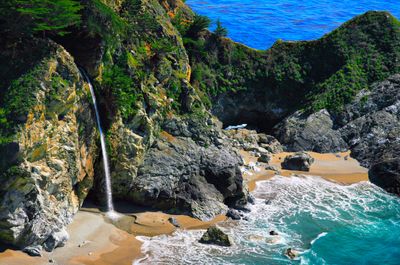
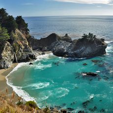
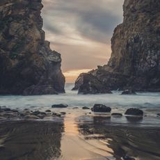
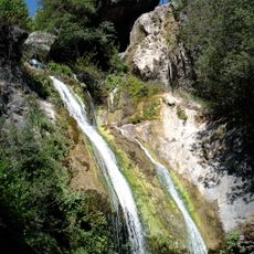
McWay Falls drops directly onto a sand beach that can only be reached from the water and is never walked on by people. The waterfall flows year round because it is fed by an underground spring that does not dry up even during the driest summer months.

The community of curious travelers

AroundUs brings together thousands of curated places, local tips, and hidden gems, enriched daily by 60,000 contributors worldwide.

Start exploring
Location
Part of
Central Coast
GPS coordinates
36.10750,-121.62583
Latest update
December 12, 2025 16:38
Coastal and mountain cliffs worldwide

Cliffs rank among Earth's most striking geological formations, ranging from coastal precipices to inland mountain faces. Along oceans, they shape coastlines for thousands of miles, while in mountain regions they form vertical walls that draw climbers from around the world. This collection documents...

Around this place
Bixby Creek Bridge
United States of America

Bixby Creek Bridge

38.4 km
McWay Falls
United States of America

McWay Falls

7 km
Julia Pfeiffer Burns State Park
United States of America

Julia Pfeiffer Burns State Park

7.8 km
Pfeiffer Big Sur State Park
United States of America

Pfeiffer Big Sur State Park

21 km
Mission Nuestra Señora de la Soledad
United States of America

Mission Nuestra Señora de la Soledad

41 km
Tassajara Zen Mountain Center
United States of America

Tassajara Zen Mountain Center

29.4 km
Tassajara Hot Springs
United States of America

Tassajara Hot Springs

15.6 km
Point Sur Lighthouse
United States of America

Point Sur Lighthouse

32.9 km
Limekiln State Park
United States of America

Limekiln State Park

14.5 km
Andrew Molera State Park
United States of America

Andrew Molera State Park

27 km
Ventana Wilderness
United States of America

Ventana Wilderness

16.3 km
The Hacienda
United States of America

The Hacienda

36.1 km
Junipero Serra Peak
United States of America

Junipero Serra Peak

19.1 km
Point Sur State Historic Park
United States of America

Point Sur State Historic Park

33 km
Pfeiffer Beach
United States of America

Pfeiffer Beach

22.6 km
Rocky Creek Bridge
United States of America

Rocky Creek Bridge

39.1 km
Deetjen's Big Sur Inn
United States of America

Deetjen's Big Sur Inn

16.6 km
Salmon Creek Falls
United States of America

Salmon Creek Falls

40.5 km
Sand Dollar Beach
United States of America

Sand Dollar Beach

24.9 km
Big Creek Bridge
United States of America

Big Creek Bridge

4.8 km
Big Creek State Marine Reserve and Big Creek State Marine Conservation Area
United States of America

Big Creek State Marine Reserve and Big Creek State Marine Conservation Area

1.8 km
San Clemente Dam
United States of America

San Clemente Dam

37.3 km
Silver Peak Wilderness
United States of America

Silver Peak Wilderness

42.3 km
Palo Corona Regional Park
United States of America

Palo Corona Regional Park

43.1 km
King City High School Auditorium
United States of America

King City High School Auditorium

45.8 km
Mission Soledad Museum
United States of America

Mission Soledad Museum

41 km
Fort Hunter Liggett
United States of America

Fort Hunter Liggett

39.6 km
Keyhole Arch
United States of America

Keyhole Arch

22.5 km
Show the full map
« Big Sur - Coastal region along Pacific Highway 1 in California, United States » is provided by Around Us (aroundus.com). Images and texts are derived from Wikimedia project under a Creative Commons license. You are allowed to copy, distribute, and modify copies of this page, under the conditions set by the license, as long as this note is clearly visible.

Discover hidden gems everywhere you go!

From secret cafés to breathtaking viewpoints, skip the crowded tourist spots and find places that match your style. Our app makes it easy with voice search, smart filtering, route optimization, and insider tips from travelers worldwide. Download now for the complete mobile experience.

Around Us App Screenshot

A unique approach to discovering new places

Le Figaro

All the places worth exploring

France Info

A tailor-made excursion in just a few clicks

20 Minutes

Around Us
Travel Guide & Maps
Download

Send to your phone

QR Code
1

Open the camera app on your mobile.

2

Point at the QR code with your camera. A notification will appear.

3

Tap the notification to open the link.