Enable Location

We need your location to show you interesting places around you

Discover nearby places

Find interesting locations and hidden gems around you

Precise directions

Get accurate directions and distances to places

Your location is never shared with other users. It's only used when you tap the location button.

Log in to your account

Start exploring — it's free

Trusted by 63,590 travelers worldwide

Continue with Google
Continue with Apple
or

We will send you a code to connect

By continuing, you accept our Terms and Conditions and our Privacy Policy

Check your inbox

We've sent a pincode in your inbox. Please enter the code below.

Recreation Park
Discussion Reviews Photo
4.5k Popularity

Recreation Park, name of several former baseball parks in San Francisco

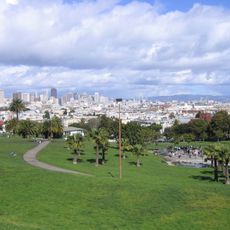
Recreation Park is a sports venue and public space in San Francisco that offers facilities for various outdoor activities. The grounds feature open grass areas, sports courts, play structures, and maintained paths that allow visitors to exercise, play, or spend time in the open air.

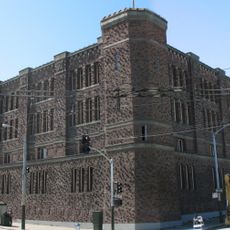
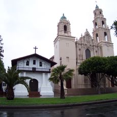
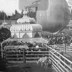
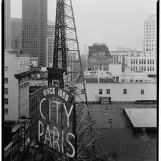
The first Recreation Park opened in 1868 as the city's first enclosed baseball field before closing in 1884. A second venue at 8th and Market Streets was destroyed in the 1906 earthquake. A third Recreation Park in the Mission District (1897 onwards) became home to the San Francisco Seals baseball team until Seals Stadium replaced it in 1931.

The name Recreation Park reflects its original purpose as a public space for community leisure and enjoyment. Today, visitors can still experience it as a gathering place where neighbors meet regularly and families create memories together across generations.

The park is accessible to visitors during daylight hours and provides seating areas, picnic spots, and play zones throughout the grounds. It is best to visit during the day, especially on weekends and summer months when activity is highest and the weather is most pleasant.

The site was once home to three different baseball stadiums sharing the same name across several decades, with the most famous in the Mission District operating from 1897 to 1930. Though the original structures have long disappeared, the stories of fans and teams who played there remain part of local memory.

The community of curious travelers

AroundUs brings together thousands of curated places, local tips, and hidden gems, enriched daily by 60,000 contributors worldwide.

Start exploring
GPS coordinates
37.76740,-122.42300
Latest update
February 7, 2026 11:00
Around this place
San Francisco Armory
United States of America

San Francisco Armory

182 m
Mission San Francisco de Asís
United States of America

Mission San Francisco de Asís

485 m
San Francisco Mint
United States of America

San Francisco Mint

504 m
Mission Dolores Park
United States of America

Mission Dolores Park

1.1 km
Pioneer Building
United States of America

Pioneer Building

918 m
Clarion Alley
United States of America

Clarion Alley

520 m
Woodward's Gardens
United States of America

Woodward's Gardens

188 m
NEMA
United States of America

NEMA

1 km
City of Paris Dry Goods Co.
United States of America

City of Paris Dry Goods Co.

2.7 km
The Deaf Club
United States of America

The Deaf Club

356 m
California Automobile Association Building
United States of America

California Automobile Association Building

1.1 km
Redstone Building
United States of America

Redstone Building

493 m
Cafe Du Nord
United States of America

Cafe Du Nord

621 m
Nourse Theater
United States of America

Nourse Theater

1.1 km
Victoria Theatre
United States of America

Victoria Theatre

442 m
San Francisco Eagle
United States of America

San Francisco Eagle

893 m
New Conservatory Theatre Center
United States of America

New Conservatory Theatre Center

961 m
Charles Dietle House
United States of America

Charles Dietle House

765 m
Nightingale House
United States of America

Nightingale House

603 m
California Volunteers
United States of America

California Volunteers

373 m
Girls Club
United States of America

Girls Club

890 m
Trinity Presbyterian Church
United States of America

Trinity Presbyterian Church

545 m
Second Church of Christ, Scientist
United States of America

Second Church of Christ, Scientist

974 m
Carmel Fallon Building
United States of America

Carmel Fallon Building

558 m
St. Matthew’s Lutheran Church
United States of America

St. Matthew’s Lutheran Church

417 m
Maxime Leforestier's blue house
United States of America

Maxime Leforestier's blue house

897 m
Eureka Valley - Harvey Milk Memorial Branch Library
United States of America

Eureka Valley - Harvey Milk Memorial Branch Library

859 m
Cafe Flore
United States of America

Cafe Flore

920 m
Show the full map
Reviews
Share your experience

No review yet

Discussions
Start a discussion...

No discussion yet

« Recreation Park - name of several former baseball parks in San Francisco » is provided by Around Us (aroundus.com). Images and texts are derived from Wikimedia project under a Creative Commons license. You are allowed to copy, distribute, and modify copies of this page, under the conditions set by the license, as long as this note is clearly visible.

Discover hidden gems everywhere you go!

From secret cafés to breathtaking viewpoints, skip the crowded tourist spots and find places that match your style. Our app makes it easy with voice search, smart filtering, route optimization, and insider tips from travelers worldwide. Download now for the complete mobile experience.

Around Us App Screenshot

A unique approach to discovering new places

Le Figaro

All the places worth exploring

France Info

A tailor-made excursion in just a few clicks

20 Minutes

Around Us
Travel Guide & Maps
Download

Send to your phone

QR Code
1

Open the camera app on your mobile.

2

Point at the QR code with your camera. A notification will appear.

3

Tap the notification to open the link.