Chest opened
+${chestReward.xp} XP
Explorer
NOUVEAU ×${chestReward.collectible.quantity}
tapez pour fermer
Chest locked

Open chests in the app

Around Us is built for your phone — chests unlock when you walk, explore and capture nearby places.

Enable Location

We need your location to show you interesting places around you

Discover nearby places

Find interesting locations and hidden gems around you

Precise directions

Get accurate directions and distances to places

Your location is never shared with other users. It's only used when you tap the location button.

Castroville

Log in to your account

Start exploring — it's free

Trusted by 72,888 travelers worldwide

Continue with Google
Continue with Apple
or

We will send you a code to connect

By continuing, you accept our Terms and Conditions and our Privacy Policy

Check your inbox

We've sent a pincode in your inbox. Please enter the code below.

Discussion Reviews 1 Photos
21.2k Popularity

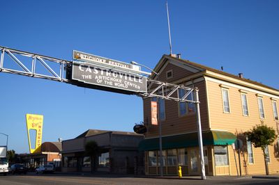
Castroville, Census designated place in Monterey County, United States

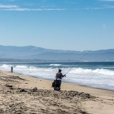
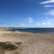
Castroville is a small town in Monterey County situated in California's agricultural zone on fertile land just above sea level. The settlement is organized around farm operations, packing facilities, and roadside stands that support the region's produce trade.

Juan Bautista Castro founded the town in 1863 on territory from the Mexican-era Rancho Bolsa Nueva y Moro Cojo. It remained a farming community until artichoke cultivation took root in 1922 and transformed the area into a major production center.

The town's identity is deeply rooted in artichoke farming, visible in local events and how people organize their year around harvest seasons. Visitors notice how the farming cycle shapes daily routines and community gatherings throughout the year.

The town has local shops, restaurants, and farm stands where visitors can purchase fresh produce and simple meals. The small size makes it easy to walk around and see most of what the place has to offer within an hour or two.

The first artichoke field appeared in 1922 when a local farmer began experimenting with the crop, accidentally launching an industry. This unexpected transformation turned a quiet agricultural village into the artichoke capital of North America.

The community of curious travelers

AroundUs brings together thousands of curated places, local tips, and hidden gems, enriched daily by 60,000 contributors worldwide.

Start exploring
Location
Inception
1863
Elevation above the sea
7 m
GPS coordinates
36.76583,-121.75806
Latest update
December 23, 2025 21:06
Around this place
Zmudowski State Beach
United States of America

Zmudowski State Beach

9.4 km
Marina State Beach
United States of America

Marina State Beach

10.3 km
Moss Landing State Beach
United States of America

Moss Landing State Beach

6.1 km
Salinas River State Beach
United States of America

Salinas River State Beach

3.9 km
United States of America

Moss Landing Wildlife Area

5.7 km
Salinas River National Wildlife Refuge
United States of America

Salinas River National Wildlife Refuge

4.9 km
United States of America

Moro Cojo Slough State Marine Reserve

4.7 km
Marina State Beach
United States of America

Marina State Beach

8.8 km
Jose Eusebio Boronda Adobe
United States of America

Jose Eusebio Boronda Adobe

10.2 km
Fort Ord Station Veterinary Hospital
United States of America

Fort Ord Station Veterinary Hospital

12.1 km
Sheriff William Joseph Nesbitt House
United States of America

Sheriff William Joseph Nesbitt House

13.2 km
Castroville Japanese Language School
United States of America

Castroville Japanese Language School

724 m
Giant artichoke
United States of America

Giant artichoke

582 m
Peter J. Bontadelli House
United States of America

Peter J. Bontadelli House

10 km
United States of America

Weaver Student Observatory

12.4 km
United States of America

Cavalry Bluff

12.7 km
Jetty Beach
United States of America

Jetty Beach

5.7 km
Island Beach
United States of America

Island Beach

5.1 km
United States of America

Pajaro Valley Golf Club

11.7 km
United States of America

The Club at Crazy Horse Ranch

11.3 km
United States of America

Sea otters

5.4 km

North Marina

8.7 km
United States of America

Jesus Statue

10.2 km
United States of America

If it has no other explanation, it must be art

6.6 km
United States of America

Motorcycle from license plates

7.3 km
United States of America

Motorcycle from chains

7.3 km
United States of America

North Marsh Overlook

7.3 km
United States of America

Elkhorn Slough viewpoint

6.1 km
Show the full map
Reviews
Share your experience

No review yet

Discussions
Start a discussion...

No discussion yet

« Castroville - Census designated place in Monterey County, United States » is provided by Around Us (aroundus.com). Images and texts are derived from Wikimedia project under a Creative Commons license. You are allowed to copy, distribute, and modify copies of this page, under the conditions set by the license, as long as this note is clearly visible.

Discover hidden gems everywhere you go!

From secret cafés to breathtaking viewpoints, skip the crowded tourist spots and find places that match your style. Our app makes it easy with voice search, smart filtering, route optimization, and insider tips from travelers worldwide. Download now for the complete mobile experience.

Around Us App Screenshot

A unique approach to discovering new places

Le Figaro

All the places worth exploring

France Info

A tailor-made excursion in just a few clicks

20 Minutes

Around Us
Travel Guide & Maps
Download

Send to your phone

QR Code
1

Open the camera app on your mobile.

2

Point at the QR code with your camera. A notification will appear.

3

Tap the notification to open the link.