Chest opened
+${chestReward.xp} XP
Explorer
NOUVEAU ×${chestReward.collectible.quantity}
tapez pour fermer
Chest locked

Open chests in the app

Around Us is built for your phone — chests unlock when you walk, explore and capture nearby places.

Enable Location

We need your location to show you interesting places around you

Discover nearby places

Find interesting locations and hidden gems around you

Precise directions

Get accurate directions and distances to places

Your location is never shared with other users. It's only used when you tap the location button.

Prunedale

Log in to your account

Start exploring — it's free

Trusted by 72,881 travelers worldwide

Continue with Google
Continue with Apple
or

We will send you a code to connect

By continuing, you accept our Terms and Conditions and our Privacy Policy

Check your inbox

We've sent a pincode in your inbox. Please enter the code below.

Discussion Reviews 1 Photos
12.5k Popularity

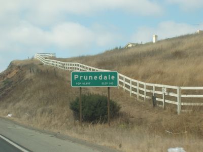
Prunedale, Census-designated place in Monterey County, United States.

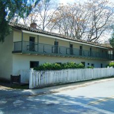
Prunedale is a census-designated place in northern Monterey County with a mix of residential areas, farmland, and commercial zones spread across several miles. The landscape combines rural stretches with developing neighborhoods and shopping areas.

The first post office opened in 1894 but closed by 1908, reopening only in 1953 as the area began to grow. Highway 101 was rerouted through the region in the early 1930s, which brought new development and connected the community to major routes.

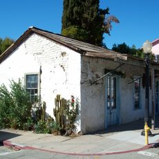
The name reflects early plum orchards that once covered the land, a heritage visible in how locals still identify with the area's agricultural past. This connection to the land shapes how people think about their community today.

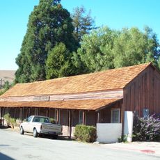
The main shopping hub is the Prunedale Shopping Center from the 1970s, centrally located and easy to access for errands and services. Exploring the area works best by car, as distances between different sections are substantial.

The current San Juan Grade Road was the original path of Highway 101 before being rerouted between 1931 and 1932. This former route remains visible today and shows how infrastructure changes reshaped the area.

The community of curious travelers

AroundUs brings together thousands of curated places, local tips, and hidden gems, enriched daily by 60,000 contributors worldwide.

Start exploring
Location
Elevation above the sea
28 m
GPS coordinates
36.79972,-121.66722
Latest update
December 7, 2025 20:44
Around this place
Mission San Juan Bautista
United States of America

Mission San Juan Bautista

12.8 km
San Juan Bautista State Historic Park
United States of America

San Juan Bautista State Historic Park

12.9 km
Moss Landing State Beach
United States of America

Moss Landing State Beach

11.1 km
Salinas River State Beach
United States of America

Salinas River State Beach

11.6 km
United States of America

Moss Landing Wildlife Area

10.6 km
United States of America

Moro Cojo Slough State Marine Reserve

10.5 km
Jose Castro House
United States of America

Jose Castro House

12.8 km
Juan de Anza House
United States of America

Juan de Anza House

12.7 km
Jose Eusebio Boronda Adobe
United States of America

Jose Eusebio Boronda Adobe

11 km
Rozas House
United States of America

Rozas House

12.6 km
Castroville Japanese Language School
United States of America

Castroville Japanese Language School

8.3 km
Giant artichoke
United States of America

Giant artichoke

8.7 km
Benjamin Wilcox House
United States of America

Benjamin Wilcox House

12.7 km
United States of America

San Juan Bautista Historic District

12.7 km
Marentis House
United States of America

Marentis House

12.4 km
Jetty Beach
United States of America

Jetty Beach

11 km
Island Beach
United States of America

Island Beach

10.8 km
United States of America

Pajaro Valley Golf Club

11.2 km
United States of America

Twin Creeks Golf Course

12.3 km
United States of America

Sea otters

9.3 km
United States of America

Outdoor Theater / Stage

12.4 km
United States of America

If it has no other explanation, it must be art

7.1 km
United States of America

Motorcycle from license plates

9.9 km
United States of America

Motorcycle from chains

10 km
United States of America

Cato Phillips Park

8.4 km
United States of America

Work of art, statue

12.5 km
United States of America

North Marsh Overlook

6.9 km
United States of America

Elkhorn Slough viewpoint

6.2 km
Show the full map
Reviews
Share your experience

No review yet

Discussions
Start a discussion...

No discussion yet

« Prunedale - Census-designated place in Monterey County, United States » is provided by Around Us (aroundus.com). Images and texts are derived from Wikimedia project under a Creative Commons license. You are allowed to copy, distribute, and modify copies of this page, under the conditions set by the license, as long as this note is clearly visible.

Discover hidden gems everywhere you go!

From secret cafés to breathtaking viewpoints, skip the crowded tourist spots and find places that match your style. Our app makes it easy with voice search, smart filtering, route optimization, and insider tips from travelers worldwide. Download now for the complete mobile experience.

Around Us App Screenshot

A unique approach to discovering new places

Le Figaro

All the places worth exploring

France Info

A tailor-made excursion in just a few clicks

20 Minutes

Around Us
Travel Guide & Maps
Download

Send to your phone

QR Code
1

Open the camera app on your mobile.

2

Point at the QR code with your camera. A notification will appear.

3

Tap the notification to open the link.