Chest opened
+${chestReward.xp} XP
Explorer
NOUVEAU ×${chestReward.collectible.quantity}
tapez pour fermer
Chest locked

Open chests in the app

Around Us is built for your phone — chests unlock when you walk, explore and capture nearby places.

Enable Location

We need your location to show you interesting places around you

Discover nearby places

Find interesting locations and hidden gems around you

Precise directions

Get accurate directions and distances to places

Your location is never shared with other users. It's only used when you tap the location button.

Log in to your account

Start exploring — it's free

Trusted by 72,885 travelers worldwide

Continue with Google
Continue with Apple
or

We will send you a code to connect

By continuing, you accept our Terms and Conditions and our Privacy Policy

Check your inbox

We've sent a pincode in your inbox. Please enter the code below.

Sonoma Creek
Discussion Reviews Photo
9k Popularity

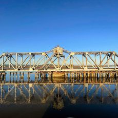
Sonoma Creek, Stream in Sonoma County, United States.

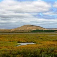
Sonoma Creek is a waterway that flows through Sonoma Valley and shapes the landscape of this region. The stream travels from the higher elevations through agricultural areas and eventually reaches the bay, serving as a vital water source for the surrounding communities.

The creek flowed in its natural state for centuries until farming practices in the 1800s changed how water moved through the valley. These changes to the waterway continue to influence the region's ecology and water patterns today.

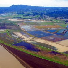
The creek shapes the identity of the Sonoma Valley wine region and influences how grapes are grown in the surrounding vineyards. Locals and visitors can see how the water connects the agricultural landscape and supports the area's farming traditions.

The banks of the creek are accessible at several locations and offer good viewing areas for visitors. Be aware of water conditions, especially during winter months when water levels can rise quickly.

After disappearing for decades, beaver populations returned to the creek in the 1990s and began creating natural pools. These water reservoirs now support fish and other aquatic life throughout the waterway.

The community of curious travelers

AroundUs brings together thousands of curated places, local tips, and hidden gems, enriched daily by 60,000 contributors worldwide.

Start exploring
Location
Shares border with
Rancho Los Guilicos, Rancho Petaluma
GPS coordinates
38.15060,-122.40400
Latest update
December 10, 2025 15:59
Around this place
Sonoma Raceway
United States of America

Sonoma Raceway

4.6 km
Hamilton Air Force Base
United States of America

Hamilton Air Force Base

12.6 km
USS LCS-102
United States of America

USS LCS-102

12.4 km
San Pablo Bay National Wildlife Refuge
United States of America

San Pablo Bay National Wildlife Refuge

1 km
United States of America

Skaggs Island Naval Communication Station

4.5 km
Hamilton Wetland Restoration Project
United States of America

Hamilton Wetland Restoration Project

12.6 km
Black Point Railroad Bridge
United States of America

Black Point Railroad Bridge

9.6 km
First Presbyterian Church
United States of America

First Presbyterian Church

12.6 km
United States of America

Railway Lift Bridge

10.7 km
United States of America

Viewpoint & Information Boards

12 km
United States of America

Information Board

11.7 km
United States of America

Information Board

12.1 km
United States of America

Information Board

11.8 km
United States of America

Abandoned Fishing Huts

11.6 km
United States of America

StoneTree Golf Club

10.7 km
United States of America

Pepper Pond

11.7 km
United States of America

Glass Beach

10.6 km
United States of America

Paintball Jungle

12.2 km
United States of America

Viewpoint & Information Boards

11.4 km
United States of America

Scenic viewpoint

10 km
United States of America

Scenic viewpoint

11.1 km
United States of America

Scenic viewpoint

11.2 km
United States of America

Three Bridges Vista Point

10.5 km
United States of America

Wildlife Viewing Platform

11.8 km
United States of America

Tolay Creek Vista

9.9 km
United States of America

Petaluma Marsh Vista

10.3 km
United States of America

Sonoma Creek East Vista Point

575 m
United States of America

Baylands Vista Point

10.8 km
Show the full map
Reviews
Share your experience

No review yet

Discussions
Start a discussion...

No discussion yet

« Sonoma Creek - Stream in Sonoma County, United States » is provided by Around Us (aroundus.com). Images and texts are derived from Wikimedia project under a Creative Commons license. You are allowed to copy, distribute, and modify copies of this page, under the conditions set by the license, as long as this note is clearly visible.

Discover hidden gems everywhere you go!

From secret cafés to breathtaking viewpoints, skip the crowded tourist spots and find places that match your style. Our app makes it easy with voice search, smart filtering, route optimization, and insider tips from travelers worldwide. Download now for the complete mobile experience.

Around Us App Screenshot

A unique approach to discovering new places

Le Figaro

All the places worth exploring

France Info

A tailor-made excursion in just a few clicks

20 Minutes

Around Us
Travel Guide & Maps
Download

Send to your phone

QR Code
1

Open the camera app on your mobile.

2

Point at the QR code with your camera. A notification will appear.

3

Tap the notification to open the link.