Chest opened
+${chestReward.xp} XP
Explorer
NOUVEAU ×${chestReward.collectible.quantity}
tapez pour fermer
Chest locked

Open chests in the app

Around Us is built for your phone — chests unlock when you walk, explore and capture nearby places.

Enable Location

We need your location to show you interesting places around you

Discover nearby places

Find interesting locations and hidden gems around you

Precise directions

Get accurate directions and distances to places

Your location is never shared with other users. It's only used when you tap the location button.

Chinese Camp

Log in to your account

Start exploring — it's free

Trusted by 72,959 travelers worldwide

Continue with Google
Continue with Apple
or

We will send you a code to connect

By continuing, you accept our Terms and Conditions and our Privacy Policy

Check your inbox

We've sent a pincode in your inbox. Please enter the code below.

Discussion Reviews 2 Photos
21.7k Popularity

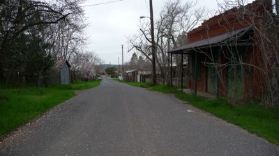
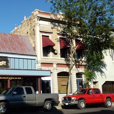
Chinese Camp, census-designated place in Tuolumne County, California

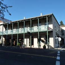
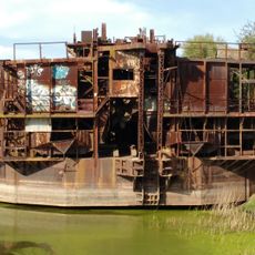
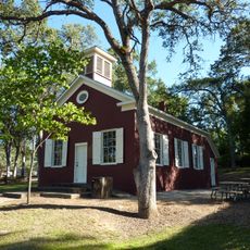
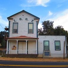
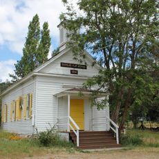
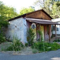
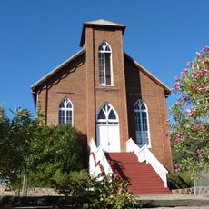
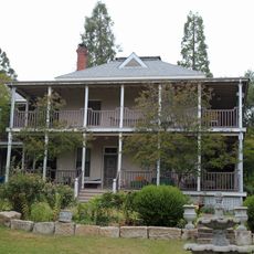
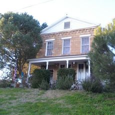
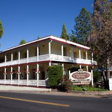
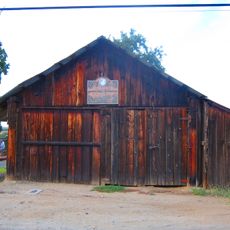
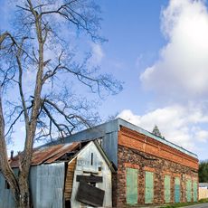
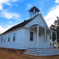
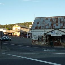
Chinese Camp is a historic mining settlement in Tuolumne County, California, founded during the gold rush period when workers came to extract ore from local claims. The site contains several remaining structures including a church and houses scattered across open land, though most buildings have disappeared over time.

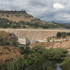
The settlement emerged during California's gold rush in the mid-1800s when Chinese workers and other groups came together to mine gold and other minerals from nearby claims. As mining declined, residents left the area, gradually transforming Chinese Camp into a ghost town.

The name comes from the Chinese miners who settled here during the gold rush era to work the local claims. The few remaining structures reflect how different ethnic groups lived alongside one another in these remote mining camps.

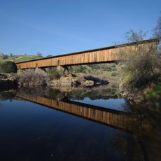
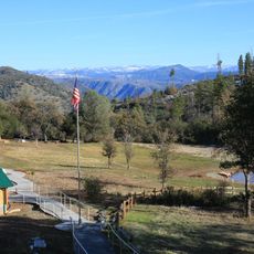
The site is easily reached and typically quiet, with light traffic on the local roads leading to the remains. Wear comfortable walking shoes and expect uneven ground and open terrain, as there are minimal facilities on site.

The site holds significance for documenting Chinese immigration and economic activity during the gold rush, making it an important location for understanding this historical period. Visitors can witness an often-overlooked chapter of California history that reflects the contributions of foreign laborers to the region.

The community of curious travelers

AroundUs brings together thousands of curated places, local tips, and hidden gems, enriched daily by 60,000 contributors worldwide.

Start exploring
Location
Elevation above the sea
388 m
GPS coordinates
37.87028,-120.43333
Latest update
December 14, 2025 17:01
Around this place
New Melones Lake
United States of America

New Melones Lake

16.3 km
Railtown 1897 State Historic Park
United States of America

Railtown 1897 State Historic Park

9.1 km
Lake Tulloch
United States of America

Lake Tulloch

13.7 km
Ironstone Vineyards
United States of America

Ironstone Vineyards

28 km
Angels Hotel
United States of America

Angels Hotel

24.2 km
Knight's Ferry Bridge
United States of America

Knight's Ferry Bridge

21 km
Gold Dredge
United States of America

Gold Dredge

26.6 km
Twisted Oak Winery
United States of America

Twisted Oak Winery

24.5 km
Track Bus No. 19
United States of America

Track Bus No. 19

9 km
Altaville Grammar School
United States of America

Altaville Grammar School

26.2 km
Archie Stevenot Bridge
United States of America

Archie Stevenot Bridge

16 km
Odd Fellows Hall
United States of America

Odd Fellows Hall

23.2 km
Shell Gas Station
United States of America

Shell Gas Station

23.1 km
Douglas Flat School
United States of America

Douglas Flat School

27.5 km
Sam Choy Brick Store
United States of America

Sam Choy Brick Store

24 km
Copperopolis Congregational Church
United States of America

Copperopolis Congregational Church

21.8 km
Utica Mansion
United States of America

Utica Mansion

24.3 km
Abraham Schell House
United States of America

Abraham Schell House

21.8 km
Groveland Hotel
United States of America

Groveland Hotel

18.3 km
Old Adobe Barn
United States of America

Old Adobe Barn

23.1 km
Calaveras County Bank
United States of America

Calaveras County Bank

24.1 km
Gamble Building and Miner's Bean Kettle
United States of America

Gamble Building and Miner's Bean Kettle

16.4 km
Jacksonville Road Bridge
United States of America

Jacksonville Road Bridge

8.5 km
La Grange Dam
United States of America

La Grange Dam

22.1 km
Old La Grange Schoolhouse
United States of America

Old La Grange Schoolhouse

23.3 km
Coulterville Main Street Historic District
United States of America

Coulterville Main Street Historic District

27.3 km
Camp Tuolumne Trails
United States of America

Camp Tuolumne Trails

26.6 km
Don Pedro Reservoir
United States of America

Don Pedro Reservoir

15.3 km
Show the full map
Reviews
Share your experience

No review yet

Discussions
Start a discussion...

No discussion yet

« Chinese Camp - census-designated place in Tuolumne County, California » is provided by Around Us (aroundus.com). Images and texts are derived from Wikimedia project under a Creative Commons license. You are allowed to copy, distribute, and modify copies of this page, under the conditions set by the license, as long as this note is clearly visible.

Discover hidden gems everywhere you go!

From secret cafés to breathtaking viewpoints, skip the crowded tourist spots and find places that match your style. Our app makes it easy with voice search, smart filtering, route optimization, and insider tips from travelers worldwide. Download now for the complete mobile experience.

Around Us App Screenshot

A unique approach to discovering new places

Le Figaro

All the places worth exploring

France Info

A tailor-made excursion in just a few clicks

20 Minutes

Around Us
Travel Guide & Maps
Download

Send to your phone

QR Code
1

Open the camera app on your mobile.

2

Point at the QR code with your camera. A notification will appear.

3

Tap the notification to open the link.