Chest opened
+${chestReward.xp} XP
Explorer
NOUVEAU ×${chestReward.collectible.quantity}
tapez pour fermer
Chest locked

Open chests in the app

Around Us is built for your phone — chests unlock when you walk, explore and capture nearby places.

Enable Location

We need your location to show you interesting places around you

Discover nearby places

Find interesting locations and hidden gems around you

Precise directions

Get accurate directions and distances to places

Your location is never shared with other users. It's only used when you tap the location button.

Volcano

Log in to your account

Start exploring — it's free

Trusted by 72,972 travelers worldwide

Continue with Google
Continue with Apple
or

We will send you a code to connect

By continuing, you accept our Terms and Conditions and our Privacy Policy

Check your inbox

We've sent a pincode in your inbox. Please enter the code below.

Discussion Reviews 1 Photos
20.8k Popularity

Volcano, Mining settlement in Amador County, United States.

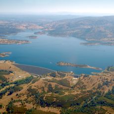
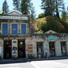
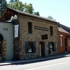
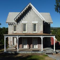
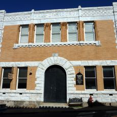
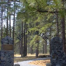
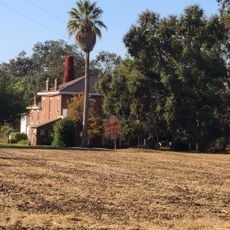
Volcano is a former mining settlement in a bowl-shaped valley surrounded by Sierra Nevada foothills and forest. The town preserves many stone buildings from the 1850s, including a general store that has operated continuously since 1852.

The settlement grew quickly during California's Gold Rush in the 1850s as miners arrived seeking fortune. It expanded rapidly until the gold became scarce and people moved elsewhere.

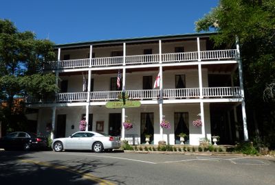
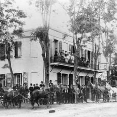
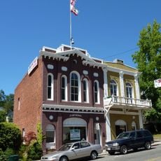
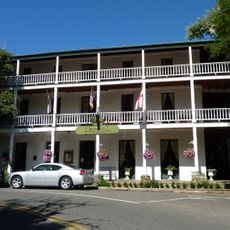
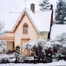
The St. George Hotel from 1862 shows how buildings looked during the Gold Rush era and is registered as a national landmark. Walking through town, you see how miners and merchants shaped the place with their choices about where to build and what to keep.

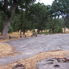
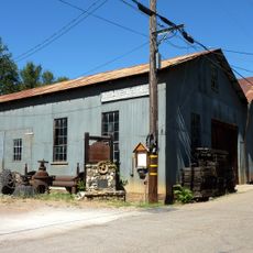
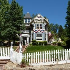
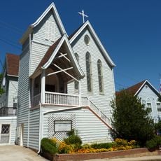
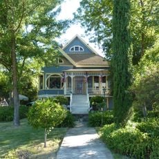
You can walk through the streets to see the old buildings, most dating from around 1850 or shortly after. Wear good shoes since the terrain is hilly and the paths can be uneven in places.

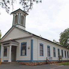
In the 1850s, the community established California's first theater group, debate society, and lending library. These institutions arose while the place was still functioning as a mining camp, showing how much residents valued culture and learning.

The community of curious travelers

AroundUs brings together thousands of curated places, local tips, and hidden gems, enriched daily by 60,000 contributors worldwide.

Start exploring
Location
Elevation above the sea
631 m
GPS coordinates
38.44310,-120.63100
Latest update
December 7, 2025 10:05
Around this place
Preston School of Industry
United States of America

Preston School of Industry

28.1 km
Calaveras Big Trees State Park
United States of America

Calaveras Big Trees State Park

35.2 km
Pioneer Cabin Tree
United States of America

Pioneer Cabin Tree

33.9 km
Murphys Hotel
United States of America

Murphys Hotel

36.9 km
Indian Grinding Rock State Historic Park
United States of America

Indian Grinding Rock State Historic Park

2.3 km
New Hogan Lake
United States of America

New Hogan Lake

36.2 km
Mercer Caverns
United States of America

Mercer Caverns

35.1 km
California Caverns
United States of America

California Caverns

28.8 km
Pardee Dam
United States of America

Pardee Dam

28.2 km
Salt Springs Reservoir
United States of America

Salt Springs Reservoir

36.8 km
John Pearson Soda Works
United States of America

John Pearson Soda Works

34.9 km
Knight Foundry
United States of America

Knight Foundry

14.4 km
Bear River Dam
United States of America

Bear River Dam

38.3 km
Fountain-Tallman Soda Works
United States of America

Fountain-Tallman Soda Works

35 km
Combellack-Blair House
United States of America

Combellack-Blair House

34.8 km
Church of Our Saviour
United States of America

Church of Our Saviour

35.2 km
Confidence Hall
United States of America

Confidence Hall

35.1 km
St. George Hotel
United States of America

St. George Hotel

170 m
Community Methodist Church of Ione
United States of America

Community Methodist Church of Ione

28.3 km
Thorn House
United States of America

Thorn House

27.9 km
Sierra Nevada Logging Museum
United States of America

Sierra Nevada Logging Museum

31.9 km
Calaveras County Courthouse
United States of America

Calaveras County Courthouse

27.8 km
Eddy Arboretum
United States of America

Eddy Arboretum

35.1 km
D. Stewart Company Store
United States of America

D. Stewart Company Store

28.2 km
John J. Snyder House
United States of America

John J. Snyder House

27.7 km
Murphys Grammar School
United States of America

Murphys Grammar School

37.5 km
Scully Ranch
United States of America

Scully Ranch

30.3 km
William J. Paugh House
United States of America

William J. Paugh House

15.9 km
Show the full map
Reviews
Share your experience

No review yet

Discussions
Start a discussion...

No discussion yet

« Volcano - Mining settlement in Amador County, United States » is provided by Around Us (aroundus.com). Images and texts are derived from Wikimedia project under a Creative Commons license. You are allowed to copy, distribute, and modify copies of this page, under the conditions set by the license, as long as this note is clearly visible.

Discover hidden gems everywhere you go!

From secret cafés to breathtaking viewpoints, skip the crowded tourist spots and find places that match your style. Our app makes it easy with voice search, smart filtering, route optimization, and insider tips from travelers worldwide. Download now for the complete mobile experience.

Around Us App Screenshot

A unique approach to discovering new places

Le Figaro

All the places worth exploring

France Info

A tailor-made excursion in just a few clicks

20 Minutes

Around Us
Travel Guide & Maps
Download

Send to your phone

QR Code
1

Open the camera app on your mobile.

2

Point at the QR code with your camera. A notification will appear.

3

Tap the notification to open the link.