Chest opened
+${chestReward.xp} XP
Explorer
NOUVEAU ×${chestReward.collectible.quantity}
tapez pour fermer

See the monuments around you in AR Open chests in the app

Around Us is built for your phone — point your camera at the streets and discover the monuments and places around you in augmented reality. Around Us is built for your phone — chests unlock when you walk, explore and capture nearby places.

Enable Location

We need your location to show you interesting places around you

Discover nearby places

Find interesting locations and hidden gems around you

Precise directions

Get accurate directions and distances to places

Your location is never shared with other users. It's only used when you tap the location button.

Pardee Dam

Log in to your account

Start exploring — it's free

Trusted by 85,224 travelers worldwide

Continue with Google
Continue with Apple
or

We will send you a code to connect

By continuing, you accept our Terms and Conditions and our Privacy Policy

Check your inbox

We've sent a pincode in your inbox. Please enter the code below.

Pardee Dam
Discussion Reviews 1 Photos
4.6k Popularity

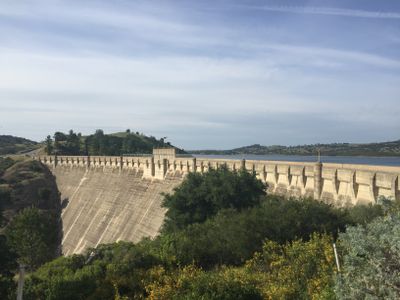
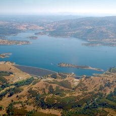
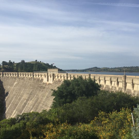
Pardee Dam, Arch dam across Mokelumne River in Amador County and Calaveras County, United States.

Pardee Dam is an arch dam spanning the Mokelumne River across the border between Amador and Calaveras County. The structure creates a large reservoir that serves as a water storage facility for the surrounding region.

Construction began in 1927 and finished in 1929, marking a turning point in California's infrastructure development. The project reflected the region's growing need for reliable water supply during that era.

The structure takes its name from George Pardee, a former California governor who shaped the state's water management approach. His name reflects the importance of this facility to regional water supply.

The facility is managed by the East Bay Municipal Utility District and is accessible by roads in the surrounding area. Visitors should be prepared for uneven terrain and changing weather conditions.

The reservoir water is subject to strict regulations to protect drinking water quality and is not open for swimming. Instead, visitors can fish or boat on the water.

The community of curious travelers

AroundUs brings together thousands of curated places, local tips, and hidden gems, enriched daily by 60,000 contributors worldwide.
Start exploring
Location
Location
GPS coordinates
38.25739,-120.85000
Latest update
August 30, 2026 12:57
Around this place
Preston School of Industry
United States of America

Preston School of Industry

8.6 mi
Camanche Reservoir
United States of America

Camanche Reservoir

8.5 mi
Indian Grinding Rock State Historic Park
United States of America

Indian Grinding Rock State Historic Park

16.1 mi
New Hogan Lake
United States of America

New Hogan Lake

7.7 mi
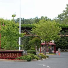
Ironstone Vineyards
United States of America

Ironstone Vineyards

22.7 mi
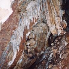
Mercer Caverns
United States of America

Mercer Caverns

21.5 mi
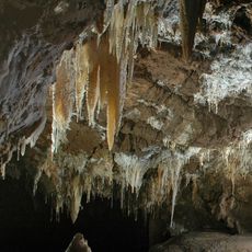
California Caverns
United States of America

California Caverns

18.9 mi
Angels Hotel
United States of America

Angels Hotel

21.1 mi
Knight Foundry
United States of America

Knight Foundry

10.1 mi
Salt Spring Valley Reservoir
United States of America

Salt Spring Valley Reservoir

16.3 mi
Community Methodist Church of Ione
United States of America

Community Methodist Church of Ione

7.8 mi
Altaville Grammar School
United States of America

Altaville Grammar School

19.8 mi
Thorn House
United States of America

Thorn House

10.3 mi
Calaveras County Courthouse
United States of America

Calaveras County Courthouse

10.2 mi
Alta Mesa Farm Bureau Hall
United States of America

Alta Mesa Farm Bureau Hall

22.1 mi
D. Stewart Company Store
United States of America

D. Stewart Company Store

8 mi
Harmony Grove Church
United States of America

Harmony Grove Church

19.3 mi
John J. Snyder House
United States of America

John J. Snyder House

9.9 mi
Sam Choy Brick Store
United States of America

Sam Choy Brick Store

21.4 mi
Copperopolis Congregational Church
United States of America

Copperopolis Congregational Church

22.4 mi
Utica Mansion
United States of America

Utica Mansion

21.1 mi
Scully Ranch
United States of America

Scully Ranch

8.9 mi
William J. Paugh House
United States of America

William J. Paugh House

7.8 mi
Locke's Meat Market
United States of America

Locke's Meat Market

17.5 mi
Jackson Downtown Historic District
United States of America

Jackson Downtown Historic District

7.6 mi
Calaveras County Bank
United States of America

Calaveras County Bank

21.3 mi
Chaparral Gardens
United States of America

Chaparral Gardens

22.1 mi
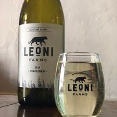
Leoni Farms Wine
United States of America

Leoni Farms Wine

9.8 mi
Show the full map
Reviews
Share your experience

No review yet

Discussions
Start a discussion...

No discussion yet

« Pardee Dam - Arch dam across Mokelumne River in Amador County and Calaveras County, United States » is provided by Around Us (aroundus.com). Images and texts are derived from Wikimedia project under a Creative Commons license. You are allowed to copy, distribute, and modify copies of this page, under the conditions set by the license, as long as this note is clearly visible.

Discover hidden gems everywhere you go!

From secret cafés to breathtaking viewpoints, skip the crowded tourist spots and find places that match your style. Our app makes it easy with voice search, smart filtering, route optimization, and insider tips from travelers worldwide. Download now for the complete mobile experience.
Around Us App Screenshot

A unique approach to discovering new places

Le Figaro

All the places worth exploring

France Info

A tailor-made excursion in just a few clicks

20 Minutes

Around Us
Travel Guide & Maps
Download

Send to your phone

QR Code
1

Open the camera app on your mobile.

2

Point at the QR code with your camera. A notification will appear.

3

Tap the notification to open the link.