Enable Location

We need your location to show you interesting places around you

Discover nearby places

Find interesting locations and hidden gems around you

Precise directions

Get accurate directions and distances to places

Your location is never shared with other users. It's only used when you tap the location button.

MacKerricher State Park

Log in to your account

Start exploring — it's free

Trusted by 63,675 travelers worldwide

Continue with Google
Continue with Apple
or

We will send you a code to connect

By continuing, you accept our Terms and Conditions and our Privacy Policy

Check your inbox

We've sent a pincode in your inbox. Please enter the code below.

MacKerricher State Park
Discussion Reviews 1 Photos
15.6k Popularity

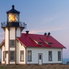
MacKerricher State Park, Coastal state park in Mendocino County, United States.

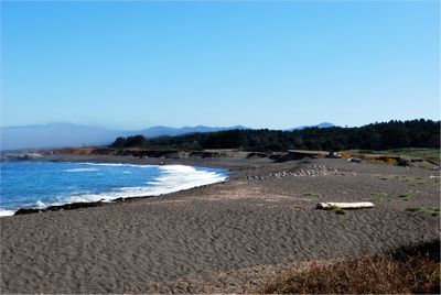
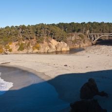
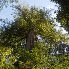
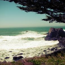
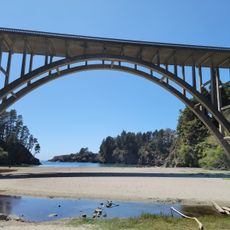
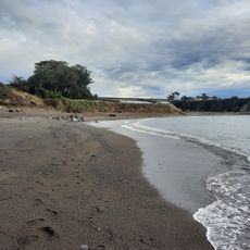
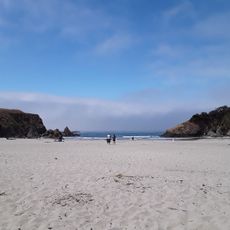
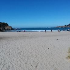
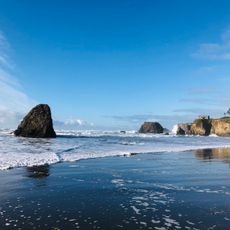
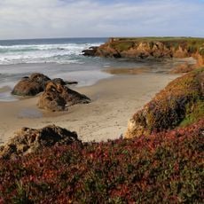
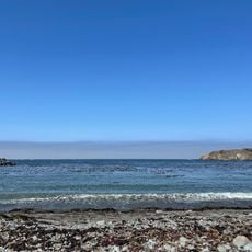
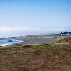
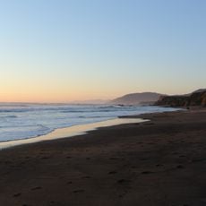
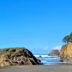
MacKerricher State Park stretches along the Mendocino County coastline with a mix of beaches, rocky headlands, and forested sections inland. The layout includes dunes near the shore, wetland areas behind them, and tide pools exposed at low water among the rocks.

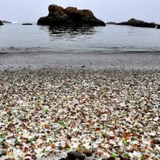
The land was home to the Pomo people before becoming an industrial site with a glass factory in the 1800s, then converted to a state park in 1952. This shift from indigenous use to manufacturing and finally to protection marked a major turning point for the place.

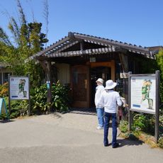
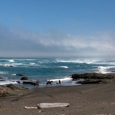
The park reflects how the land connects people to the ocean and its creatures through walking trails that pass rocky shores and tide pools. Visitors naturally learn about coastal life while moving through these spaces.

The park has two group camping areas with room for 9 to 60 people depending on the site, each with vehicle limits. Most trails are walkable, though some pass over rough ground and rocky areas that require steady footing.

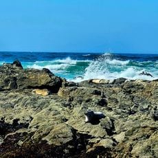
Sea lions and seals rest on the rocks year-round while gray whales migrate past during winter and spring months. These animal movements happen on natural schedules that visitors can witness from coastal lookout points with patience.

The community of curious travelers

AroundUs brings together thousands of curated places, local tips, and hidden gems, enriched daily by 60,000 contributors worldwide.

Start exploring
Location
Inception
1952
GPS coordinates
39.49330,-123.79400
Latest update
December 7, 2025 19:29
Around this place
Glass Beach
United States of America

Glass Beach

4.7 km
California Western Railroad
United States of America

California Western Railroad

5.4 km
Russian Gulch State Park
United States of America

Russian Gulch State Park

18.1 km
Point Cabrillo Light
United States of America

Point Cabrillo Light

16.3 km
Jackson Demonstration State Forest
United States of America

Jackson Demonstration State Forest

16.6 km
Jug Handle State Natural Reserve
United States of America

Jug Handle State Natural Reserve

13.3 km
Mendocino Woodlands State Park
United States of America

Mendocino Woodlands State Park

20.1 km
Mendocino Coast Botanical Gardens
United States of America

Mendocino Coast Botanical Gardens

9.5 km
Caspar Headlands State Beach
United States of America

Caspar Headlands State Beach

14.9 km
Frederick W. Panhorst Bridge
United States of America

Frederick W. Panhorst Bridge

18.3 km
Noyo River Bridge
United States of America

Noyo River Bridge

7.4 km
Weller House
United States of America

Weller House

5.2 km
Russian Gulch
United States of America

Russian Gulch

18.3 km
Mendocino and Headlands Historic District
United States of America

Mendocino and Headlands Historic District

20.6 km
Noyo Beach
United States of America

Noyo Beach

7.2 km
Jug Handle Beach
United States of America

Jug Handle Beach

13.1 km
Caspar Headlands State Beach
United States of America

Caspar Headlands State Beach

14.9 km
Seaside Creek Beach
United States of America

Seaside Creek Beach

7.7 km
Ten Mile Beach
United States of America

Ten Mile Beach

4 km
Pudding Creek Beach
United States of America

Pudding Creek Beach

4.3 km
Union Lumber Company Store
United States of America

Union Lumber Company Store

5.5 km
Laguna Point Beach
United States of America

Laguna Point Beach

397 m
Noyo Harbor Beach
United States of America

Noyo Harbor Beach

7.7 km
Ten Mile Beach
United States of America

Ten Mile Beach

4 km
Wages Creek Beach
United States of America

Wages Creek Beach

17.6 km
Hare Creek Bridge
United States of America

Hare Creek Bridge

8.4 km
Pudding Creek Trestle
United States of America

Pudding Creek Trestle

4 km
Seaside Beach
United States of America

Seaside Beach

7.6 km
Show the full map
Reviews
Share your experience

No review yet

Discussions
Start a discussion...

No discussion yet

« MacKerricher State Park - Coastal state park in Mendocino County, United States » is provided by Around Us (aroundus.com). Images and texts are derived from Wikimedia project under a Creative Commons license. You are allowed to copy, distribute, and modify copies of this page, under the conditions set by the license, as long as this note is clearly visible.

Discover hidden gems everywhere you go!

From secret cafés to breathtaking viewpoints, skip the crowded tourist spots and find places that match your style. Our app makes it easy with voice search, smart filtering, route optimization, and insider tips from travelers worldwide. Download now for the complete mobile experience.

Around Us App Screenshot

A unique approach to discovering new places

Le Figaro

All the places worth exploring

France Info

A tailor-made excursion in just a few clicks

20 Minutes

Around Us
Travel Guide & Maps
Download

Send to your phone

QR Code
1

Open the camera app on your mobile.

2

Point at the QR code with your camera. A notification will appear.

3

Tap the notification to open the link.