Chest opened
+${chestReward.xp} XP
Explorer
NOUVEAU ×${chestReward.collectible.quantity}
tapez pour fermer
Chest locked

Open chests in the app

Around Us is built for your phone — chests unlock when you walk, explore and capture nearby places.

Enable Location

We need your location to show you interesting places around you

Discover nearby places

Find interesting locations and hidden gems around you

Precise directions

Get accurate directions and distances to places

Your location is never shared with other users. It's only used when you tap the location button.

Yelm

Log in to your account

Start exploring — it's free

Trusted by 72,887 travelers worldwide

Continue with Google
Continue with Apple
or

We will send you a code to connect

By continuing, you accept our Terms and Conditions and our Privacy Policy

Check your inbox

We've sent a pincode in your inbox. Please enter the code below.

Discussion Reviews 1 Photos
24.7k Popularity

Yelm, Gateway city to Mount Rainier in Thurston County, United States

Yelm is a small city in southeastern Thurston County where State Highways 510 and 507 intersect, serving as a regional crossroads. The surrounding landscape features farmland and forested areas that shape the character of this rural community.

The area began as a Native American settlement before the Northern Pacific Railway arrived in 1873 and transformed it into a hub for agricultural and forestry trade. This rail connection opened markets for regional products and shaped development for decades.

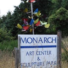
The Yelm Historical Museum maintains collections of artifacts and documents that tell the story of the region's development through different periods.

Many residents commute to Olympia and Tacoma for work, making this a bedroom community for the wider region. The highway network makes getting around straightforward, though the nearby Joint Base Lewis-McChord military installation affects some local areas.

The name Yelm comes from the Coast Salish word "shelm," which refers to the heat mirages that shimmer across the prairie on summer days. This natural phenomenon was striking enough to the original inhabitants that it became the place's name.

The community of curious travelers

AroundUs brings together thousands of curated places, local tips, and hidden gems, enriched daily by 60,000 contributors worldwide.

Start exploring
Location
Elevation above the sea
108 m
GPS coordinates
46.94139,-122.60639
Latest update
December 20, 2025 12:13
Around this place
United States of America

Chehalis Western Trail

12.1 km
United States of America

Lake Lawrence

10.3 km
Monarch Contemporary Art Center and Sculpture Park
United States of America

Monarch Contemporary Art Center and Sculpture Park

12.2 km
United States of America

Yelm–Tenino Trail

9.3 km
Lake Lawrence erratic
United States of America

Lake Lawrence erratic

8.7 km
United States of America

Sunwood Lake

13.1 km
United States of America

Thirty-eight Infantry Bluff

10 km
United States of America

Tempo Lake

15.3 km
United States of America

Nelda Lake

13.2 km
United States of America

Lake Serene

8 km
United States of America

Eighteenth Infantry Bluff

12.1 km
United States of America

Seven-infantry Bluff

9.3 km
United States of America

Tenth Field Artillery Bluff

9.5 km
United States of America

Medicine Creek Reservoir

15.5 km
United States of America

McAllister Spring Lake

13.2 km
United States of America

Andrews Arena

16.3 km
United States of America

Cascade Mini Golf

1.9 km
United States of America

Tom's Golf Center

13.5 km
United States of America

Tahoma Valley Golf and Country Club

860 m
United States of America

Food Court Stage

16.2 km
United States of America

Carnival Grounds

16.3 km
United States of America

Pioneer Wheel

113 m
United States of America

Work of art, sculpture

311 m
United States of America

Work of art, sculpture

8.7 km
United States of America

Backside Up Viewpoint

3.5 km
United States of America

Stewart Cliffs Viewpoint

3.8 km
United States of America

Deschutes Prairie Viewpoint

11.9 km
United States of America

Nisqually Falls

3 km
Show the full map
Reviews
Share your experience

No review yet

Discussions
Start a discussion...

No discussion yet

« Yelm - Gateway city to Mount Rainier in Thurston County, United States » is provided by Around Us (aroundus.com). Images and texts are derived from Wikimedia project under a Creative Commons license. You are allowed to copy, distribute, and modify copies of this page, under the conditions set by the license, as long as this note is clearly visible.

Discover hidden gems everywhere you go!

From secret cafés to breathtaking viewpoints, skip the crowded tourist spots and find places that match your style. Our app makes it easy with voice search, smart filtering, route optimization, and insider tips from travelers worldwide. Download now for the complete mobile experience.

Around Us App Screenshot

A unique approach to discovering new places

Le Figaro

All the places worth exploring

France Info

A tailor-made excursion in just a few clicks

20 Minutes

Around Us
Travel Guide & Maps
Download

Send to your phone

QR Code
1

Open the camera app on your mobile.

2

Point at the QR code with your camera. A notification will appear.

3

Tap the notification to open the link.