Enable Location

We need your location to show you interesting places around you

Discover nearby places

Find interesting locations and hidden gems around you

Precise directions

Get accurate directions and distances to places

Your location is never shared with other users. It's only used when you tap the location button.

Log in to your account

Start exploring — it's free

Trusted by 64,585 travelers worldwide

Continue with Google
Continue with Apple
or

We will send you a code to connect

By continuing, you accept our Terms and Conditions and our Privacy Policy

Check your inbox

We've sent a pincode in your inbox. Please enter the code below.

Chehalis Western Trail
Discussion Reviews Photo
3.2k Popularity

Chehalis Western Trail, Rail trail and protected area in Thurston County, United States.

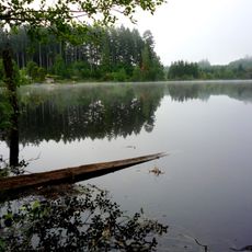
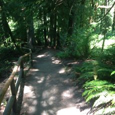
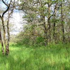
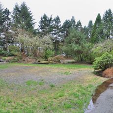
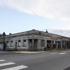
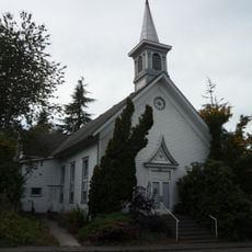
The Chehalis Western Trail is a paved rail trail in Thurston County, Washington, running from Woodard Bay south to its junction with the Yelm-Tenino Trail. The route passes through forests, wetlands, farmland, and suburban neighborhoods, staying flat the entire way.

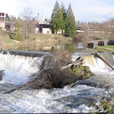
The Weyerhaeuser Timber Company ran a logging railroad along this corridor from 1926 to 1980, using it to move timber from surrounding forests to a dumping point at Woodard Bay. When operations ended, the old rail bed was gradually turned into the public trail that exists today.

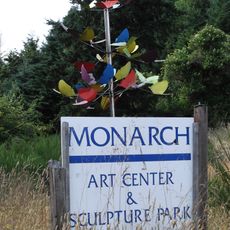
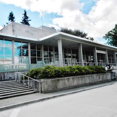
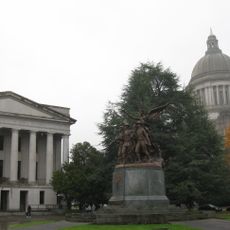
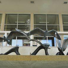
Along the route, visitors pass by the Monarch Contemporary Art Center and Sculpture Park, where outdoor sculptures sit directly beside the path. This stretch shows how a former industrial corridor has become a place where art and everyday recreation share the same space.

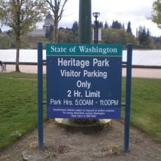
The trail has several access points with parking, including at Woodard Bay, Chambers Lake, and along 67th Avenue SE, making it easy to join the route at different spots. Because the surface is paved and level, it is accessible in most weather conditions and for people with varying levels of mobility.

Several pedestrian bridges carry the path over major roads, including Interstate 5 and Pacific Avenue SE, so the entire route can be traveled without crossing a single lane of traffic. These structures follow the alignment of the original railroad, which was itself built to avoid road crossings where possible.

The community of curious travelers

AroundUs brings together thousands of curated places, local tips, and hidden gems, enriched daily by 60,000 contributors worldwide.

Start exploring
Location
GPS coordinates
46.88610,-122.74400
Latest update
March 3, 2026 13:57
Around this place
Washington State Capitol
United States of America

Washington State Capitol

20.7 km
Washington Governor's Mansion
United States of America

Washington Governor's Mansion

20.7 km
Timberland Regional Library
United States of America

Timberland Regional Library

20.9 km
Millersylvania State Park
United States of America

Millersylvania State Park

13.1 km
Tumwater Falls
United States of America

Tumwater Falls

18.8 km
Olympic Flight Museum
United States of America

Olympic Flight Museum

15.4 km
Temple of Justice
United States of America

Temple of Justice

20.8 km
Watershed Park
United States of America

Watershed Park

19.1 km
Monarch Contemporary Art Center and Sculpture Park
United States of America

Monarch Contemporary Art Center and Sculpture Park

76 m
Miller–Brewer House
United States of America

Miller–Brewer House

20.9 km
Joel M. Pritchard Building
United States of America

Joel M. Pritchard Building

20.6 km
Scatter Creek Unit
United States of America

Scatter Creek Unit

20.9 km
Washington State Capitol Conservatory
United States of America

Washington State Capitol Conservatory

20.8 km
Insurance Building
United States of America

Insurance Building

20.7 km
Cloverfields
United States of America

Cloverfields

18.4 km
Crosby House
United States of America

Crosby House

19.4 km
Yashiro Japanese Garden
United States of America

Yashiro Japanese Garden

20.5 km
St. John's Episcopal Church
United States of America

St. John's Episcopal Church

20 km
Tenino Stone Company Quarry
United States of America

Tenino Stone Company Quarry

9 km
Heritage Park
United States of America

Heritage Park

21.2 km
Thurston County Courthouse
United States of America

Thurston County Courthouse

20.6 km
Tenino Downtown Historic District
United States of America

Tenino Downtown Historic District

8.8 km
Du Pen Fountain
United States of America

Du Pen Fountain

20.6 km
Tumwater Methodist Church
United States of America

Tumwater Methodist Church

18.9 km
Lake Lawrence erratic
United States of America

Lake Lawrence erratic

12.8 km
Elks Building
United States of America

Elks Building

21.1 km
Vietnam Veterans Memorial
Vietnam

Vietnam Veterans Memorial

20.6 km
Old Capitol Building
United States of America

Old Capitol Building

21.1 km
Show the full map
Reviews
Share your experience

No review yet

Discussions
Start a discussion...

No discussion yet

« Chehalis Western Trail - Rail trail and protected area in Thurston County, United States » is provided by Around Us (aroundus.com). Images and texts are derived from Wikimedia project under a Creative Commons license. You are allowed to copy, distribute, and modify copies of this page, under the conditions set by the license, as long as this note is clearly visible.

Discover hidden gems everywhere you go!

From secret cafés to breathtaking viewpoints, skip the crowded tourist spots and find places that match your style. Our app makes it easy with voice search, smart filtering, route optimization, and insider tips from travelers worldwide. Download now for the complete mobile experience.

Around Us App Screenshot

A unique approach to discovering new places

Le Figaro

All the places worth exploring

France Info

A tailor-made excursion in just a few clicks

20 Minutes

Around Us
Travel Guide & Maps
Download

Send to your phone

QR Code
1

Open the camera app on your mobile.

2

Point at the QR code with your camera. A notification will appear.

3

Tap the notification to open the link.