Chest opened
+${chestReward.xp} XP
Explorer
NOUVEAU ×${chestReward.collectible.quantity}
tapez pour fermer
Chest locked

Open chests in the app

Around Us is built for your phone — chests unlock when you walk, explore and capture nearby places.

Enable Location

We need your location to show you interesting places around you

Discover nearby places

Find interesting locations and hidden gems around you

Precise directions

Get accurate directions and distances to places

Your location is never shared with other users. It's only used when you tap the location button.

Parkland

Log in to your account

Start exploring — it's free

Trusted by 72,880 travelers worldwide

Continue with Google
Continue with Apple
or

We will send you a code to connect

By continuing, you accept our Terms and Conditions and our Privacy Policy

Check your inbox

We've sent a pincode in your inbox. Please enter the code below.

Discussion Reviews 1 Photos
15.4k Popularity

Parkland, Census-designated place in Pierce County, Washington, United States

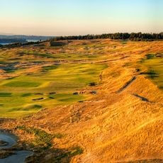
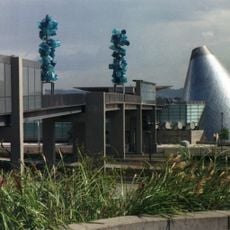
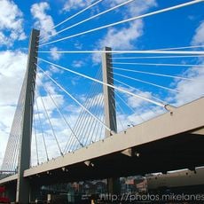
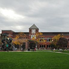
Parkland is a residential area in Pierce County near Tacoma, centered around Pacific Lutheran University and composed of neighborhoods of varying density. The region sits between Interstate 5 and Mount Rainier, with State Route 7 serving as the main transportation corridor.

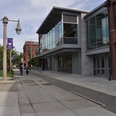
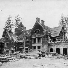
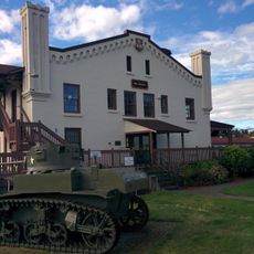
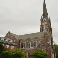
The area was established in the 1890s by Norwegian-American immigrants from the Midwest, who founded Pacific Lutheran University as the cornerstone of their new community. The university's presence catalyzed residential growth that continues to define the region.

Pacific Lutheran University shapes daily life here, with students and athletic teams actively participating in community events and shaping local activity throughout the year.

The area is easily accessed via State Route 7, which connects from Interstate 5 toward Mount Rainier and passes through multiple commercial zones. Most services and visitor facilities are located near the university campus rather than spread throughout the residential neighborhoods.

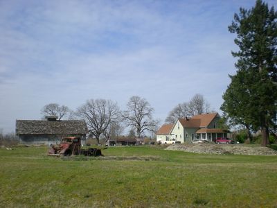
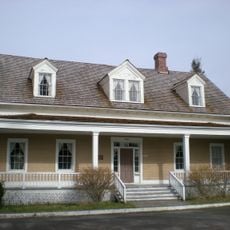
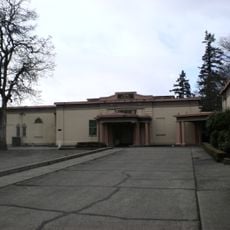
Despite its proximity to Tacoma, the area maintains a distinctly suburban and rural character with open green spaces between residential homes. The university campus itself functions as an enclosed community that remains relatively hidden from the surrounding neighborhoods despite its significant presence.

The community of curious travelers

AroundUs brings together thousands of curated places, local tips, and hidden gems, enriched daily by 60,000 contributors worldwide.

Start exploring
Location
Elevation above the sea
115 m
GPS coordinates
47.14110,-122.43800
Latest update
December 7, 2025 19:30
Around this place
Chambers Bay Golf Course
United States of America

Chambers Bay Golf Course

11.9 km
University of Washington Tacoma
United States of America

University of Washington Tacoma

11.5 km
America's Car Museum
United States of America

America's Car Museum

10.6 km
Museum of Glass
United States of America

Museum of Glass

11.7 km
Thornewood
United States of America

Thornewood

8.6 km
Western Air Defense Sector
United States of America

Western Air Defense Sector

5.4 km
Fort Steilacoom
United States of America

Fort Steilacoom

10.4 km
Washington State History Museum
United States of America

Washington State History Museum

11.5 km
Bridge of Glass
United States of America

Bridge of Glass

11.6 km
Tacoma Speedway
United States of America

Tacoma Speedway

5.8 km
Tacoma Art Museum
United States of America

Tacoma Art Museum

11.8 km
Rhodesleigh
United States of America

Rhodesleigh

7.5 km
East 21st Street Bridge
United States of America

East 21st Street Bridge

11.5 km
Washington National Guard Museum
United States of America

Washington National Guard Museum

10 km
Holy Rosary Church
United States of America

Holy Rosary Church

10.3 km
Tacoma Mausoleum
United States of America

Tacoma Mausoleum

8.1 km
Puyallup Public Library
United States of America

Puyallup Public Library

12.1 km
East 34th Street Bridge
United States of America

East 34th Street Bridge

10 km
United States of America

Children's Museum of Tacoma

12 km
Albers Brothers Mill
United States of America

Albers Brothers Mill

11.6 km
Christ Episcopal Church
United States of America

Christ Episcopal Church

12 km
LeMay Collections at Marymount
United States of America

LeMay Collections at Marymount

2.4 km
Kiwanis Kids Spray Park
United States of America

Kiwanis Kids Spray Park

12.1 km
THR3E
United States of America

THR3E

11.6 km
Tioga Library Building
United States of America

Tioga Library Building

11.5 km
Pinkerton Building
United States of America

Pinkerton Building

11.8 km
West Coast Grocery
United States of America

West Coast Grocery

11.7 km
Union Depot – Warehouse Historic District
United States of America

Union Depot – Warehouse Historic District

11.6 km
Show the full map
Reviews
Share your experience

No review yet

Discussions
Start a discussion...

No discussion yet

« Parkland - Census-designated place in Pierce County, Washington, United States » is provided by Around Us (aroundus.com). Images and texts are derived from Wikimedia project under a Creative Commons license. You are allowed to copy, distribute, and modify copies of this page, under the conditions set by the license, as long as this note is clearly visible.

Discover hidden gems everywhere you go!

From secret cafés to breathtaking viewpoints, skip the crowded tourist spots and find places that match your style. Our app makes it easy with voice search, smart filtering, route optimization, and insider tips from travelers worldwide. Download now for the complete mobile experience.

Around Us App Screenshot

A unique approach to discovering new places

Le Figaro

All the places worth exploring

France Info

A tailor-made excursion in just a few clicks

20 Minutes

Around Us
Travel Guide & Maps
Download

Send to your phone

QR Code
1

Open the camera app on your mobile.

2

Point at the QR code with your camera. A notification will appear.

3

Tap the notification to open the link.