Cape Scott Lighthouse, Maritime navigation beacon at northwestern Vancouver Island, Canada
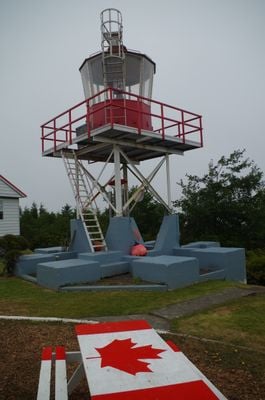
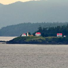
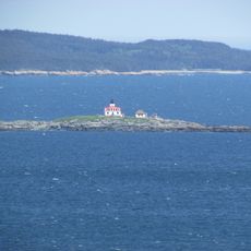
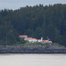
Cape Scott Lighthouse is a white steel skeletal tower standing at the far northwestern tip of Vancouver Island, supported by concrete pillars. The structure sits near a sandy neck passage and continues to serve maritime navigation.
The original lighthouse went up in 1927 as a wooden mast with red lanterns, and was replaced by a permanent steel structure in 1959. This upgrade made the facility more reliable for the increasing maritime traffic in the region.
The area holds deep connections to the Kwakwa̱ka̱ʼwakw and Quatsino First Nations, whose presence in these territories extends back many generations. Visitors walking here are surrounded by the ancestral lands of these communities.
The Canadian Coast Guard operates this active lighthouse with resident keepers and has used solar panels instead of diesel generators since 2019. The location is remote and not heavily trafficked, so visitors should expect solitude and self-sufficiency when visiting.
During World War II, the site housed a radar installation with roughly 50 personnel monitoring for potential Japanese aircraft movements. This military past is hardly visible today, but the location's role in regional defense remains part of its story.
Location: British Columbia
Inception: 1927
Height: 9 m
GPS coordinates: 50.78240,-128.42742
Latest update: December 22, 2025 01:24
Cape Scott Provincial Park
8.6 kmScott Islands Marine National Wildlife Area
58 kmLanz and Cox Islands Provincial Park
17.1 kmMarble River Provincial Park
69 km
Scarlett Point Lighthouse
58 km
Raft Cove Provincial Park
26.1 km
Quatsino Provincial Park
53.9 kmGod's Pocket Marine Provincial Park
61 kmLawn Point Provincial Park
59.2 kmScott Islands Marine National Wildlife Area
29 km
Egg Island Lighthouse
66.5 km
Pine Island Lighthouse
53.6 kmQuatsino Lighthouse
46.3 kmUgʷiwa'/Cape Caution-Blunden Bay Conservancy
64.3 kmAnne Vallee (Triangle Island) Ecological Reserve
46.9 kmSartine Island Ecological Reserve
34 kmMahpahkum-Ahkwuna/Deserters-Walker Conservancy
66.7 kmDuke of Edinburgh (Pine/Storm/Tree Islands) Ecological Reserve
53.9 kmUgʷiwa'/Cape Caution Conservancy
62.6 kmKebegwis
21.7 kmBeresford Island Ecological Reserve
24.3 kmShoe Tree
54.4 kmGraceworks Gallery
66.2 kmTripod Beach
28.1 kmNorth Coast Trail
20.9 kmScenic viewpoint
39.8 kmWaterfall
67.9 kmWaterfall
67.2 kmVisited this place? Tap the stars to rate it and share your experience / photos with the community! Try now! You can cancel it anytime.
Discover hidden gems everywhere you go!
From secret cafés to breathtaking viewpoints, skip the crowded tourist spots and find places that match your style. Our app makes it easy with voice search, smart filtering, route optimization, and insider tips from travelers worldwide. Download now for the complete mobile experience.
A unique approach to discovering new places❞
— Le Figaro
All the places worth exploring❞
— France Info
A tailor-made excursion in just a few clicks❞
— 20 Minutes