Cape Scott Provincial Park

Log in to your account

AroundUs is a community-driven map of interesting places, built by curious explorers like you. It grows with every review, story, and photo you share.
Connect to save your favorite spots, contribute locations, and create personalized routes.
Continue with Google
Continue with Apple
Continue with X
Continue with Facebook
Continue with email
By continuing, you accept our Terms and Conditions and our Privacy Policy
Create an account

Cape Scott Provincial Park

Add to collection
Map
Suggest a change
Share

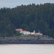
Cape Scott Provincial Park, Provincial park at Vancouver Island northern tip, Canada

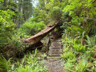
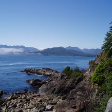
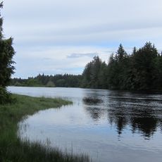
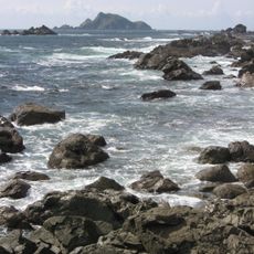
Cape Scott Provincial Park covers around 22,000 hectares along the northwest coast of Vancouver Island, combining sandy beaches with old-growth forests. A network of hiking trails connects these varied landscapes and reveals the park's natural diversity.

The cape received its name in 1786 to honor David Scott, a merchant who backed a maritime fur trade expedition in the region. Danish settlers arrived later, establishing a community around Hansen Lagoon starting in 1897 that added another layer to the area's history.

The Kwakwaka'wakw First Nations have deep roots in this territory, with their connection to the land visible throughout the park. Visitors walking the trails and beaches encounter places shaped by generations of indigenous presence.

Most visitors access the western section through forest roads connecting Port Hardy and Holberg to San Josef Bay. The eastern part of the park requires boat or floatplane access, so travelers should plan their route ahead of time.

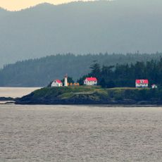
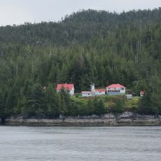
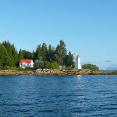
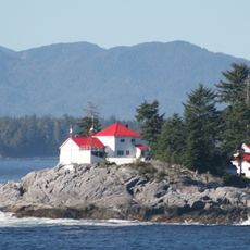
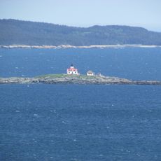
Remnants of the Danish settlement at Fisherman's Bay can still be found as historic sites, including gardens and the remains of a general store. These ruins tell the story of a European community that took root far from home.

Location: Regional District of Mount Waddington

Inception: May 18, 1973

Website: https://bcparks.ca/explore/parkpgs/cape_scott

GPS coordinates: 50.73330,-128.33300

Latest update: December 6, 2025 16:04

Photos
Natural areas in British Columbia

British Columbia stretches from the Pacific coast to the Rocky Mountains, offering geological diversity and varied ecosystems. The region includes geothermal springs such as Liard River Hot Springs and Keyhole Hot Springs, ancient coastal forests at Cathedral Grove and Carmanah Walbran, and tide...

Reviews

Visited this place? Tap the stars to rate it and share your experience / photos with the community! Try now! You can cancel it anytime.

« Cape Scott Provincial Park - Provincial park at Vancouver Island northern tip, Canada » is provided by Around Us (aroundus.com). Images and texts are derived from Wikimedia project under a Creative Commons license. You are allowed to copy, distribute, and modify copies of this page, under the conditions set by the license, as long as this note is clearly visible.

Discover hidden gems everywhere you go!

From secret cafés to breathtaking viewpoints, skip the crowded tourist spots and find places that match your style. Our app makes it easy with voice search, smart filtering, route optimization, and insider tips from travelers worldwide. Download now for the complete mobile experience.

Around Us App Screenshot

A unique approach to discovering new places

Le Figaro

All the places worth exploring

France Info

A tailor-made excursion in just a few clicks

20 Minutes