Artlish Caves Provincial Park, Cave network in Strathcona Regional District, Canada
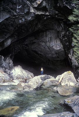
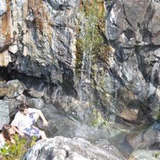
Artlish Caves Provincial Park is a limestone cave system spread across a large forest area with two main caves. The two main passages are long enough that visitors need several hours to explore them.
The area was officially documented in 1932 by the Canadian Geological Survey, though hunters and timber workers had known about it long before. Protection as a park came later after local knowledge led to formal study.
The name comes from the A'licath people of the Kyuquot confederacy, who held ties to this territory across many generations. These caves were part of the landscape they inhabited and knew well.
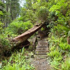
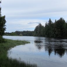
To reach the caves, visitors must walk across forest roads and trails for several kilometers before crossing the park boundary. Sturdy footwear and weather-appropriate clothing are important since the route goes through active forest areas.
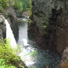
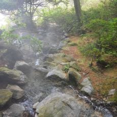
The Artlish River flows completely underground through one of the main caves, creating Vancouver Island's last undisturbed karst river system. This hidden waterway forms a rare landscape feature that has become scarce across the island.
Location: Strathcona Regional District
Inception: April 30, 1996
Website: http://env.gov.bc.ca/bcparks/explore/parkpgs/artlish_caves
GPS coordinates: 50.16670,-126.91700
Latest update: December 14, 2025 11:03
Golden Hinde
100.9 km
Strathcona Provincial Park
90 km
Cape Scott Provincial Park
118.5 km
Estevan Point lighthouse
91.3 km
Muqqiwn Provincial Park
61.8 km
Elk Falls Provincial Park
115 km
Ramsay Hot Springs
102.2 km
Nimpkish River
19.4 km
Salmon River
83.4 km
Marble River Provincial Park
60.1 km
Solander Island Ecological Reserve
36.3 km
Scarlett Point Lighthouse
91.6 km
Raft Cove Provincial Park
104.3 km
Elk Falls Suspension Bridge
114.2 km
Gibson Marine Provincial Park
117.4 km
Quatsino Provincial Park
73.5 km
Woss Lake Provincial Park
22.3 km
Flores Island Provincial Park
110.9 km
Echo Bay Marine Provincial Park
71.6 km
Bligh Island Marine Provincial Park
65.2 km
Broughton Archipelago Marine Provincial Park
59.9 km
Big Bunsby Marine Provincial Park
43.2 km
Maquinna Marine Provincial Park
94.8 km
Muchalat Inlet
74.7 km
Zeballos Peak
13.1 km
Nootka Lighthouse
67.5 km
Pine Island Lighthouse
106.7 km
Pulteney Point Lighthouse
54.3 kmVisited this place? Tap the stars to rate it and share your experience / photos with the community! Try now! You can cancel it anytime.
Discover hidden gems everywhere you go!
From secret cafés to breathtaking viewpoints, skip the crowded tourist spots and find places that match your style. Our app makes it easy with voice search, smart filtering, route optimization, and insider tips from travelers worldwide. Download now for the complete mobile experience.
A unique approach to discovering new places❞
— Le Figaro
All the places worth exploring❞
— France Info
A tailor-made excursion in just a few clicks❞
— 20 Minutes