See the monuments around you in AROpen chests in the app
Around Us is built for your phone — point your camera at the streets and discover the monuments and places around you in augmented reality.Around Us is built for your phone — chests unlock when you walk, explore and capture nearby places.
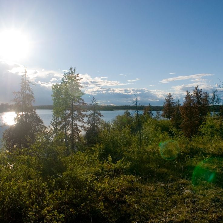
British Columbia reveals landscapes shaped by water, ice, and time, from steaming hot springs and granite fjords to forests where trees have stood for centuries.
British Columbia stretches from the Pacific coast to the Rocky Mountains, offering geological diversity and varied ecosystems. The region includes geothermal springs such as Liard River Hot Springs and Keyhole Hot Springs, ancient coastal forests at Cathedral Grove and Carmanah Walbran, and tide pools at Botanical Beach. The territory contains volcanic formations at Spotted Lake, fjords like Princess Louisa Inlet, and waterfalls including Takakkaw Falls and Hunlen Falls. Provincial parks such as Cape Scott, Mount Edziza, and Valhalla protect extensive wilderness areas.
The natural features range from cave systems like Cody Caves to fossil beds at Burgess Shale, which preserve Cambrian marine life. First Nations cultural sites, including the Haida Heritage Centre and Stein Valley Nlaka'pamux Heritage Park, provide insight into Indigenous history and land stewardship. Coastal stretches like Sombrio Beach and Combers Beach, along with marine protected areas such as Desolation Sound, offer access to Pacific waters. The Dr. Sun Yat-Sen Classical Chinese Garden in Vancouver represents historic Chinese landscape design. Visitors find hiking trails through old-growth forests, suspension bridges over gorges, and remote mountain lakes across this geographically diverse province.
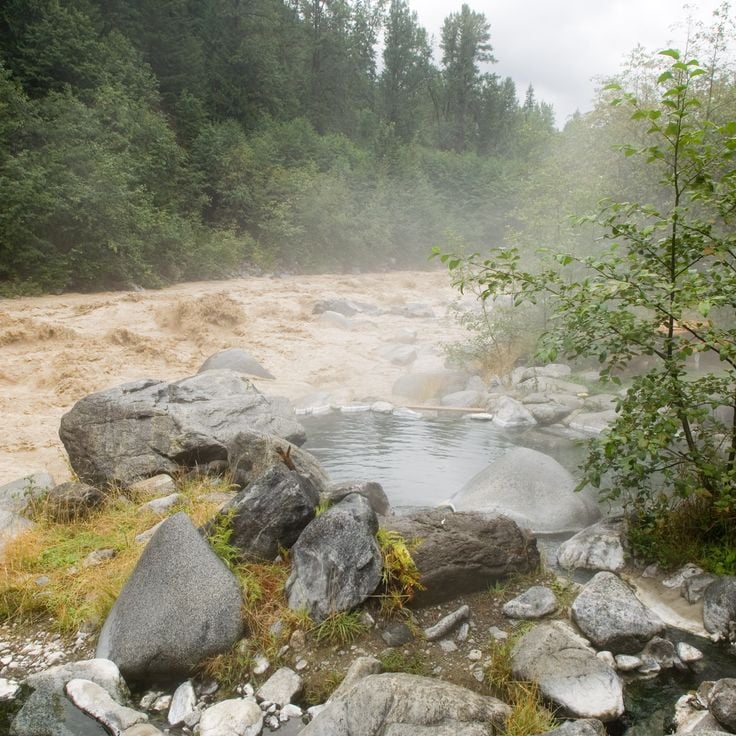
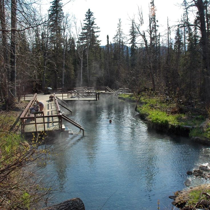
Keyhole Hot Springs sit near Pemberton and can only be reached on foot. Natural stone pools, shaped by granite boulders, fill with warm water that flows from one basin to the next. Each pool holds a slightly different temperature. The trail passes through forest, and the springs sit surrounded by trees. Among the thermal springs of British Columbia, Keyhole Hot Springs are open to visitors throughout the year.
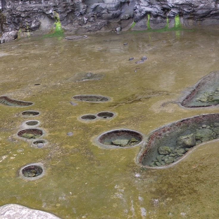
The pools at Botanical Beach form in natural rock basins carved into the Juan de Fuca shoreline. When the tide drops, water collects in these hollows and stays there, leaving starfish, crabs, and sea anemones visible in the shallow water. The best time to visit is during the lowest tides, when the basins fully drain and the sea creatures are easy to spot.
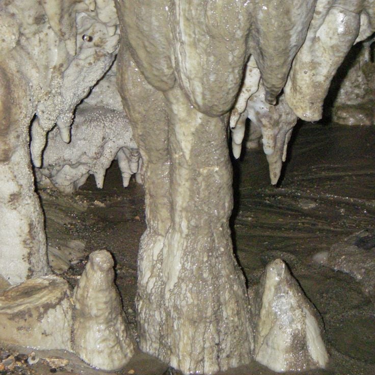
Cody Caves sit near Ainsworth Hot Springs and take you through a network of limestone passages carved over millions of years. Inside, you find stalactites, cave coral, and other rock formations shaped by water. A guided tour leads visitors deep into the rock, where it stays cool and the only light comes from your own lamp. In a province known for its variety of natural wonders, Cody Caves stand out as one of the most memorable underground places in British Columbia.
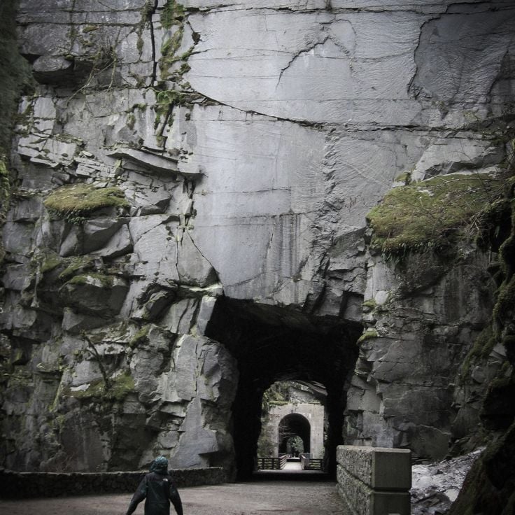
The Othello Tunnels are five concrete tunnels blasted through the granite of Coquihalla Canyon in 1914 as part of the Kettle Valley Railway. This rail route once carried goods and passengers through the mountain terrain of British Columbia. Today, the tunnels form a hiking trail where you walk through solid rock, with steep canyon walls on either side and the Coquihalla River running below. The site gives a real sense of how early engineers worked through granite to connect remote parts of the province.
The Liard River Hot Springs sit deep in the Northern Rockies and rank among the hottest natural springs in British Columbia. The water can reach 52°C (126°F) and feeds two separate pools surrounded by conifer forest. The site stays open year-round, making it one of the few places where you can bathe in naturally heated water in the middle of a remote forest.
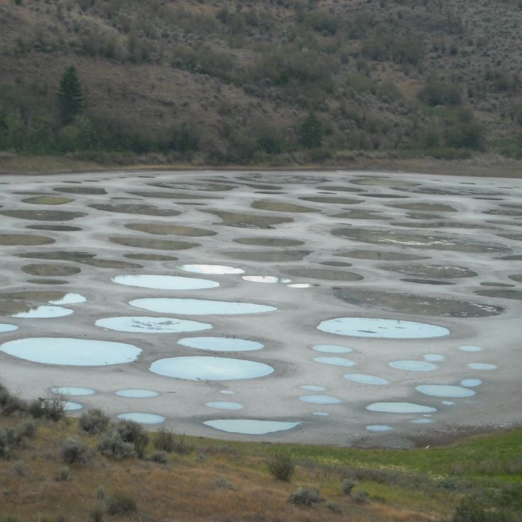
Spotted Lake sits southwest of Osoyoos and is a salt lake that produces an unusual sight in summer. As water evaporates, mineral deposits rise to the surface and form circular spots in different colors. This lake holds deep cultural meaning for the Syilx Okanagan people. It can be seen from the nearby highway, but direct access is restricted to protect the site and the natural environment around it.
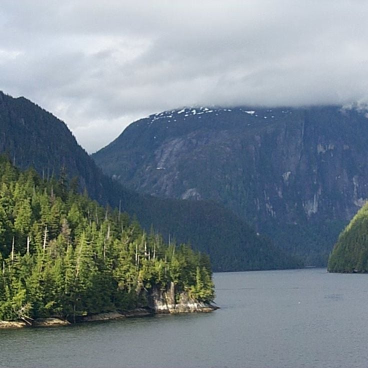
Misty Fjords National Monument sits in southern Alaska, just below the Canadian border, and connects naturally to the landscapes described in this collection. Deep ocean inlets cut between granite walls that rise sharply from the water to around 3,000 feet (900 meters). The valleys were carved by glaciers during the last ice age, and the shapes they left behind are still easy to read in the rock. You can reach the area by floatplane or boat from Ketchikan. Waterfalls drop down the cliff faces, and a low mist often hangs over the water, which is how the place got its name.
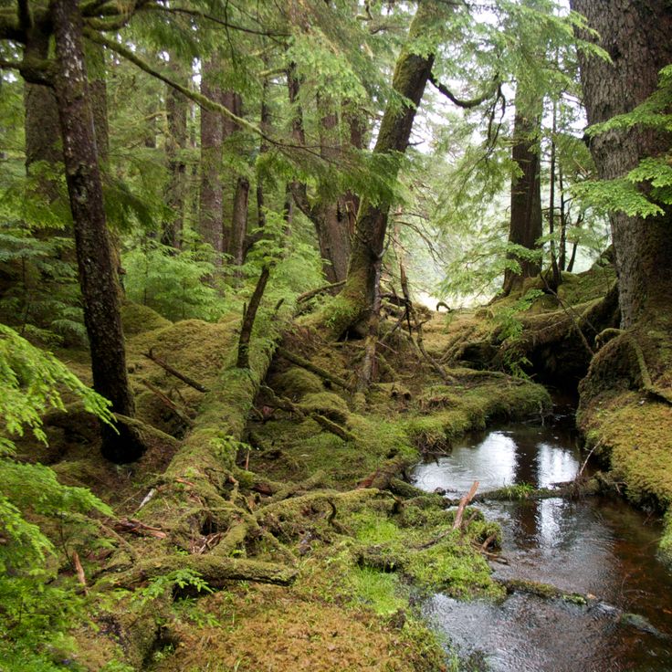
The Giant Cedars Boardwalk Trail runs through an old forest in Mount Revelstoke National Park, where cedar trees have stood for centuries and grow up to 50 meters (160 ft) tall. A wooden boardwalk follows the path through the forest and is accessible to visitors with limited mobility. Signs along the way explain the temperate rainforest and the role these trees have played in the lives of local First Nations peoples. Walking here gives a real sense of how old coastal forests in British Columbia look and feel.
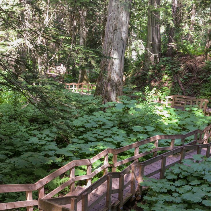
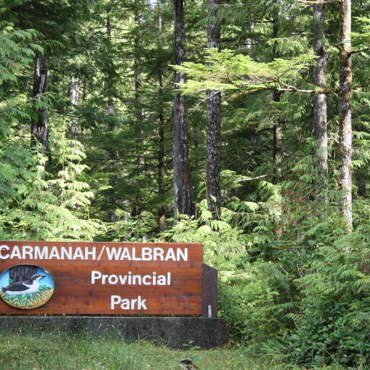
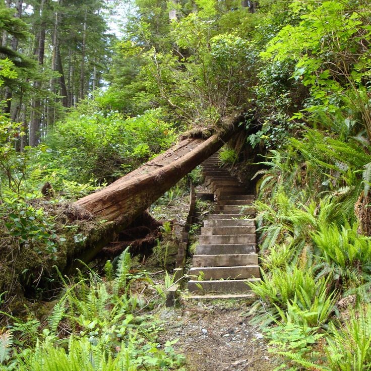
Carmanah Walbran Provincial Park sits on the southwest coast of Vancouver Island and protects one of the oldest rainforests in Canada. The Sitka spruce trees here can reach over 310 feet (95 meters) tall and live for up to 800 years. Two river valleys run through the park, and hiking trails follow the creeks deep into the forest. Walking among these trees gives a real sense of how old and undisturbed this forest has remained.
Cape Scott Provincial Park sits at the northern tip of Vancouver Island, far from roads and towns. Trails wind through coastal rainforest and open onto wild beaches where tide pools fill with sea life at low water. The park also holds the ruins of early settler farms, slowly returning to the forest. Waterfalls, old-growth trees, and the raw edge of the Pacific make this one of British Columbia's most remote corners.
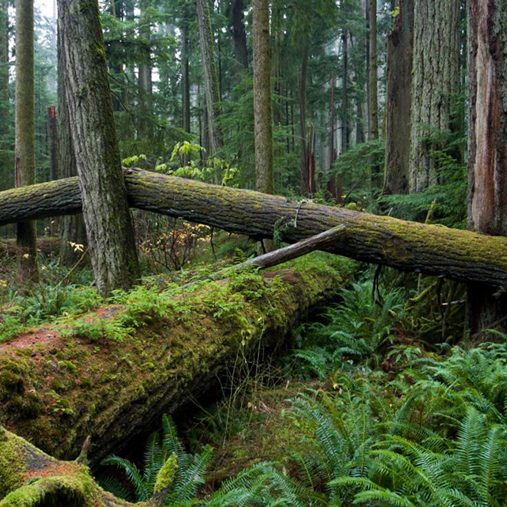
Cathedral Grove sits along the main highway between Port Alberni and Parksville on Vancouver Island, inside MacMillan Provincial Park. This forest is one of the last remaining coastal rainforests on the island. The Douglas firs here are between 300 and 800 years old, with some rising over 250 feet (75 meters) tall and trunks reaching 30 feet (9 meters) around. Walking among these trees gives a strong sense of just how old the land around you really is.
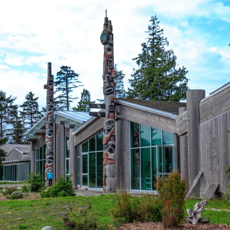
The Haida Heritage Centre sits on the islands of Haida Gwaii and gives visitors a close look at the history and culture of the Haida people. Totem poles, carvings and everyday objects tell the story of a community that has lived along the Northwest Coast for thousands of years. The centre also shows how traditional building methods and ceremonial practices are still passed on today.
Atlin Provincial Park sits in the far northwest corner of British Columbia, close to the Alaska border. Glaciers, alpine lakes, and mountain peaks of the Coast Mountains shape this land. Marked hiking trails lead through subalpine terrain and into glacier valleys. The area was historically Tlingit territory and later served as a passage route during the Klondike Gold Rush. Moraine lakes and large icefields cover much of the ground. In this collection of British Columbia landscapes, this park stands for the remote northern edge of the province, where ice and rock define the horizon.
Tweedsmuir South Provincial Park sits at the heart of British Columbia and is one of the largest protected areas in the province. Rivers and waterfalls cut through old-growth forests, and grizzly bears and moose move freely across the land. The terrain shifts between fjords, remote mountain lakes, and volcanic formations. Trails here connect very different types of landscape across the Bella Coola Valley region, making it a key part of any journey through the wilder side of British Columbia.
The Juan de Fuca Marine Trail is a multi-day coastal walk along the Juan de Fuca Strait on Vancouver Island. The trail runs through rainforest of Sitka spruce and western red cedar, connecting China Beach to Botanical Beach by way of tide pools, small waterfalls, and campsites. Some sections require ladders and ropes to navigate steep terrain. Gray whales and sea lions can often be spotted offshore.
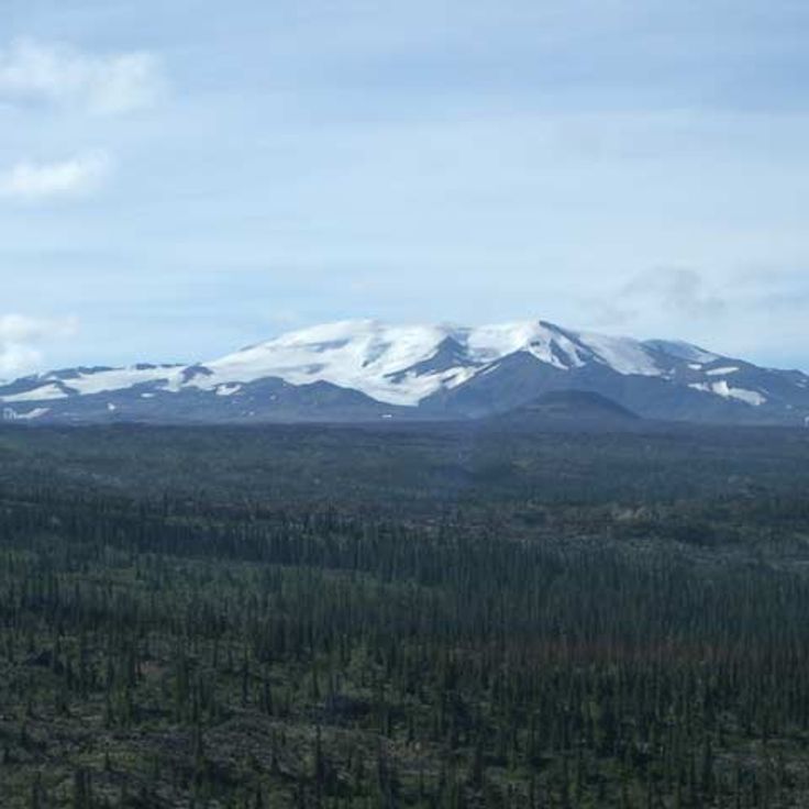
Mount Edziza Provincial Park sits in northern British Columbia and showcases a volcanic landscape shaped over millions of years by eruptions. Ash fields, lava plateaus and glaciated peaks define the terrain. On multi-day routes through subalpine and alpine ground, hikers reach craters, cinder cones and frozen lava flows. The park has no road access and lies within the traditional territory of the Tahltan First Nation.
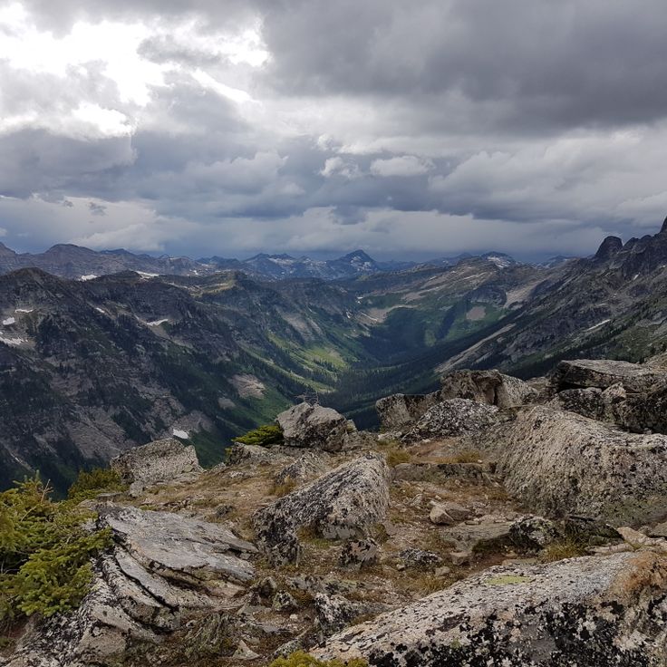
Valhalla Provincial Park sits in the Selkirk Mountains, between Slocan Lake and Arrow Lakes. The land rises from forested valleys to high alpine zones with glaciers, waterfalls, and around 30 named lakes. Peaks reach about 9,200 feet (2,800 meters), and the granite and gneiss formations were shaped during the last ice age. Hiking trails cross different elevations and lead into remote mountain terrain that very few visitors reach, making this park one of the wilder corners of British Columbia.
Kinuseo Falls drops 230 feet (70 meters) over a limestone wall into the Murray River in the northeastern forests of British Columbia. It is reached by a gravel road through the Northern Rockies backcountry. Standing at the viewpoint, you face a broad curtain of water falling straight into the gorge below. Trails follow the riverbank and lead to spots where the full drop is visible from close range.
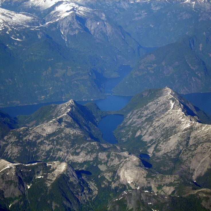
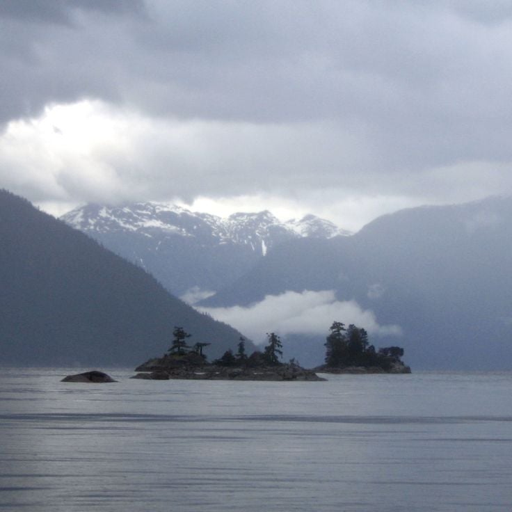
Princess Louisa Inlet is a fjord on British Columbia's Sunshine Coast, and one of the most striking natural places featured in this collection. It cuts about 5 miles (8 km) into the land, with steep granite cliffs rising on both sides of the water. During rainy periods, waterfalls pour down the rock faces in great numbers. The surrounding forest grows thick right to the shoreline. Because the inlet is reached almost entirely by boat, it feels remote in a way that few places in the province can match.
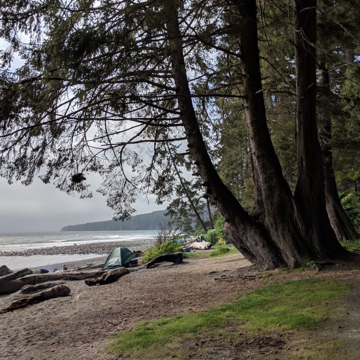
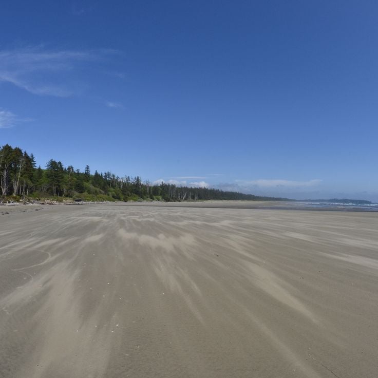
Sombrio Beach sits inside Juan de Fuca Provincial Park and shows a side of British Columbia's Pacific coast that feels raw and largely untouched. The beach is made of dark sand, framed by large driftwood logs, and dotted with shallow tide pools. Small creeks drop straight off rock faces into the ocean. The beach is reached by a roughly 0.6-mile (1-kilometer) path through a temperate rainforest, following the Juan de Fuca Trail.
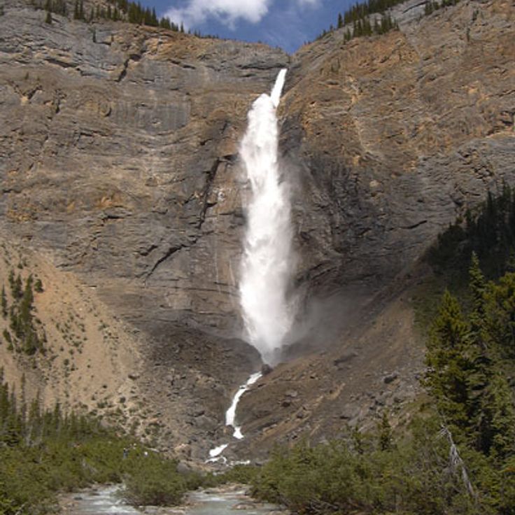
Takakkaw Falls drops 384 meters (1,260 feet) in two stages inside Yoho National Park. The water comes from the Daly Glacier and flows strongest in early summer, when the snow melts. You can reach this waterfall on foot from a parking area at the end of Yoho Valley Road. The name comes from the Cree language and means something like magnificent. It ranks among the highest waterfalls in Canada.
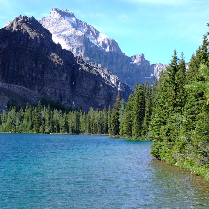
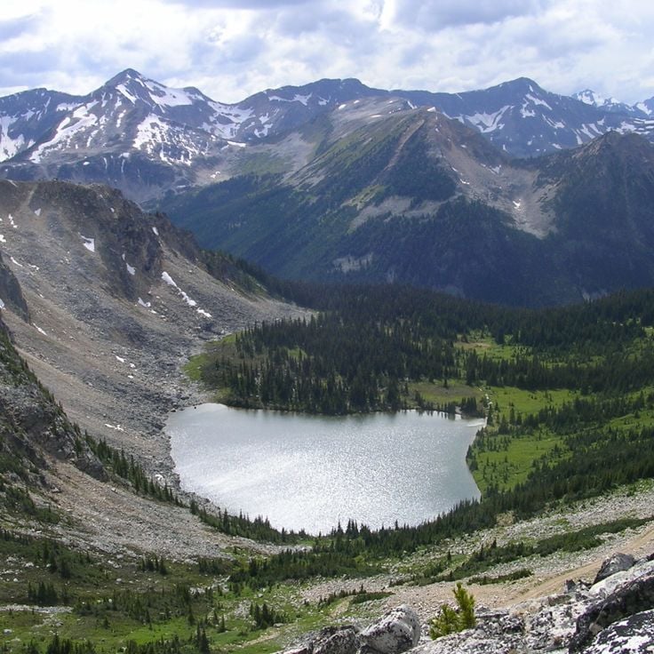
Mount Assiniboine Provincial Park sits deep in the Canadian Rockies, reachable only on foot or by helicopter. The mountain that gives the park its name rises to 11,870 feet (3,618 meters) and stands at the center of a landscape of glaciers, alpine valleys, and high meadows. Marked trails wind through conifer forests and over passes toward remote mountain lakes. The park shares a border with Banff National Park and offers backcountry huts and camping areas for those who want to spend several days here.
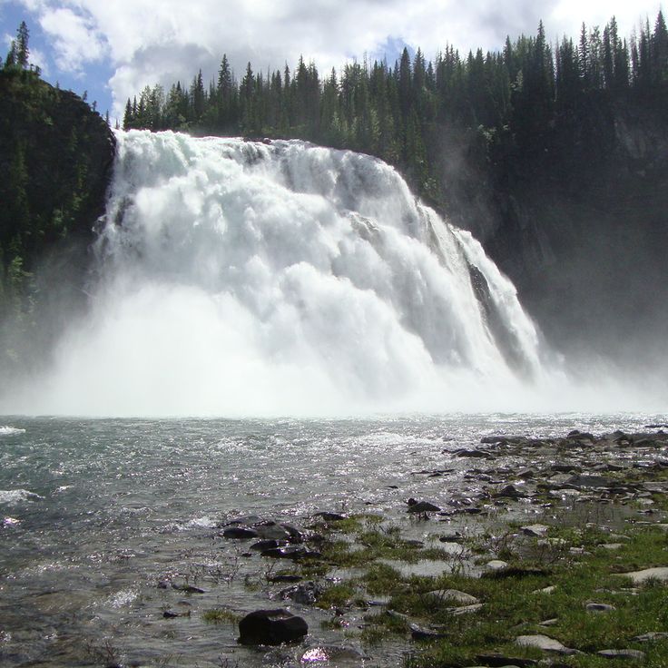
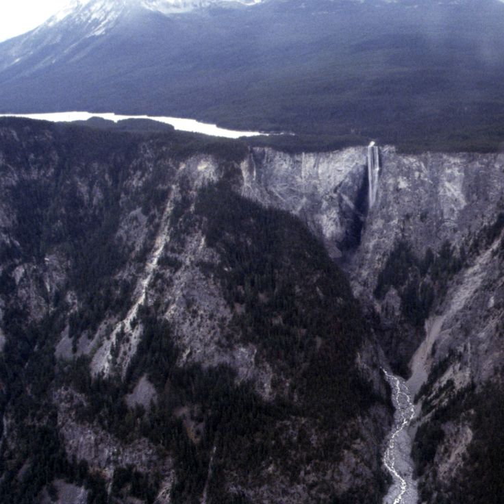
Hunlen Falls drops some 401 meters (1,316 feet) through a series of cascades into the Atnarko River valley, making it one of the tallest waterfalls in British Columbia. The water originates at Turner Lake before tumbling down through old-growth forest and alpine terrain. Reaching Hunlen Falls requires a multi-day hike deep into Tweedsmuir Provincial Park, far from roads and easy access.
Green Lake sits in the Cariboo region and gets its color from minerals carried by glacial water. The green tint of the water shifts with the light and the time of day, making it one of the more memorable natural waterways in British Columbia. Anglers come for rainbow trout and salmon, and the trails around the lake lead to spots where the color of the water is easy to see up close.
Desolation Sound Marine Provincial Park sits north of Powell River and covers a stretch of coastal waters dotted with forested islands. In summer, the water here warms more than at most other spots along this coast, which makes time on the water more comfortable. Sailboats anchor in the protected bays, and kayakers paddle quiet routes between the islands. This park is one of the most visited marine areas along the British Columbia coast.
Stein Valley Nlaka'pamux Heritage Park protects the watershed of the Stein River in British Columbia, close to the town of Lytton. The park holds rock paintings made by the Nlaka'pamux people, who have lived in connection with this land for thousands of years. Walking trails cross old-growth forests and follow the river upstream toward high mountain terrain. The valley is one of the few places in British Columbia where nature and Indigenous history feel so deeply tied together.
Gwaii Haanas National Park Reserve covers an archipelago off the coast of British Columbia, between the Pacific Ocean and Hecate Strait. The park protects old Haida villages, totem poles, and over 1,500 archaeological and cultural sites tied to the Haida Nation. Temperate rainforests run down to the shoreline, where orcas, humpback whales, sea lions, and sea otters move through protected bays and ocean channels. Few places in Canada bring together this depth of Indigenous history and coastal life in one continuous stretch of land and sea.
Nimpkish Lake sits in the northern part of Vancouver Island, surrounded by coniferous forests. Sandy beaches line its shores, and the wind on the water makes it a good spot for wind sports. From here, visitors can reach hiking trails, waterfalls, and coastal landscapes that define British Columbia from the Pacific coast to the Rockies.
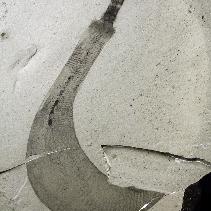
The Burgess Shale, located in Yoho National Park, holds fossils from around 508 million years ago, when early sea creatures left their marks in the rock. What makes this site so rare is that even soft body parts were preserved, giving scientists a clear picture of how complex life first appeared on Earth. You can visit only with a guided hike, since the fossil beds are closely protected. Walking here feels like stepping into one of the oldest chapters of life on this planet.
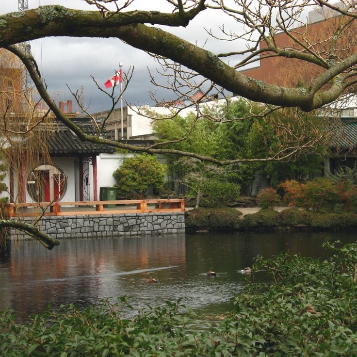
The Dr. Sun Yat-Sen Classical Chinese Garden in Vancouver was built following the design principles of the Ming Dynasty. Craftsmen from Suzhou constructed the pavilions, courtyards, and water features using traditional methods. Walking through this garden, you notice curved rooftops, still pools, and carefully arranged rocks and plants that show how Chinese garden design looked in the 15th and 16th centuries. Right in the middle of the city, this place feels like stepping into a very different world.
Combers Beach sits within Pacific Rim National Park Reserve near Tofino and is one of the coastal stretches that make British Columbia's Pacific shore worth visiting. The beach runs along a long sandy shoreline where driftwood piles up in natural formations. At low tide, pools appear among the rocks, giving visitors a close look at marine life along this open Pacific coast.
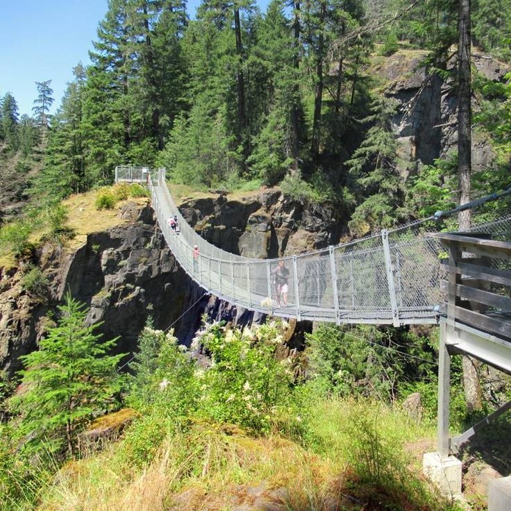
The Elk Falls Suspension Bridge crosses a canyon of volcanic rock in Elk Falls Provincial Park. Standing on it, you look down at the Campbell River as it drops roughly 82 feet (25 meters) over a waterfall below. A short trail through coastal forest leads to the bridge, which connects both sides of the gorge. Secured platforms along the way give you a direct view of the falls and the river running beneath.
Keyhole Hot Springs sit near Pemberton and can only be reached on foot. Natural stone pools, shaped by granite boulders, fill with warm water that flows from one basin to the next. Each pool holds a slightly different temperature. The trail passes through forest, and the springs sit surrounded by trees. Among the thermal springs of British Columbia, Keyhole Hot Springs are open to visitors throughout the year.
The pools at Botanical Beach form in natural rock basins carved into the Juan de Fuca shoreline. When the tide drops, water collects in these hollows and stays there, leaving starfish, crabs, and sea anemones visible in the shallow water. The best time to visit is during the lowest tides, when the basins fully drain and the sea creatures are easy to spot.
Cody Caves sit near Ainsworth Hot Springs and take you through a network of limestone passages carved over millions of years. Inside, you find stalactites, cave coral, and other rock formations shaped by water. A guided tour leads visitors deep into the rock, where it stays cool and the only light comes from your own lamp. In a province known for its variety of natural wonders, Cody Caves stand out as one of the most memorable underground places in British Columbia.
The Othello Tunnels are five concrete tunnels blasted through the granite of Coquihalla Canyon in 1914 as part of the Kettle Valley Railway. This rail route once carried goods and passengers through the mountain terrain of British Columbia. Today, the tunnels form a hiking trail where you walk through solid rock, with steep canyon walls on either side and the Coquihalla River running below. The site gives a real sense of how early engineers worked through granite to connect remote parts of the province.
The Liard River Hot Springs sit deep in the Northern Rockies and rank among the hottest natural springs in British Columbia. The water can reach 52°C (126°F) and feeds two separate pools surrounded by conifer forest. The site stays open year-round, making it one of the few places where you can bathe in naturally heated water in the middle of a remote forest.
Spotted Lake sits southwest of Osoyoos and is a salt lake that produces an unusual sight in summer. As water evaporates, mineral deposits rise to the surface and form circular spots in different colors. This lake holds deep cultural meaning for the Syilx Okanagan people. It can be seen from the nearby highway, but direct access is restricted to protect the site and the natural environment around it.
Misty Fjords National Monument sits in southern Alaska, just below the Canadian border, and connects naturally to the landscapes described in this collection. Deep ocean inlets cut between granite walls that rise sharply from the water to around 3,000 feet (900 meters). The valleys were carved by glaciers during the last ice age, and the shapes they left behind are still easy to read in the rock. You can reach the area by floatplane or boat from Ketchikan. Waterfalls drop down the cliff faces, and a low mist often hangs over the water, which is how the place got its name.
The Giant Cedars Boardwalk Trail runs through an old forest in Mount Revelstoke National Park, where cedar trees have stood for centuries and grow up to 50 meters (160 ft) tall. A wooden boardwalk follows the path through the forest and is accessible to visitors with limited mobility. Signs along the way explain the temperate rainforest and the role these trees have played in the lives of local First Nations peoples. Walking here gives a real sense of how old coastal forests in British Columbia look and feel.
Carmanah Walbran Provincial Park sits on the southwest coast of Vancouver Island and protects one of the oldest rainforests in Canada. The Sitka spruce trees here can reach over 310 feet (95 meters) tall and live for up to 800 years. Two river valleys run through the park, and hiking trails follow the creeks deep into the forest. Walking among these trees gives a real sense of how old and undisturbed this forest has remained.
Cape Scott Provincial Park sits at the northern tip of Vancouver Island, far from roads and towns. Trails wind through coastal rainforest and open onto wild beaches where tide pools fill with sea life at low water. The park also holds the ruins of early settler farms, slowly returning to the forest. Waterfalls, old-growth trees, and the raw edge of the Pacific make this one of British Columbia's most remote corners.
Cathedral Grove sits along the main highway between Port Alberni and Parksville on Vancouver Island, inside MacMillan Provincial Park. This forest is one of the last remaining coastal rainforests on the island. The Douglas firs here are between 300 and 800 years old, with some rising over 250 feet (75 meters) tall and trunks reaching 30 feet (9 meters) around. Walking among these trees gives a strong sense of just how old the land around you really is.
The Haida Heritage Centre sits on the islands of Haida Gwaii and gives visitors a close look at the history and culture of the Haida people. Totem poles, carvings and everyday objects tell the story of a community that has lived along the Northwest Coast for thousands of years. The centre also shows how traditional building methods and ceremonial practices are still passed on today.
Atlin Provincial Park sits in the far northwest corner of British Columbia, close to the Alaska border. Glaciers, alpine lakes, and mountain peaks of the Coast Mountains shape this land. Marked hiking trails lead through subalpine terrain and into glacier valleys. The area was historically Tlingit territory and later served as a passage route during the Klondike Gold Rush. Moraine lakes and large icefields cover much of the ground. In this collection of British Columbia landscapes, this park stands for the remote northern edge of the province, where ice and rock define the horizon.
Tweedsmuir South Provincial Park sits at the heart of British Columbia and is one of the largest protected areas in the province. Rivers and waterfalls cut through old-growth forests, and grizzly bears and moose move freely across the land. The terrain shifts between fjords, remote mountain lakes, and volcanic formations. Trails here connect very different types of landscape across the Bella Coola Valley region, making it a key part of any journey through the wilder side of British Columbia.
The Juan de Fuca Marine Trail is a multi-day coastal walk along the Juan de Fuca Strait on Vancouver Island. The trail runs through rainforest of Sitka spruce and western red cedar, connecting China Beach to Botanical Beach by way of tide pools, small waterfalls, and campsites. Some sections require ladders and ropes to navigate steep terrain. Gray whales and sea lions can often be spotted offshore.
Mount Edziza Provincial Park sits in northern British Columbia and showcases a volcanic landscape shaped over millions of years by eruptions. Ash fields, lava plateaus and glaciated peaks define the terrain. On multi-day routes through subalpine and alpine ground, hikers reach craters, cinder cones and frozen lava flows. The park has no road access and lies within the traditional territory of the Tahltan First Nation.
Valhalla Provincial Park sits in the Selkirk Mountains, between Slocan Lake and Arrow Lakes. The land rises from forested valleys to high alpine zones with glaciers, waterfalls, and around 30 named lakes. Peaks reach about 9,200 feet (2,800 meters), and the granite and gneiss formations were shaped during the last ice age. Hiking trails cross different elevations and lead into remote mountain terrain that very few visitors reach, making this park one of the wilder corners of British Columbia.
Kinuseo Falls drops 230 feet (70 meters) over a limestone wall into the Murray River in the northeastern forests of British Columbia. It is reached by a gravel road through the Northern Rockies backcountry. Standing at the viewpoint, you face a broad curtain of water falling straight into the gorge below. Trails follow the riverbank and lead to spots where the full drop is visible from close range.
Princess Louisa Inlet is a fjord on British Columbia's Sunshine Coast, and one of the most striking natural places featured in this collection. It cuts about 5 miles (8 km) into the land, with steep granite cliffs rising on both sides of the water. During rainy periods, waterfalls pour down the rock faces in great numbers. The surrounding forest grows thick right to the shoreline. Because the inlet is reached almost entirely by boat, it feels remote in a way that few places in the province can match.
Sombrio Beach sits inside Juan de Fuca Provincial Park and shows a side of British Columbia's Pacific coast that feels raw and largely untouched. The beach is made of dark sand, framed by large driftwood logs, and dotted with shallow tide pools. Small creeks drop straight off rock faces into the ocean. The beach is reached by a roughly 0.6-mile (1-kilometer) path through a temperate rainforest, following the Juan de Fuca Trail.
Takakkaw Falls drops 384 meters (1,260 feet) in two stages inside Yoho National Park. The water comes from the Daly Glacier and flows strongest in early summer, when the snow melts. You can reach this waterfall on foot from a parking area at the end of Yoho Valley Road. The name comes from the Cree language and means something like magnificent. It ranks among the highest waterfalls in Canada.
Mount Assiniboine Provincial Park sits deep in the Canadian Rockies, reachable only on foot or by helicopter. The mountain that gives the park its name rises to 11,870 feet (3,618 meters) and stands at the center of a landscape of glaciers, alpine valleys, and high meadows. Marked trails wind through conifer forests and over passes toward remote mountain lakes. The park shares a border with Banff National Park and offers backcountry huts and camping areas for those who want to spend several days here.
Hunlen Falls drops some 401 meters (1,316 feet) through a series of cascades into the Atnarko River valley, making it one of the tallest waterfalls in British Columbia. The water originates at Turner Lake before tumbling down through old-growth forest and alpine terrain. Reaching Hunlen Falls requires a multi-day hike deep into Tweedsmuir Provincial Park, far from roads and easy access.
Green Lake sits in the Cariboo region and gets its color from minerals carried by glacial water. The green tint of the water shifts with the light and the time of day, making it one of the more memorable natural waterways in British Columbia. Anglers come for rainbow trout and salmon, and the trails around the lake lead to spots where the color of the water is easy to see up close.
Desolation Sound Marine Provincial Park sits north of Powell River and covers a stretch of coastal waters dotted with forested islands. In summer, the water here warms more than at most other spots along this coast, which makes time on the water more comfortable. Sailboats anchor in the protected bays, and kayakers paddle quiet routes between the islands. This park is one of the most visited marine areas along the British Columbia coast.
Stein Valley Nlaka'pamux Heritage Park protects the watershed of the Stein River in British Columbia, close to the town of Lytton. The park holds rock paintings made by the Nlaka'pamux people, who have lived in connection with this land for thousands of years. Walking trails cross old-growth forests and follow the river upstream toward high mountain terrain. The valley is one of the few places in British Columbia where nature and Indigenous history feel so deeply tied together.
Gwaii Haanas National Park Reserve covers an archipelago off the coast of British Columbia, between the Pacific Ocean and Hecate Strait. The park protects old Haida villages, totem poles, and over 1,500 archaeological and cultural sites tied to the Haida Nation. Temperate rainforests run down to the shoreline, where orcas, humpback whales, sea lions, and sea otters move through protected bays and ocean channels. Few places in Canada bring together this depth of Indigenous history and coastal life in one continuous stretch of land and sea.
Nimpkish Lake sits in the northern part of Vancouver Island, surrounded by coniferous forests. Sandy beaches line its shores, and the wind on the water makes it a good spot for wind sports. From here, visitors can reach hiking trails, waterfalls, and coastal landscapes that define British Columbia from the Pacific coast to the Rockies.
The Burgess Shale, located in Yoho National Park, holds fossils from around 508 million years ago, when early sea creatures left their marks in the rock. What makes this site so rare is that even soft body parts were preserved, giving scientists a clear picture of how complex life first appeared on Earth. You can visit only with a guided hike, since the fossil beds are closely protected. Walking here feels like stepping into one of the oldest chapters of life on this planet.
The Dr. Sun Yat-Sen Classical Chinese Garden in Vancouver was built following the design principles of the Ming Dynasty. Craftsmen from Suzhou constructed the pavilions, courtyards, and water features using traditional methods. Walking through this garden, you notice curved rooftops, still pools, and carefully arranged rocks and plants that show how Chinese garden design looked in the 15th and 16th centuries. Right in the middle of the city, this place feels like stepping into a very different world.
Combers Beach sits within Pacific Rim National Park Reserve near Tofino and is one of the coastal stretches that make British Columbia's Pacific shore worth visiting. The beach runs along a long sandy shoreline where driftwood piles up in natural formations. At low tide, pools appear among the rocks, giving visitors a close look at marine life along this open Pacific coast.
The Elk Falls Suspension Bridge crosses a canyon of volcanic rock in Elk Falls Provincial Park. Standing on it, you look down at the Campbell River as it drops roughly 82 feet (25 meters) over a waterfall below. A short trail through coastal forest leads to the bridge, which connects both sides of the gorge. Secured platforms along the way give you a direct view of the falls and the river running beneath.
Before you visit, learn about the First Nations whose territories you'll be exploring. This preparation helps you understand what you see and shows respect for the people who have called these lands home for millennia. Many parks and museums offer visitor guides that explain Indigenous history and current communities.