Enable Location

We need your location to show you interesting places around you

Discover nearby places

Find interesting locations and hidden gems around you

Precise directions

Get accurate directions and distances to places

Your location is never shared with other users. It's only used when you tap the location button.

Mount Edziza Provincial Park and Recreation Area

Log in to your account

Start exploring — it's free

Trusted by 62,965 travelers worldwide

Continue with Google
Continue with Apple
or

We will send you a code to connect

By continuing, you accept our Terms and Conditions and our Privacy Policy

Check your inbox

We've sent a pincode in your inbox. Please enter the code below.

Mount Edziza Provincial Park and Recreation Area
Discussion Reviews 1 Photos 1 Collections
900+ Popularity

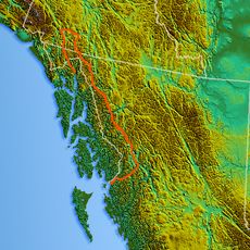
Mount Edziza Provincial Park and Recreation Area, Provincial park in Cassiar Land District, Canada

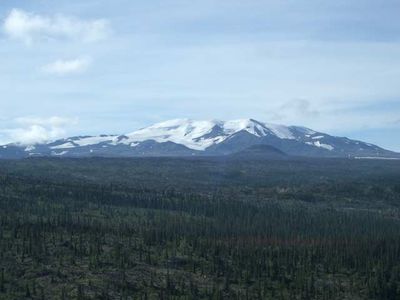
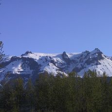
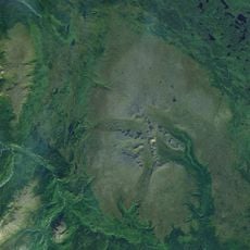
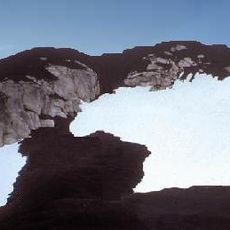
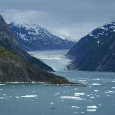
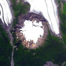
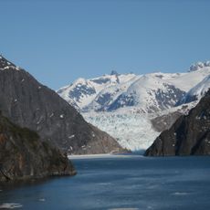
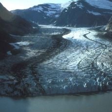
Mount Edziza Provincial Park is a vast wilderness covering about 266,180 hectares and features many types of volcanoes, including shield volcanoes, stratovolcanoes, cinder cones, lava domes, and calderas. The landscape displays a remarkable range of volcanic formations built over thousands of years by repeated eruptions.

British Columbia officially created the park in 1972 after aerial surveys revealed its remarkable volcanic landscape. The region had long held importance for its valuable stone deposits that attracted trade long before modern times.

The Tahltan First Nation extracted obsidian from the volcanic rocks here and traded it with peoples across the Queen Charlotte Islands and into Alaska. This exchange was a vital economic link between distant communities for many generations.

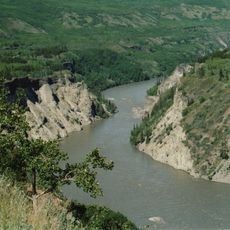
The park has no road access, so visitors typically arrive by floatplane landing at one of five lakes or by hiking trails from Telegraph Creek. Planning ahead is important since the remote location means limited facilities and services for travelers.

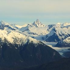
The park holds about thirty cone-shaped volcanoes with striking colors of brown, magenta, and white arranged in a notably symmetric pattern across the landscape. The most recent eruption happened around 1,300 years ago, making this one of Canada's younger volcanic regions.

The community of curious travelers

AroundUs brings together thousands of curated places, local tips, and hidden gems, enriched daily by 60,000 contributors worldwide.

Start exploring
Inception
1972
GPS coordinates
57.58310,-130.66700
Latest update
December 6, 2025 17:47
Natural areas in British Columbia

British Columbia stretches from the Pacific coast to the Rocky Mountains, offering geological diversity and varied ecosystems. The region includes geothermal springs such as Liard River Hot Springs and Keyhole Hot Springs, ancient coastal forests at Cathedral Grove and Carmanah Walbran, and tide...

Reviews
Share your experience

No review yet

Discussions
Start a discussion...

No discussion yet

« Mount Edziza Provincial Park and Recreation Area - Provincial park in Cassiar Land District, Canada » is provided by Around Us (aroundus.com). Images and texts are derived from Wikimedia project under a Creative Commons license. You are allowed to copy, distribute, and modify copies of this page, under the conditions set by the license, as long as this note is clearly visible.

Discover hidden gems everywhere you go!

From secret cafés to breathtaking viewpoints, skip the crowded tourist spots and find places that match your style. Our app makes it easy with voice search, smart filtering, route optimization, and insider tips from travelers worldwide. Download now for the complete mobile experience.

Around Us App Screenshot

A unique approach to discovering new places

Le Figaro

All the places worth exploring

France Info

A tailor-made excursion in just a few clicks

20 Minutes

Around Us
Travel Guide & Maps
Download

Send to your phone

QR Code
1

Open the camera app on your mobile.

2

Point at the QR code with your camera. A notification will appear.

3

Tap the notification to open the link.