Enable Location

We need your location to show you interesting places around you

Discover nearby places

Find interesting locations and hidden gems around you

Precise directions

Get accurate directions and distances to places

Your location is never shared with other users. It's only used when you tap the location button.

Misty Fiords National Monument

Log in to your account

Start exploring — it's free

Trusted by 61,818 travelers worldwide

Continue with Google
Continue with Apple
or

We will send you a code to connect

By continuing, you accept our Terms and Conditions and our Privacy Policy

Check your inbox

We've sent a pincode in your inbox. Please enter the code below.

Misty Fiords National Monument, Wilderness area in Ketchikan Gateway Borough, Alaska.

Description

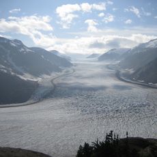
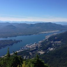
This monument spans more than 2 million acres of wild terrain shaped by deep fjords, towering granite walls, and thick coastal forests of spruce and cedar. The landscape is defined by countless small islands and interconnected waterways that create a complex maze of inlets and passages.

History

The area became a national monument in 1978 when President Jimmy Carter used federal authority to protect this vast stretch of wilderness from development. This action came during a period of heightened concern about preserving Alaska's remaining untouched coastal lands.

Culture

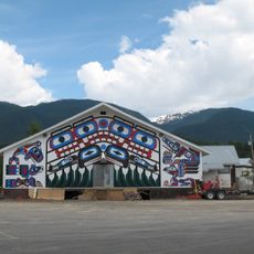
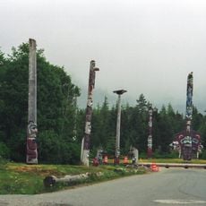
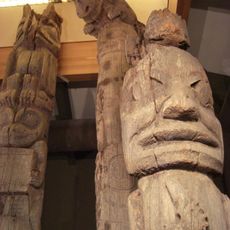
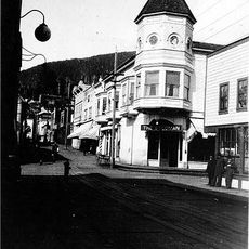
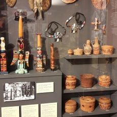
Indigenous Tlingit and other Native peoples have lived in connection with these lands for thousands of years, and their relationship to the forest and water remains central to how local communities value the place. You can sense this deep bond with nature throughout the area, visible in how people interact respectfully with the environment.

Practical

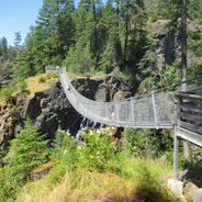
You can only reach this place by floatplane or boat from Ketchikan, as no roads lead into the monument. Plan for wet and changeable weather, which is typical for Southeast Alaska's coastal environment.

Did you know?

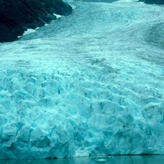
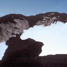
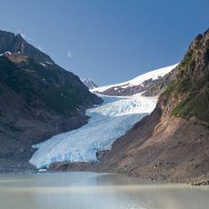
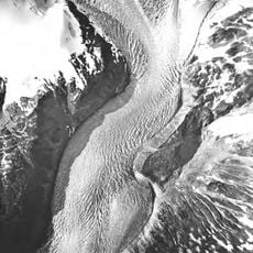
The monument holds one of the largest concentrations of tidewater glaciers in North America, where ice calves directly into the sea. These constantly shifting ice formations offer a rare view of geology in motion, a spectacle few places on the continent provide.

Location
Inception
1978
GPS coordinates
55.62170,-130.60700
Latest update
December 6, 2025 17:40

AroundUs brings together thousands of curated places, local tips, and hidden gems, enriched daily by 60,000 contributors worldwide. Discover all places nearby (Alaska).

Natural areas in British Columbia

British Columbia stretches from the Pacific coast to the Rocky Mountains, offering geological diversity and varied ecosystems. The region includes geothermal springs such as Liard River Hot Springs and Keyhole Hot Springs, ancient coastal forests at Cathedral Grove and Carmanah Walbran, and tide...

« Misty Fiords National Monument - Wilderness area in Ketchikan Gateway Borough, Alaska » is provided by Around Us (aroundus.com). Images and texts are derived from Wikimedia project under a Creative Commons license. You are allowed to copy, distribute, and modify copies of this page, under the conditions set by the license, as long as this note is clearly visible.

Discover hidden gems everywhere you go!

From secret cafés to breathtaking viewpoints, skip the crowded tourist spots and find places that match your style. Our app makes it easy with voice search, smart filtering, route optimization, and insider tips from travelers worldwide. Download now for the complete mobile experience.

Around Us App Screenshot

A unique approach to discovering new places

Le Figaro

All the places worth exploring

France Info

A tailor-made excursion in just a few clicks

20 Minutes

Around Us
Travel Guide & Maps
Download

Send to your phone

QR Code
1

Open the camera app on your mobile.

2

Point at the QR code with your camera. A notification will appear.

3

Tap the notification to open the link.